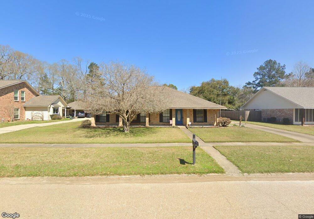
17311 Monitor Ave Baton Rouge, LA 70817
Shenandoah NeighborhoodEstimated Value: $240,661 - $300,000
--
Bed
--
Bath
1,850
Sq Ft
$145/Sq Ft
Est. Value
About This Home
This home is located at 17311 Monitor Ave, Baton Rouge, LA 70817 and is currently estimated at $268,415, approximately $145 per square foot. 17311 Monitor Ave is a home located in East Baton Rouge Parish with nearby schools including Shenandoah Elementary School, Woodlawn Middle School, and Woodlawn High School.
Ownership History
Date
Name
Owned For
Owner Type
Purchase Details
Closed on
May 23, 2001
Sold by
Guidry Guidry Donald G Donald G
Bought by
Campagna George J and Campagna Mary Sue
Current Estimated Value
Home Financials for this Owner
Home Financials are based on the most recent Mortgage that was taken out on this home.
Original Mortgage
$83,000
Outstanding Balance
$30,946
Interest Rate
7.01%
Estimated Equity
$237,469
Create a Home Valuation Report for This Property
The Home Valuation Report is an in-depth analysis detailing your home's value as well as a comparison with similar homes in the area
Home Values in the Area
Average Home Value in this Area
Purchase History
| Date | Buyer | Sale Price | Title Company |
|---|---|---|---|
| Campagna George J | $135,900 | -- |
Source: Public Records
Mortgage History
| Date | Status | Borrower | Loan Amount |
|---|---|---|---|
| Open | Campagna George J | $83,000 |
Source: Public Records
Tax History Compared to Growth
Tax History
| Year | Tax Paid | Tax Assessment Tax Assessment Total Assessment is a certain percentage of the fair market value that is determined by local assessors to be the total taxable value of land and additions on the property. | Land | Improvement |
|---|---|---|---|---|
| 2024 | $1,080 | $16,650 | $2,000 | $14,650 |
| 2023 | $1,080 | $16,650 | $2,000 | $14,650 |
| 2022 | $1,900 | $16,650 | $2,000 | $14,650 |
| 2021 | $1,938 | $16,650 | $2,000 | $14,650 |
| 2020 | $1,963 | $16,650 | $2,000 | $14,650 |
| 2019 | $2,039 | $16,650 | $2,000 | $14,650 |
| 2018 | $2,014 | $16,650 | $2,000 | $14,650 |
| 2017 | $2,014 | $16,650 | $2,000 | $14,650 |
| 2016 | $1,103 | $16,650 | $2,000 | $14,650 |
| 2015 | $1,102 | $16,650 | $2,000 | $14,650 |
| 2014 | $1,080 | $16,650 | $2,000 | $14,650 |
| 2013 | -- | $16,650 | $2,000 | $14,650 |
Source: Public Records
Map
Nearby Homes
- 17237 Monitor Ave
- 17633 Gray Moss Ave
- 4036 Copperridge Dr
- 4818 Pine Hill Dr
- 17440 Beachwood Ave
- 16849 Monitor Ave
- 16756 Merrimac Ave
- 16825 Chadsford Ave
- 5246 Stones River Ave
- 3801 Villa Michel Dr
- 5534 Round Forrest Dr
- 5487 Hagerstown Dr
- 4830 Kennesaw Dr Unit A
- 16570 Spiller's
- Lot 41A Carnifix Ct
- 17750 Shady Elm Ave
- 18403 Shadow Creek Ave
- 3439 Timber Grove Dr
- 16103 Knoll Creek Ave
- 16039 Haynes Bluff Ave
- 17321 Monitor Ave
- 17277 Monitor Ave
- 4732 Williamsburg Dr
- 17331 Monitor Ave
- 17267 Monitor Ave
- 4742 Williamsburg Dr
- 4811 Rapidan Dr
- 17341 Monitor Ave
- 17268 Monitor Ave
- 4821 Rapidan Dr
- 17257 Monitor Ave
- 4916 Williamsburg Dr
- 17248 Monitor Ave
- 17247 Monitor Ave
- 17826 Gray Moss Ave
- 4913 Rapidan Dr
- 17816 Gray Moss Ave
- 4926 Williamsburg Dr
- 4820 Rapidan Dr
- 4733 Williamsburg Dr