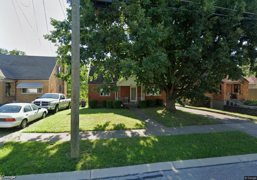
1732 Hillfred Ln Cincinnati, OH 45238
West Price Hill NeighborhoodEstimated Value: $171,000 - $198,000
3
Beds
1
Bath
875
Sq Ft
$210/Sq Ft
Est. Value
About This Home
This home is located at 1732 Hillfred Ln, Cincinnati, OH 45238 and is currently estimated at $183,873, approximately $210 per square foot. 1732 Hillfred Ln is a home located in Hamilton County with nearby schools including Carson School, Gilbert A. Dater High School, and Western Hills High School.
Ownership History
Date
Name
Owned For
Owner Type
Purchase Details
Closed on
Apr 20, 2006
Sold by
Yunger Pamela and Yunger Mark S
Bought by
Dawkins Robyn L
Current Estimated Value
Home Financials for this Owner
Home Financials are based on the most recent Mortgage that was taken out on this home.
Original Mortgage
$105,000
Outstanding Balance
$60,444
Interest Rate
6.39%
Mortgage Type
Fannie Mae Freddie Mac
Estimated Equity
$123,429
Purchase Details
Closed on
Nov 15, 2005
Sold by
Hatton Victoria
Bought by
Two H Properties Llc
Create a Home Valuation Report for This Property
The Home Valuation Report is an in-depth analysis detailing your home's value as well as a comparison with similar homes in the area
Home Values in the Area
Average Home Value in this Area
Purchase History
| Date | Buyer | Sale Price | Title Company |
|---|---|---|---|
| Dawkins Robyn L | $105,000 | None Available | |
| Two H Properties Llc | -- | None Available |
Source: Public Records
Mortgage History
| Date | Status | Borrower | Loan Amount |
|---|---|---|---|
| Open | Dawkins Robyn L | $105,000 |
Source: Public Records
Tax History Compared to Growth
Tax History
| Year | Tax Paid | Tax Assessment Tax Assessment Total Assessment is a certain percentage of the fair market value that is determined by local assessors to be the total taxable value of land and additions on the property. | Land | Improvement |
|---|---|---|---|---|
| 2024 | $2,698 | $45,025 | $5,590 | $39,435 |
| 2023 | $2,759 | $45,025 | $5,590 | $39,435 |
| 2022 | $2,045 | $29,869 | $5,551 | $24,318 |
| 2021 | $1,965 | $29,869 | $5,551 | $24,318 |
| 2020 | $2,022 | $29,869 | $5,551 | $24,318 |
| 2019 | $2,010 | $27,153 | $5,047 | $22,106 |
| 2018 | $2,013 | $27,153 | $5,047 | $22,106 |
| 2017 | $1,912 | $27,153 | $5,047 | $22,106 |
| 2016 | $2,018 | $28,270 | $5,394 | $22,876 |
| 2015 | $1,819 | $28,270 | $5,394 | $22,876 |
| 2014 | $1,832 | $28,270 | $5,394 | $22,876 |
| 2013 | $2,116 | $32,124 | $6,129 | $25,995 |
Source: Public Records
Map
Nearby Homes
- 1774 Ashbrook Dr
- 1803 Ashbrook Dr
- 4764 Clevesdale Dr
- 1861 Ashbrook Dr
- 1869 Ashbrook Dr
- 4769 Hardwick Dr
- 4798 Prosperity Place
- 4826 Prosperity Place
- 4885 N Overlook Ave
- 4638 Glenway Ave
- 4965 Glenway Ave
- 4934 Relleum Ave
- 1131 Olivia Ln
- 1225 Amanda Place
- 1205 Amanda Place
- 1226 Rutledge Ave
- 1227 Texas Ave
- 1660 Dewey Ave
- 1617 Dewey Ave
- 1646 Dewey Ave
- 1736 Hillfred Ln
- 1728 Hillfred Ln
- 1740 Hillfred Ln
- 1724 Hillfred Ln
- 1804 Tuxworth Ave
- 1806 Tuxworth Ave
- 4700 Embrett Ct
- 1720 Hillfred Ln
- 1746 Hillfred Ln
- 1810 Tuxworth Ave
- 1810 Tuxworth Ave
- 4704 Embrett Ct
- 1716 Hillfred Ln
- 1790 Tuxworth Ave
- 4701 Embrett Ct
- 1812 Tuxworth Ave
- 1812 Tuxworth Ave
- 1812 Tuxworth Ave Unit 1
- 4708 Embrett Ct
- 1784 Tuxworth Ave