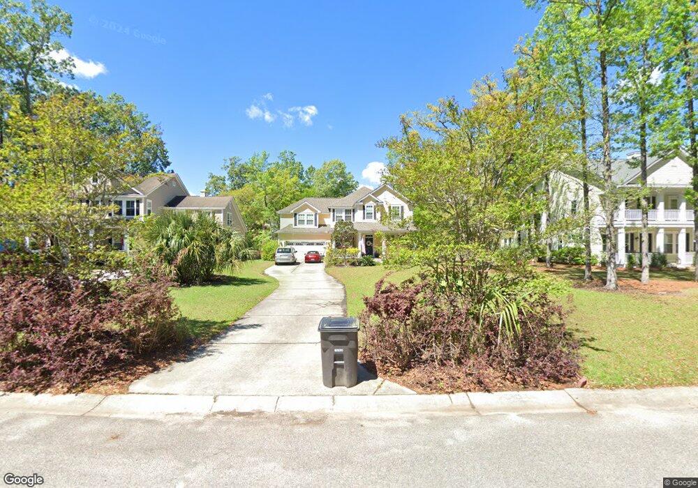
1732 Wellstead St Mount Pleasant, SC 29466
Park West NeighborhoodEstimated Value: $940,000 - $1,087,000
5
Beds
4
Baths
3,007
Sq Ft
$335/Sq Ft
Est. Value
About This Home
This home is located at 1732 Wellstead St, Mount Pleasant, SC 29466 and is currently estimated at $1,007,037, approximately $334 per square foot. 1732 Wellstead St is a home located in Charleston County with nearby schools including Charles Pinckney Elementary School, Laurel Hill Primary School, and Thomas C. Cario Middle School.
Ownership History
Date
Name
Owned For
Owner Type
Purchase Details
Closed on
Apr 28, 2009
Sold by
The Ryland Group Inc
Bought by
Kidd Wayne Robert and Kidd Pamela Clemmons
Current Estimated Value
Home Financials for this Owner
Home Financials are based on the most recent Mortgage that was taken out on this home.
Original Mortgage
$342,052
Outstanding Balance
$217,971
Interest Rate
5.01%
Mortgage Type
Purchase Money Mortgage
Estimated Equity
$789,066
Purchase Details
Closed on
Oct 21, 2008
Sold by
Piedmont Investments Llc
Bought by
The Ryland Group Inc
Create a Home Valuation Report for This Property
The Home Valuation Report is an in-depth analysis detailing your home's value as well as a comparison with similar homes in the area
Home Values in the Area
Average Home Value in this Area
Purchase History
| Date | Buyer | Sale Price | Title Company |
|---|---|---|---|
| Kidd Wayne Robert | $427,565 | -- | |
| The Ryland Group Inc | $165,000 | -- |
Source: Public Records
Mortgage History
| Date | Status | Borrower | Loan Amount |
|---|---|---|---|
| Open | Kidd Wayne Robert | $342,052 |
Source: Public Records
Tax History
| Year | Tax Paid | Tax Assessment Tax Assessment Total Assessment is a certain percentage of the fair market value that is determined by local assessors to be the total taxable value of land and additions on the property. | Land | Improvement |
|---|---|---|---|---|
| 2024 | $2,283 | $20,230 | $0 | $0 |
| 2023 | $2,035 | $20,230 | $0 | $0 |
| 2022 | $1,868 | $20,230 | $0 | $0 |
| 2021 | $2,054 | $20,230 | $0 | $0 |
| 2020 | $2,124 | $20,230 | $0 | $0 |
| 2019 | $1,872 | $17,790 | $0 | $0 |
| 2017 | $1,845 | $17,790 | $0 | $0 |
| 2016 | $1,757 | $17,790 | $0 | $0 |
| 2015 | $1,837 | $17,790 | $0 | $0 |
| 2014 | $1,583 | $0 | $0 | $0 |
| 2011 | -- | $0 | $0 | $0 |
Source: Public Records
Map
Nearby Homes
- 1740 Wellstead St
- 1753 Wellstead St
- 3456 Claremont St
- 3443 Claremont St
- 1716 Alan Brooke Dr
- 1563 Capel St
- 3052 Ashburton Way
- 2217 Beckenham Dr
- 2296 Beckenham Dr
- 3261 Beaconsfield Rd
- 3269 Beaconsfield Rd
- 2196 Beckenham Dr
- 3555 Holmgren St
- 2068 Promenade Ct
- 2254 Beckenham Dr
- 2265 Beckenham Dr
- 314 Commonwealth Rd
- 3711 Riverstation Ct
- 3600 Henrietta Hartford Rd
- 3708 Colonel Vanderhorst Cir
- 1736 Wellstead St
- 1724 Wellstead St
- 1851 Hall Point Rd
- 1855 Hall Point Rd
- 1733 Wellstead St
- 1847 Hall Point Rd
- 1744 Wellstead St
- 1729 Wellstead St
- 1737 Wellstead St
- 1859 Hall Point Rd
- 1843 Hall Point Rd
- 1725 Wellstead St
- 1741 Wellstead St
- 1748 Wellstead St
- 1863 Hall Point Rd
- 1717 Wellstead St
- 1867 Hall Point Rd
- 1745 Wellstead St
- 1713 Wellstead St
- 1705 Wellstead St
Your Personal Tour Guide
Ask me questions while you tour the home.