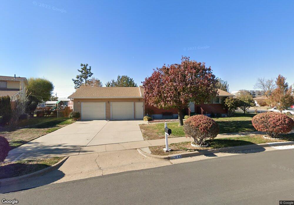
1733 Bennett St Layton, UT 84041
Estimated Value: $384,000 - $448,000
3
Beds
2
Baths
1,865
Sq Ft
$224/Sq Ft
Est. Value
About This Home
This home is located at 1733 Bennett St, Layton, UT 84041 and is currently estimated at $418,367, approximately $224 per square foot. 1733 Bennett St is a home located in Davis County with nearby schools including Lincoln Elementary School, North Layton Junior High School, and Northridge High School.
Ownership History
Date
Name
Owned For
Owner Type
Purchase Details
Closed on
Sep 3, 2003
Sold by
Hamblin Dean R and Hamblin Jeanne M
Bought by
Caldwell Gary A and Caldwell Khan
Current Estimated Value
Home Financials for this Owner
Home Financials are based on the most recent Mortgage that was taken out on this home.
Original Mortgage
$128,173
Outstanding Balance
$57,468
Interest Rate
5.87%
Mortgage Type
VA
Estimated Equity
$360,899
Create a Home Valuation Report for This Property
The Home Valuation Report is an in-depth analysis detailing your home's value as well as a comparison with similar homes in the area
Home Values in the Area
Average Home Value in this Area
Purchase History
| Date | Buyer | Sale Price | Title Company |
|---|---|---|---|
| Caldwell Gary A | -- | Backman Stewart Title Servic |
Source: Public Records
Mortgage History
| Date | Status | Borrower | Loan Amount |
|---|---|---|---|
| Open | Caldwell Gary A | $128,173 |
Source: Public Records
Tax History
| Year | Tax Paid | Tax Assessment Tax Assessment Total Assessment is a certain percentage of the fair market value that is determined by local assessors to be the total taxable value of land and additions on the property. | Land | Improvement |
|---|---|---|---|---|
| 2025 | -- | $206,800 | $99,966 | $106,834 |
| 2024 | -- | $203,500 | $116,295 | $87,205 |
| 2023 | $1,842 | $344,000 | $136,544 | $207,456 |
| 2022 | $1,842 | $186,450 | $72,703 | $113,747 |
| 2021 | $1,722 | $260,000 | $103,344 | $156,656 |
| 2020 | $1,567 | $227,000 | $86,382 | $140,618 |
| 2019 | $1,586 | $225,000 | $81,522 | $143,478 |
| 2018 | $1,405 | $200,000 | $81,522 | $118,478 |
| 2016 | $1,252 | $91,961 | $26,417 | $65,544 |
| 2015 | $1,185 | $82,666 | $26,417 | $56,249 |
| 2014 | $1,086 | $77,433 | $26,417 | $51,016 |
| 2013 | -- | $86,866 | $24,816 | $62,050 |
Source: Public Records
Map
Nearby Homes
- 1715 N Alder St
- 538 W 1875 N
- 1683 N 250 W
- 247 W 1925 N
- 1571 N 160 W
- 1908 N 200 W
- 2149 N 750 W
- 1500 N Angel St Unit 12
- 1500 N Angel St Unit 22
- 2211 N 525 W
- 506 W 2200 N
- 2236 N 525 W
- 1857 N 50 W
- 2234 N 450 W
- 2246 N 475 W
- 1094 N Angel St W
- 14 W Belvedere Way
- 1617 N Angel St
- 2048 Evans Cove Loop
- 1148 N 350 W
Your Personal Tour Guide
Ask me questions while you tour the home.