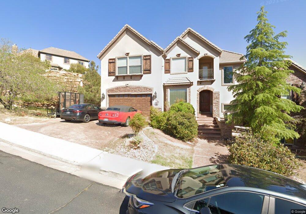
1733 Castle Rock Rd St. George, UT 84770
Estimated Value: $852,000 - $910,000
6
Beds
3
Baths
5,400
Sq Ft
$163/Sq Ft
Est. Value
About This Home
This home is located at 1733 Castle Rock Rd, St. George, UT 84770 and is currently estimated at $882,422, approximately $163 per square foot. 1733 Castle Rock Rd is a home located in Washington County with nearby schools including Snow Canyon Middle School, Diamond Valley School, and Lava Ridge Intermediate School.
Ownership History
Date
Name
Owned For
Owner Type
Purchase Details
Closed on
Apr 12, 2022
Sold by
Lauren Wood
Bought by
Wood Lauren Alyssa
Current Estimated Value
Home Financials for this Owner
Home Financials are based on the most recent Mortgage that was taken out on this home.
Original Mortgage
$259,660
Outstanding Balance
$245,076
Interest Rate
4.72%
Mortgage Type
New Conventional
Estimated Equity
$637,346
Purchase Details
Closed on
Apr 7, 2022
Sold by
Lauren Wood
Bought by
Wood Lauren and Sherer Don
Home Financials for this Owner
Home Financials are based on the most recent Mortgage that was taken out on this home.
Original Mortgage
$259,660
Outstanding Balance
$245,076
Interest Rate
4.72%
Mortgage Type
New Conventional
Estimated Equity
$637,346
Purchase Details
Closed on
Jan 28, 2020
Sold by
Wood William A
Bought by
Wood Lauren
Purchase Details
Closed on
Jun 24, 2016
Sold by
Wood William A
Bought by
Wood William A and Wood Lauren
Purchase Details
Closed on
Aug 24, 2010
Sold by
Schulzke Reinhold and Schulzke Pamela
Bought by
Wood William A and Wood Lauren
Home Financials for this Owner
Home Financials are based on the most recent Mortgage that was taken out on this home.
Original Mortgage
$237,000
Interest Rate
4.52%
Mortgage Type
Seller Take Back
Purchase Details
Closed on
Dec 12, 2008
Sold by
Federal Deposit Insurance Corporation
Bought by
Jpmorgan Chase Bank National Association
Purchase Details
Closed on
Dec 11, 2008
Sold by
Jpmorgan Chase Bank
Bought by
Schulzke Reinhold and Schulzke Pamela
Purchase Details
Closed on
Jun 30, 2008
Sold by
Proctor Brandon and Washington Mutual Bank Fa
Bought by
Washington Mutual Bank
Purchase Details
Closed on
Nov 7, 2005
Sold by
Foster Gary L and Foster Nancy M
Bought by
Proctor Brandon
Home Financials for this Owner
Home Financials are based on the most recent Mortgage that was taken out on this home.
Original Mortgage
$490,000
Interest Rate
5.93%
Mortgage Type
Construction
Create a Home Valuation Report for This Property
The Home Valuation Report is an in-depth analysis detailing your home's value as well as a comparison with similar homes in the area
Home Values in the Area
Average Home Value in this Area
Purchase History
| Date | Buyer | Sale Price | Title Company |
|---|---|---|---|
| Wood Lauren Alyssa | -- | Vanguard Title | |
| Wood Lauren | -- | Vanguard Title | |
| Wood Lauren | -- | Vanguard Title | |
| Wood Lauren | -- | None Available | |
| Wood William A | -- | Southern Utah Title | |
| Wood William A | -- | Southern Utah Title | |
| Wood William A | -- | Southern Utah Title | |
| Jpmorgan Chase Bank National Association | -- | The Title Ins Agency Inc | |
| Schulzke Reinhold | -- | The Title Ins Agency Inc | |
| Washington Mutual Bank | $427,500 | None Available | |
| Proctor Brandon | -- | Southern Utah Title Co |
Source: Public Records
Mortgage History
| Date | Status | Borrower | Loan Amount |
|---|---|---|---|
| Open | Wood Lauren | $259,660 | |
| Closed | Wood Lauren | $259,660 | |
| Previous Owner | Wood William A | $237,000 | |
| Previous Owner | Proctor Brandon | $490,000 |
Source: Public Records
Tax History Compared to Growth
Tax History
| Year | Tax Paid | Tax Assessment Tax Assessment Total Assessment is a certain percentage of the fair market value that is determined by local assessors to be the total taxable value of land and additions on the property. | Land | Improvement |
|---|---|---|---|---|
| 2025 | $3,079 | $467,885 | $98,175 | $369,710 |
| 2023 | $2,929 | $437,690 | $92,400 | $345,290 |
| 2022 | $3,218 | $452,100 | $86,625 | $365,475 |
| 2021 | $2,982 | $624,900 | $131,300 | $493,600 |
| 2020 | $2,789 | $550,400 | $105,000 | $445,400 |
| 2019 | $2,802 | $540,200 | $105,000 | $435,200 |
| 2018 | $2,853 | $284,020 | $0 | $0 |
| 2017 | $2,789 | $269,555 | $0 | $0 |
| 2016 | $3,048 | $272,470 | $0 | $0 |
| 2015 | $2,937 | $251,900 | $0 | $0 |
| 2014 | $2,769 | $238,920 | $0 | $0 |
Source: Public Records
Map
Nearby Homes
- 2294 N Gunsight Dr
- 1996 W 1940 N
- 2090 N Tuweap Dr Unit 13
- 2090 N Tuweap Dr Unit 9
- 2090 N Tuweap Dr Unit 15
- 2090 N Tuweap Dr Unit 56
- 1989 W 1800 N
- 2139 W Cougar Rock Cir Unit 192
- 2139 W Cougar Rock Cir
- 2139 W Cougar Rock Cir Unit 131
- 2139 W Cougar Rock Cir Unit 179
- 2139 W Cougar Rock Cir Unit 135
- 2139 W Cougar Rock Cir Unit 192
- 2139 W Cougar Rock Cir Unit 195
- 2139 W Cougar Rock Cir Unit 182
- 2195 W 1970 Cir N
- 1795 N Snow Canyon Parkway #40
- 1708 N 1975 W
- 20 Grayhawk Cir
- 1756 N 2065 W
- 1733 Castle Rock Rd
- 1733 Castle Rock Rd
- 1779 W Castle Rock Rd
- 1735 W Castle Rock Rd
- 2082 Lone Rock Dr
- 2082 N Lone Rock Dr
- 2107 N Cascade Canyon Dr
- 2119 N Cascade Canyon Dr
- 2119 N Cascade Canyon Dr Unit 109
- 0 W Castle Rock Dr Unit 13-144051
- 0 W Castle Rock Dr Unit 7-86527
- 0 W Castle Rock Dr Unit 18-197818
- 0 W Castle Rock Dr Unit 12-139570
- 0 W Castle Rock Dr Unit 7-87947
- 1779 W Castle Rock Dr
- 116 W Castle Rock Dr
- Lot 117 W Castle Rock Dr
- Lot 98 W Castle Rock Dr
- 0 W Castle Rock Dr Unit 5-69209
- Lot 141 W Castle Rock Dr Unit 141