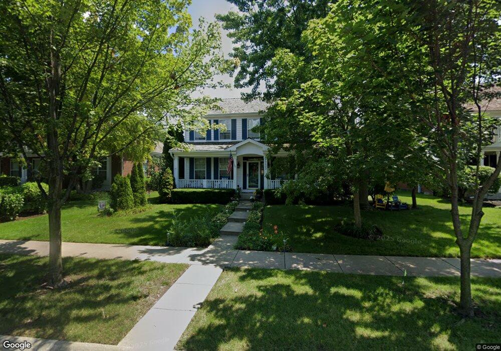
1733 Independence Ave Glenview, IL 60026
The Glen NeighborhoodEstimated Value: $1,323,419 - $1,403,000
3
Beds
3
Baths
2,822
Sq Ft
$485/Sq Ft
Est. Value
About This Home
This home is located at 1733 Independence Ave, Glenview, IL 60026 and is currently estimated at $1,367,605, approximately $484 per square foot. 1733 Independence Ave is a home located in Cook County with nearby schools including Westbrook Elementary School, Glen Grove Elementary School, and Attea Middle School.
Ownership History
Date
Name
Owned For
Owner Type
Purchase Details
Closed on
Sep 20, 2000
Sold by
Chapel Crossing Ltd Partnership
Bought by
Uhl Gregory H and Uhl Carol L
Current Estimated Value
Home Financials for this Owner
Home Financials are based on the most recent Mortgage that was taken out on this home.
Original Mortgage
$200,000
Outstanding Balance
$69,653
Interest Rate
8.05%
Estimated Equity
$1,297,952
Create a Home Valuation Report for This Property
The Home Valuation Report is an in-depth analysis detailing your home's value as well as a comparison with similar homes in the area
Home Values in the Area
Average Home Value in this Area
Purchase History
| Date | Buyer | Sale Price | Title Company |
|---|---|---|---|
| Uhl Gregory H | $640,500 | -- |
Source: Public Records
Mortgage History
| Date | Status | Borrower | Loan Amount |
|---|---|---|---|
| Open | Uhl Gregory H | $200,000 |
Source: Public Records
Tax History Compared to Growth
Tax History
| Year | Tax Paid | Tax Assessment Tax Assessment Total Assessment is a certain percentage of the fair market value that is determined by local assessors to be the total taxable value of land and additions on the property. | Land | Improvement |
|---|---|---|---|---|
| 2025 | $19,394 | $113,000 | $29,721 | $83,279 |
| 2024 | $19,394 | $90,942 | $25,188 | $65,754 |
| 2023 | $18,825 | $90,942 | $25,188 | $65,754 |
| 2022 | $18,825 | $90,942 | $25,188 | $65,754 |
| 2021 | $18,140 | $76,212 | $12,090 | $64,122 |
| 2020 | $17,981 | $76,212 | $12,090 | $64,122 |
| 2019 | $16,753 | $83,750 | $12,090 | $71,660 |
| 2018 | $16,895 | $76,895 | $10,578 | $66,317 |
| 2017 | $16,458 | $76,895 | $10,578 | $66,317 |
| 2016 | $15,737 | $76,895 | $10,578 | $66,317 |
| 2015 | $15,862 | $69,232 | $8,563 | $60,669 |
| 2014 | $15,584 | $69,232 | $8,563 | $60,669 |
| 2013 | $15,096 | $69,232 | $8,563 | $60,669 |
Source: Public Records
Map
Nearby Homes
- 2020 Chestnut Ave Unit 312
- 2000 Chestnut Ave Unit 103
- 1847 Tanglewood Dr Unit 2B
- 1855 Tanglewood Dr Unit F
- 1809 Jefferson Ave
- 1764 Jefferson Ave Unit 1764
- 1774 Rogers Ave
- 2750 Langley Cir Unit 203013
- 1429 Pebblecreek Dr Unit 171
- 2408 Violet St
- 1220 Depot St Unit 305
- 1220 Depot St Unit 109
- 1220 Depot St Unit 409
- 1743 Melise Dr
- 1088 Shermer Rd Unit DW
- 2101 Valley lo Ln
- 1717 Independence Ave
- 1749 Independence Ave
- 1701 Independence Ave
- 1736 Primrose Ln
- 1748 Primrose Ln
- 1724 Primrose Ln
- 1699 Independence Ave
- 2326 Fielding Dr
- 2314 Fielding Dr
- 1712 Primrose Ln Unit 1
- 2338 Fielding Dr
- 2298 Fielding Dr
- 1689 Independence Ave
- 2350 Fielding Dr
- 1724 Independence Ave
- 1700 Primrose Ln Unit 1
- 2272 Fielding Dr
- 1700 Independence Ave
- 1737 Primrose Ln
- 1679 Independence Ave
