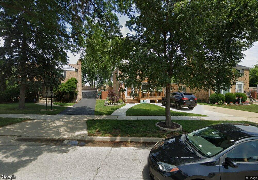
1733 Mannheim Rd Des Plaines, IL 60018
Estimated Value: $368,000 - $385,846
3
Beds
1
Bath
1,213
Sq Ft
$309/Sq Ft
Est. Value
About This Home
This home is located at 1733 Mannheim Rd, Des Plaines, IL 60018 and is currently estimated at $374,712, approximately $308 per square foot. 1733 Mannheim Rd is a home located in Cook County with nearby schools including South Elementary School, Algonquin Middle School, and Maine West High School.
Ownership History
Date
Name
Owned For
Owner Type
Purchase Details
Closed on
Nov 16, 2015
Sold by
Mukahin Mark
Bought by
Mukahin Mark and Mukahin Laura
Current Estimated Value
Purchase Details
Closed on
Apr 29, 2002
Sold by
Guerrero Gabriel and Guerrero Mercedes D
Bought by
Mukahirn Mark A
Home Financials for this Owner
Home Financials are based on the most recent Mortgage that was taken out on this home.
Original Mortgage
$177,625
Outstanding Balance
$73,205
Interest Rate
7.16%
Mortgage Type
FHA
Estimated Equity
$301,507
Purchase Details
Closed on
Oct 21, 1996
Sold by
Fagiano Anthony S and Fagiano Patricia
Bought by
Guerrero Gabriel and Guerrero Mercedes D
Home Financials for this Owner
Home Financials are based on the most recent Mortgage that was taken out on this home.
Original Mortgage
$124,000
Interest Rate
8.26%
Create a Home Valuation Report for This Property
The Home Valuation Report is an in-depth analysis detailing your home's value as well as a comparison with similar homes in the area
Home Values in the Area
Average Home Value in this Area
Purchase History
| Date | Buyer | Sale Price | Title Company |
|---|---|---|---|
| Mukahin Mark | -- | None Available | |
| Mukahirn Mark A | $214,500 | Lawyers Title Insurance Corp | |
| Guerrero Gabriel | $155,000 | -- |
Source: Public Records
Mortgage History
| Date | Status | Borrower | Loan Amount |
|---|---|---|---|
| Open | Mukahirn Mark A | $177,625 | |
| Previous Owner | Guerrero Gabriel | $124,000 |
Source: Public Records
Tax History
| Year | Tax Paid | Tax Assessment Tax Assessment Total Assessment is a certain percentage of the fair market value that is determined by local assessors to be the total taxable value of land and additions on the property. | Land | Improvement |
|---|---|---|---|---|
| 2025 | $7,299 | $31,000 | $6,840 | $24,160 |
| 2024 | $7,299 | $31,000 | $5,814 | $25,186 |
| 2023 | $7,097 | $31,000 | $5,814 | $25,186 |
| 2022 | $7,097 | $31,000 | $5,814 | $25,186 |
| 2021 | $4,340 | $17,449 | $4,788 | $12,661 |
| 2020 | $4,335 | $17,449 | $4,788 | $12,661 |
| 2019 | $4,353 | $19,606 | $4,788 | $14,818 |
| 2018 | $5,083 | $20,432 | $4,104 | $16,328 |
| 2017 | $5,559 | $22,296 | $4,104 | $18,192 |
| 2016 | $5,502 | $22,296 | $4,104 | $18,192 |
| 2015 | $5,118 | $19,554 | $3,591 | $15,963 |
| 2014 | $5,027 | $19,554 | $3,591 | $15,963 |
| 2013 | $4,884 | $19,554 | $3,591 | $15,963 |
Source: Public Records
Map
Nearby Homes
- 1696 S Elm St
- 1445 Everett Ave
- 1689 S Elm St
- 1645 Illinois St
- 1080 Bogart St
- 1721 Prospect Ave
- 1370 Fargo Ave Unit E
- 1754 E Lincoln Ave
- 815 E Oakton St Unit 311
- 2220 S Chestnut St
- 1700 E Forest Ave
- 1394 Carol Ln
- 1640 S River Rd
- 664 E Oakton St
- 635 Birchwood Ave
- 1561 E Walnut Ave
- 1990 Berry Ln
- 1048 E Walnut Ave
- 1630 Henry Ave
- 1629 E Touhy Ave
- 1737 Mannheim Rd
- 1731 Mannheim Rd
- 1739 Mannheim Rd
- 1729 Mannheim Rd
- 1331 Briar Ct
- 1335 Briar Ct
- 1325 Briar Ct
- 1727 Mannheim Rd
- 1743 Mannheim Rd
- 1317 Briar Ct
- 1343 Briar Ct
- 1711 Ash St
- 1311 Briar Ct
- 1738 Mannheim Rd
- 1732 Mannheim Rd
- 1730 Mannheim Rd
- 1303 Briar Ct
- 1728 Mannheim Rd
- 1746 Mannheim Rd
- 1755 Ash St
Your Personal Tour Guide
Ask me questions while you tour the home.