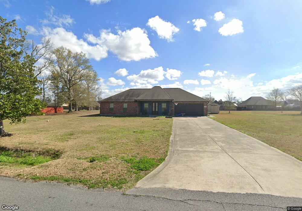
1733 N Borel Dr Lake Charles, LA 70611
Moss Bluff NeighborhoodEstimated Value: $260,700 - $302,000
3
Beds
2
Baths
1,689
Sq Ft
$168/Sq Ft
Est. Value
About This Home
This home is located at 1733 N Borel Dr, Lake Charles, LA 70611 and is currently estimated at $283,425, approximately $167 per square foot. 1733 N Borel Dr is a home located in Calcasieu Parish with nearby schools including Graham & Parks Alternative Public School, Moss Bluff Elementary School, and Putnam Avenue Upper School.
Ownership History
Date
Name
Owned For
Owner Type
Purchase Details
Closed on
Jun 5, 2020
Sold by
Lozada Josue Misael and Lozada Brittany Elyse
Bought by
Cox Kayla S and Cox Jermy G
Current Estimated Value
Purchase Details
Closed on
Jul 24, 2014
Sold by
Book George K and Book Gloria D
Bought by
Lozada Josne Misael
Purchase Details
Closed on
May 21, 2014
Sold by
Brandon Bellon Development Llc
Bought by
Lozada Josue Misael and Lozada Brittany Elyse
Home Financials for this Owner
Home Financials are based on the most recent Mortgage that was taken out on this home.
Original Mortgage
$173,469
Interest Rate
4.38%
Mortgage Type
New Conventional
Create a Home Valuation Report for This Property
The Home Valuation Report is an in-depth analysis detailing your home's value as well as a comparison with similar homes in the area
Home Values in the Area
Average Home Value in this Area
Purchase History
| Date | Buyer | Sale Price | Title Company |
|---|---|---|---|
| Cox Kayla S | $250,000 | None Available | |
| Lozada Josne Misael | $28,500 | None Available | |
| Lozada Josue Misael | $170,000 | None Available |
Source: Public Records
Mortgage History
| Date | Status | Borrower | Loan Amount |
|---|---|---|---|
| Previous Owner | Lozada Josue Misael | $173,469 |
Source: Public Records
Tax History Compared to Growth
Tax History
| Year | Tax Paid | Tax Assessment Tax Assessment Total Assessment is a certain percentage of the fair market value that is determined by local assessors to be the total taxable value of land and additions on the property. | Land | Improvement |
|---|---|---|---|---|
| 2024 | $1,056 | $17,170 | $3,210 | $13,960 |
| 2023 | $1,039 | $17,170 | $3,210 | $13,960 |
| 2022 | $1,814 | $17,170 | $3,210 | $13,960 |
| 2021 | $1,904 | $17,170 | $3,210 | $13,960 |
| 2020 | $1,703 | $15,640 | $3,080 | $12,560 |
| 2019 | $1,850 | $16,930 | $2,970 | $13,960 |
| 2018 | $1,032 | $16,930 | $2,970 | $13,960 |
| 2017 | $1,879 | $16,930 | $2,970 | $13,960 |
| 2016 | $1,851 | $16,930 | $2,970 | $13,960 |
| 2015 | $332 | $16,930 | $2,970 | $13,960 |
| 2014 | $332 | $2,970 | $2,970 | $0 |
| 2013 | $332 | $2,970 | $2,970 | $0 |
Source: Public Records
Map
Nearby Homes
- 1630 Hollow Cove Ln
- 568 Parkwood Dr
- 1647 Hollow Cove
- 1731 Marlin Rd
- 1492 Becky St
- 1929 S Borel Dr
- 231 Merlot Dr
- 385 W Borel Dr
- 443 W Borel Dr
- 751 N Perkins Ferry Rd
- 1563 Noelie St
- 1706 Heard Rd
- 1910 Reisling Dr
- 362 W Park Manor Dr
- 284 W Park Manor Dr
- 141 W Park Manor Dr
- TBD Tan Tara Cir
- 0 Sam Houston Jones Pkwy Unit 145953
- 334 Coushatta Ln
- 1032 Tan Tara Cir
- 1707 N Borel Dr
- 1741 N Borel Dr
- 1714 Hollow Cove Ln
- 1674 Hollow Cove Ln
- 1734 N Borel Dr
- 1662 Hollow Cove Ln
- 1708 N Borel Dr
- 1742 N Borel Dr
- 1744 Hollow Cove Ln
- 1646 Hollow Cove Ln
- 541 Goodwood Dr
- 1771 N Borel Dr
- 1744 Hollow Cove
- 1733 Hollow Cove Ln
- 1715 Hollow Cove Ln
- 1673 Hollow Cove Ln
- 0 Hollow Cove
- 560 Parkwood Dr
- 1772 N Borel Dr
- 1661 Hollow Cove