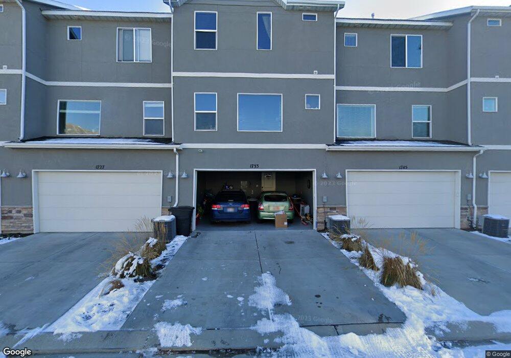
1733 W 10 S Unit 188 Pleasant Grove, UT 84062
Estimated Value: $440,000 - $486,000
4
Beds
4
Baths
1,918
Sq Ft
$238/Sq Ft
Est. Value
About This Home
This home is located at 1733 W 10 S Unit 188, Pleasant Grove, UT 84062 and is currently estimated at $457,374, approximately $238 per square foot. 1733 W 10 S Unit 188 is a home located in Utah County with nearby schools including Barratt Elementary School, American Fork Junior High School, and American Fork High School.
Ownership History
Date
Name
Owned For
Owner Type
Purchase Details
Closed on
Sep 29, 2018
Sold by
Encinias Torrey Michael
Bought by
Encinias Torrey Michael and Sampson Shaley Ann
Current Estimated Value
Home Financials for this Owner
Home Financials are based on the most recent Mortgage that was taken out on this home.
Original Mortgage
$245,268
Outstanding Balance
$214,159
Interest Rate
4.75%
Mortgage Type
FHA
Estimated Equity
$243,215
Purchase Details
Closed on
Aug 3, 2018
Sold by
Wennerholm Kiersten
Bought by
Encinias Torrey Michael
Home Financials for this Owner
Home Financials are based on the most recent Mortgage that was taken out on this home.
Original Mortgage
$245,268
Outstanding Balance
$214,159
Interest Rate
4.75%
Mortgage Type
FHA
Estimated Equity
$243,215
Purchase Details
Closed on
Jun 3, 2015
Sold by
D R Horton Inc
Bought by
Wennerholim Kiersten
Home Financials for this Owner
Home Financials are based on the most recent Mortgage that was taken out on this home.
Original Mortgage
$224,945
Interest Rate
3.87%
Mortgage Type
FHA
Create a Home Valuation Report for This Property
The Home Valuation Report is an in-depth analysis detailing your home's value as well as a comparison with similar homes in the area
Home Values in the Area
Average Home Value in this Area
Purchase History
| Date | Buyer | Sale Price | Title Company |
|---|---|---|---|
| Encinias Torrey Michael | -- | None Available | |
| Encinias Torrey Michael | -- | Vangaurd Title Inds Agcy | |
| Wennerholim Kiersten | -- | Provo Land Title Co |
Source: Public Records
Mortgage History
| Date | Status | Borrower | Loan Amount |
|---|---|---|---|
| Open | Encinias Torrey Michael | $245,268 | |
| Previous Owner | Wennerholim Kiersten | $224,945 |
Source: Public Records
Tax History Compared to Growth
Tax History
| Year | Tax Paid | Tax Assessment Tax Assessment Total Assessment is a certain percentage of the fair market value that is determined by local assessors to be the total taxable value of land and additions on the property. | Land | Improvement |
|---|---|---|---|---|
| 2025 | $2,027 | $235,730 | $63,000 | $365,600 |
| 2024 | $2,027 | $241,340 | $0 | $0 |
| 2023 | $1,776 | $217,030 | $0 | $0 |
| 2022 | $1,926 | $234,190 | $0 | $0 |
| 2021 | $1,659 | $307,100 | $46,100 | $261,000 |
| 2020 | $1,538 | $279,100 | $41,900 | $237,200 |
| 2019 | $1,487 | $279,100 | $41,900 | $237,200 |
| 2018 | $1,381 | $245,100 | $36,800 | $208,300 |
| 2017 | $1,333 | $125,950 | $0 | $0 |
| 2016 | $1,381 | $125,950 | $0 | $0 |
| 2015 | $1,083 | $93,500 | $0 | $0 |
Source: Public Records
Map
Nearby Homes
- 1584 W 110 N
- 1559 W 50 N
- 1542 W 110 N
- 29 S 2000 W
- 1512 W 50 N
- 1593 W 220 N
- 1775 W 120 S Unit 54
- 1795 W 120 S Unit 52
- The Hastings Plan at Tayside Farm - Townhome
- The Henley A Plan at Tayside Farm - Single Family Home
- The Denton Plan at Tayside Farm - Townhome
- The Henley B Plan at Tayside Farm - Single Family Home
- 128 S 1700 W Unit 12
- 1541 W 250 N
- 1429 W 110 N
- 1406 W 50 N
- 293 N 1630 W
- 1525 W 300 N
- 150 N 1300 W
- 1267 W 20 S