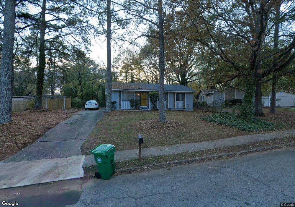
1733 W Austin Rd Unit 1 Decatur, GA 30032
Estimated Value: $172,000 - $225,000
3
Beds
1
Bath
1,075
Sq Ft
$180/Sq Ft
Est. Value
About This Home
This home is located at 1733 W Austin Rd Unit 1, Decatur, GA 30032 and is currently estimated at $193,572, approximately $180 per square foot. 1733 W Austin Rd Unit 1 is a home located in DeKalb County with nearby schools including Snapfinger Elementary School, Columbia Middle School, and Columbia High School.
Ownership History
Date
Name
Owned For
Owner Type
Purchase Details
Closed on
Oct 11, 2000
Sold by
Focer Samuel W
Bought by
Bryant Christopher
Current Estimated Value
Home Financials for this Owner
Home Financials are based on the most recent Mortgage that was taken out on this home.
Original Mortgage
$74,700
Outstanding Balance
$26,955
Interest Rate
7.96%
Mortgage Type
New Conventional
Estimated Equity
$166,617
Purchase Details
Closed on
Jul 7, 1998
Sold by
Witherspoon Herman
Bought by
Focer Samuel W
Home Financials for this Owner
Home Financials are based on the most recent Mortgage that was taken out on this home.
Original Mortgage
$46,300
Interest Rate
6.94%
Mortgage Type
New Conventional
Create a Home Valuation Report for This Property
The Home Valuation Report is an in-depth analysis detailing your home's value as well as a comparison with similar homes in the area
Home Values in the Area
Average Home Value in this Area
Purchase History
| Date | Buyer | Sale Price | Title Company |
|---|---|---|---|
| Bryant Christopher | $70,000 | -- | |
| Focer Samuel W | $57,900 | -- |
Source: Public Records
Mortgage History
| Date | Status | Borrower | Loan Amount |
|---|---|---|---|
| Open | Bryant Christopher | $74,700 | |
| Previous Owner | Focer Samuel W | $46,300 |
Source: Public Records
Tax History Compared to Growth
Tax History
| Year | Tax Paid | Tax Assessment Tax Assessment Total Assessment is a certain percentage of the fair market value that is determined by local assessors to be the total taxable value of land and additions on the property. | Land | Improvement |
|---|---|---|---|---|
| 2025 | $3,741 | $75,840 | $52,000 | $23,840 |
| 2024 | $3,144 | $62,280 | $52,000 | $10,280 |
| 2023 | $3,144 | $56,960 | $31,720 | $25,240 |
| 2022 | $2,135 | $41,520 | $16,000 | $25,520 |
| 2021 | $2,058 | $39,760 | $16,000 | $23,760 |
| 2020 | $1,970 | $37,760 | $16,000 | $21,760 |
| 2019 | $1,798 | $33,840 | $16,000 | $17,840 |
| 2018 | $1,286 | $24,560 | $4,080 | $20,480 |
| 2017 | $1,264 | $21,560 | $4,080 | $17,480 |
| 2016 | $1,275 | $21,760 | $4,080 | $17,680 |
| 2014 | $858 | $12,040 | $4,080 | $7,960 |
Source: Public Records
Map
Nearby Homes
- 1729 W Austin Rd
- 1669 Freedom Valley
- 1674 Freedom Valley
- 1603 Hollyhock Terrace
- 3651 Tulip Dr
- 3682 Daisy Dr
- 3711 Daisy Dr
- 1688 Danrich Dr
- 3705 Daisy Dr
- 1581 Hollyhock Terrace
- 1733 Hollyhock Terrace
- 3738 Larkspur Terrace
- 3842 Brookcrest Cir
- 3699 Larkspur Terrace
- 1701 Corey Blvd
- 3513 Larkspur Terrace
- 4366 Glenwood Pkwy
- 3519 Larkspur Terrace
- 1788 Danrich Dr
- 1803 Hollyhock Terrace
- 1731 W Austin Rd
- 1655 Hollyhock Terrace
- 1649 Hollyhock Terrace
- 1699 Freedom Valley
- 1727 W Austin Rd Unit 1
- 1698 Freedom Valley Unit 3
- 1730 W Austin Rd
- 1659 Hollyhock Terrace
- 1685 Freedom Valley Unit 3
- 1645 Hollyhock Terrace Unit 5
- 1645 Hollyhock Terrace
- 1745 W Austin Rd
- 1725 W Austin Rd
- 1677 Freedom Valley
- 1692 Freedom Valley
- 1726 W Austin Rd
- 1740 W Austin Rd
- 1646 Hollyhock Terrace
- 1635 Hollyhock Terrace
- 1693 Liberty Valley