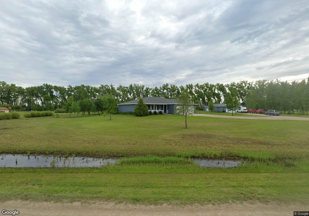
1733 Whip Poor Will Ln NE Grand Forks, ND 58203
Estimated Value: $462,000 - $545,727
4
Beds
3
Baths
2,160
Sq Ft
$232/Sq Ft
Est. Value
About This Home
This home is located at 1733 Whip Poor Will Ln NE, Grand Forks, ND 58203 and is currently estimated at $501,432, approximately $232 per square foot. 1733 Whip Poor Will Ln NE is a home located in Grand Forks County with nearby schools including Wilder Elementary School, Valley Middle School, and Central High School.
Ownership History
Date
Name
Owned For
Owner Type
Purchase Details
Closed on
Apr 14, 2022
Sold by
Swanson Michael D and Swanson Anne Mary
Bought by
Rice Bradley Alan and Rice Rebecca Dwan
Current Estimated Value
Home Financials for this Owner
Home Financials are based on the most recent Mortgage that was taken out on this home.
Original Mortgage
$445,000
Outstanding Balance
$421,148
Interest Rate
5%
Mortgage Type
VA
Estimated Equity
$80,284
Purchase Details
Closed on
Oct 22, 2007
Sold by
Dubuque Keyes Farm Llp
Bought by
Beireis Douglas and Beireis Connie
Create a Home Valuation Report for This Property
The Home Valuation Report is an in-depth analysis detailing your home's value as well as a comparison with similar homes in the area
Home Values in the Area
Average Home Value in this Area
Purchase History
| Date | Buyer | Sale Price | Title Company |
|---|---|---|---|
| Rice Bradley Alan | -- | Priority Title | |
| Beireis Douglas | -- | None Available | |
| Swanson Michael D | -- | None Available |
Source: Public Records
Mortgage History
| Date | Status | Borrower | Loan Amount |
|---|---|---|---|
| Open | Rice Bradley Alan | $445,000 |
Source: Public Records
Tax History Compared to Growth
Tax History
| Year | Tax Paid | Tax Assessment Tax Assessment Total Assessment is a certain percentage of the fair market value that is determined by local assessors to be the total taxable value of land and additions on the property. | Land | Improvement |
|---|---|---|---|---|
| 2024 | $2,558 | $215,800 | $0 | $0 |
| 2023 | $4,205 | $197,700 | $25,000 | $172,700 |
| 2022 | $3,264 | $171,300 | $25,000 | $146,300 |
| 2021 | $3,118 | $165,600 | $25,000 | $140,600 |
| 2020 | $2,758 | $152,800 | $20,200 | $132,600 |
| 2018 | $2,605 | $130,350 | $17,150 | $113,200 |
| 2017 | $2,530 | $130,350 | $17,150 | $113,200 |
| 2016 | $2,431 | $0 | $0 | $0 |
| 2015 | $2,244 | $0 | $0 | $0 |
| 2014 | $2,215 | $130,350 | $0 | $0 |
Source: Public Records
Map
Nearby Homes
- 1759 18th St NE
- 1784 16th St NE
- LF B1 Mulholland Dr
- L2 B1 Mulholland Dr
- L3 B1 Mulholland Dr
- LE B1 Mulholland Dr
- L3 B2 Mulholland Dr
- L5 B1 Muhlholland Dr
- 2075 17th St NE
- 1613 15th Ave NE
- 6801 27th Ave N
- TBD Bucko Ct
- 3565 Donna Dr
- RURAL Falconer Twp
- 5450 Gateway Dr
- 1530 55th St N
- 5370 Myron Ave
- 5380 Myron Ave
- 5201 Gateway Dr
- 5174 W Lanark Dr
- 1729 Whip Poor Will Ln NE
- L3 B6 Whip Poor Will Ln NE
- LOT 3 B 6 Whip Poor Will Ln NE
- 1709 Whip Poor Will Ln NE
- 1712 Whip Poor Will Ln NE
- 1734 Whip Poor Will Ln NE
- 1737 Whip Poor Will Ln NE
- 1738 Whip Poor Will Ln NE
- 1726 Whipperwill Ln
- 1725 Whipperwill Ln
- 1741 Whip Poor Will Ln NE
- LOT 3 Blk 2 Airport Estate
- 1830 Mallard Ln
- 1831 Mallard Ln
- L1B1 Airport Estates
- 1745 Whipperwill Ln
- 1745 Whip Poor Will Ln NE
- 1703 Red Hawk Rd NE
- 1811 17th St NE
- 1708 Whip Poor Will Ln NE