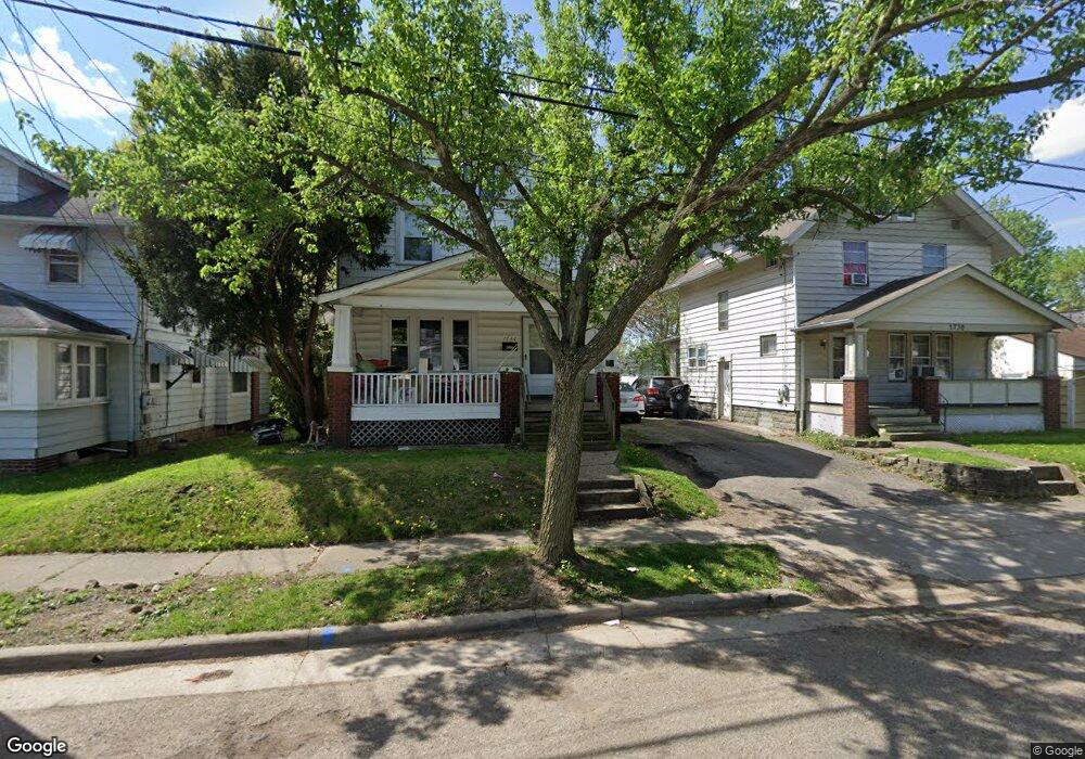
1734 Flint Ave Akron, OH 44305
Goodyear Heights NeighborhoodEstimated Value: $110,000 - $122,000
4
Beds
1
Bath
1,267
Sq Ft
$92/Sq Ft
Est. Value
About This Home
This home is located at 1734 Flint Ave, Akron, OH 44305 and is currently estimated at $116,501, approximately $91 per square foot. 1734 Flint Ave is a home located in Summit County with nearby schools including Seiberling Community Learning Center, Akron Preparatory school, and Middlebury Academy.
Ownership History
Date
Name
Owned For
Owner Type
Purchase Details
Closed on
Jul 28, 2006
Sold by
Fannie Mae
Bought by
T & P Land Management Co Ltd
Current Estimated Value
Purchase Details
Closed on
Mar 31, 2006
Sold by
Czocher Cindy E
Bought by
Fannie Mae and Federal National Mortgage Association
Purchase Details
Closed on
Mar 25, 2003
Sold by
Trefney Larry D and Trefney Kara L
Bought by
Czocher Cindy E
Home Financials for this Owner
Home Financials are based on the most recent Mortgage that was taken out on this home.
Original Mortgage
$58,400
Interest Rate
7.25%
Mortgage Type
Purchase Money Mortgage
Create a Home Valuation Report for This Property
The Home Valuation Report is an in-depth analysis detailing your home's value as well as a comparison with similar homes in the area
Home Values in the Area
Average Home Value in this Area
Purchase History
| Date | Buyer | Sale Price | Title Company |
|---|---|---|---|
| T & P Land Management Co Ltd | $43,250 | Beacon Title Agency Inc | |
| Fannie Mae | $48,000 | None Available | |
| Czocher Cindy E | $64,900 | -- |
Source: Public Records
Mortgage History
| Date | Status | Borrower | Loan Amount |
|---|---|---|---|
| Previous Owner | Czocher Cindy E | $58,400 |
Source: Public Records
Tax History Compared to Growth
Tax History
| Year | Tax Paid | Tax Assessment Tax Assessment Total Assessment is a certain percentage of the fair market value that is determined by local assessors to be the total taxable value of land and additions on the property. | Land | Improvement |
|---|---|---|---|---|
| 2025 | $1,711 | $31,109 | $6,759 | $24,350 |
| 2024 | $1,711 | $31,109 | $6,759 | $24,350 |
| 2023 | $1,711 | $31,109 | $6,759 | $24,350 |
| 2022 | $1,481 | $21,022 | $4,568 | $16,454 |
| 2021 | $1,482 | $21,022 | $4,568 | $16,454 |
| 2020 | $1,561 | $21,020 | $4,570 | $16,450 |
| 2019 | $1,454 | $17,620 | $4,760 | $12,860 |
| 2018 | $1,436 | $17,620 | $4,760 | $12,860 |
| 2017 | $1,407 | $17,620 | $4,760 | $12,860 |
| 2016 | $1,408 | $17,620 | $4,760 | $12,860 |
| 2015 | $1,407 | $17,620 | $4,760 | $12,860 |
| 2014 | $1,397 | $17,620 | $4,760 | $12,860 |
| 2013 | $1,370 | $17,620 | $4,760 | $12,860 |
Source: Public Records
Map
Nearby Homes
- 1769 Flint Ave
- 1818 Flint Ave
- 1726 Shaw Ave
- 1826 Ford Ave
- 1837 Marks Ave
- 1874 Adelaide Blvd
- 1551 Preston Ave
- 1508 Malasia Rd
- 1483 Preston Ave
- 1792 Malasia Rd
- 1947 Preston Ave Unit 1949
- 174 Colony Crescent
- 1955 Preston Ave Unit 1957
- 1598 Pilgrim St
- 156 Colony Crescent
- 165 Colony Crescent
- 183 Colony Crescent
- 1490 Hillside Terrace
- 1892 Malasia Rd
- 82 Detroit St
- 1738 Flint Ave
- 1730 Flint Ave
- 1742 Flint Ave
- 1726 Flint Ave
- 1733 Ford Ave
- 1748 Flint Ave
- 1727 Ford Ave Unit 1729
- 1737 Ford Ave
- 1720 Flint Ave
- 1741 Ford Ave
- 1725 Ford Ave
- 1750 Flint Ave
- 1733 Flint Ave
- 1737 Flint Ave
- 1729 Flint Ave
- 1741 Flint Ave
- 1725 Flint Ave
- 63 Brittain Rd
- 1749 Ford Ave
- 1745 Flint Ave