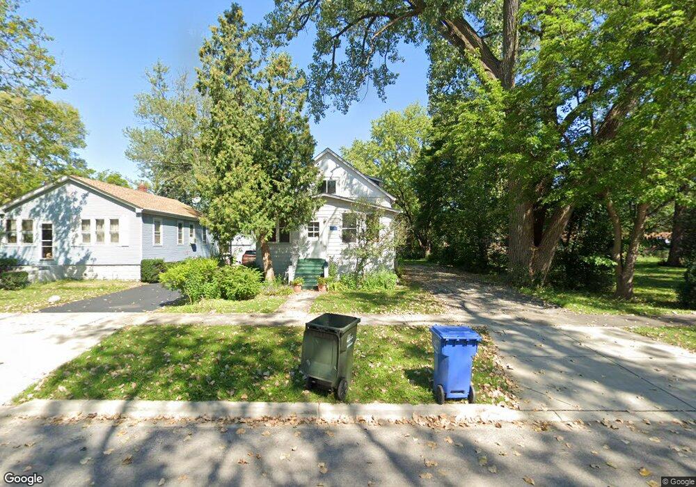
1734 Whitcomb Ave Des Plaines, IL 60018
Estimated Value: $335,000 - $416,000
3
Beds
1
Bath
1,295
Sq Ft
$289/Sq Ft
Est. Value
About This Home
This home is located at 1734 Whitcomb Ave, Des Plaines, IL 60018 and is currently estimated at $373,891, approximately $288 per square foot. 1734 Whitcomb Ave is a home located in Cook County with nearby schools including Central Elementary School, Chippewa Middle School, and Maine West High School.
Ownership History
Date
Name
Owned For
Owner Type
Purchase Details
Closed on
May 30, 2007
Sold by
Lund Richard R
Bought by
Amcore Investment Group Na and Trust #04-15210
Current Estimated Value
Home Financials for this Owner
Home Financials are based on the most recent Mortgage that was taken out on this home.
Original Mortgage
$150,000
Outstanding Balance
$90,043
Interest Rate
6.2%
Mortgage Type
Unknown
Estimated Equity
$283,848
Purchase Details
Closed on
Nov 11, 2005
Sold by
Kaufman Godfrey E
Bought by
Lund Richard R and Godfrey E Kaufman Living Trust
Create a Home Valuation Report for This Property
The Home Valuation Report is an in-depth analysis detailing your home's value as well as a comparison with similar homes in the area
Home Values in the Area
Average Home Value in this Area
Purchase History
| Date | Buyer | Sale Price | Title Company |
|---|---|---|---|
| Amcore Investment Group Na | $200,000 | Attorneys Title Guaranty Fun | |
| Lund Richard R | -- | -- |
Source: Public Records
Mortgage History
| Date | Status | Borrower | Loan Amount |
|---|---|---|---|
| Open | Amcore Investment Group Na | $150,000 |
Source: Public Records
Tax History
| Year | Tax Paid | Tax Assessment Tax Assessment Total Assessment is a certain percentage of the fair market value that is determined by local assessors to be the total taxable value of land and additions on the property. | Land | Improvement |
|---|---|---|---|---|
| 2025 | $7,495 | $35,000 | $8,964 | $26,036 |
| 2024 | $7,495 | $28,429 | $7,968 | $20,461 |
| 2023 | $7,315 | $28,429 | $7,968 | $20,461 |
| 2022 | $7,315 | $28,429 | $7,968 | $20,461 |
| 2021 | $6,108 | $19,871 | $6,474 | $13,397 |
| 2020 | $6,005 | $19,871 | $6,474 | $13,397 |
| 2019 | $5,942 | $22,079 | $6,474 | $15,605 |
| 2018 | $5,818 | $19,454 | $5,727 | $13,727 |
| 2017 | $5,715 | $19,454 | $5,727 | $13,727 |
| 2016 | $5,406 | $19,454 | $5,727 | $13,727 |
| 2015 | $5,945 | $19,666 | $4,980 | $14,686 |
| 2014 | $5,820 | $19,666 | $4,980 | $14,686 |
| 2013 | $5,675 | $19,666 | $4,980 | $14,686 |
Source: Public Records
Map
Nearby Homes
- 1700 E Forest Ave
- 1630 Henry Ave
- 1990 Berry Ln
- 1638 Oakwood Ave
- 1649 Ashland Ave Unit 501
- 1524 Oakwood Ave
- 1640 S River Rd
- 1645 Illinois St
- 1600 E Thacker St Unit 513
- 1380 Oakwood Ave Unit 306
- 905 Center St Unit B208
- 1689 S Elm St
- 1696 S Elm St
- 900 Center St Unit 3A
- 770 Pearson St Unit 808
- 711 S River Rd Unit 617
- 711 S River Rd Unit 704
- 750 Pearson St Unit 904
- 821 Lexington Cir E
- 1685 Mill St Unit 409
- 1724 Whitcomb Ave
- 1714 Whitcomb Ave
- 1754 Whitcomb Ave
- 1733 Van Buren Ave
- 1725 Van Buren Ave
- 1741 Van Buren Ave
- 1704 Whitcomb Ave
- 1713 Van Buren Ave
- 1723 Whitcomb Ave
- 1753 Van Buren Ave
- 1698 Whitcomb Ave
- 1768 Whitcomb Ave
- 1715 Whitcomb Ave
- 1703 Van Buren Ave
- 1753 Whitcomb Ave
- 1270 S River Rd
- 1759 Van Buren Ave
- 1709 Whitcomb Ave
- 1280 S River Rd
- 1763 Whitcomb Ave
Your Personal Tour Guide
Ask me questions while you tour the home.