NOT LISTED FOR SALE

17344 Bethlehem Rd Winslow, AR 72959

Estimated Value: $130,950 - $227,000

5 Acres
$37,048 Price per Acre
217,800 Sq Ft Lot

Last Sold June 17, 2022

Last sale price $105,000

Est. 76% increase in value since last sale

Current estimated payment $1,033/month

76 Days on Market

Highlights

  • Pasture
  • Partially Fenced Property
  • Lot Has A Rolling Slope

About This Lot

As of June 2022

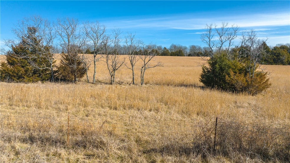
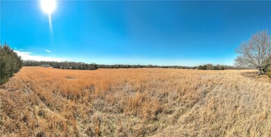
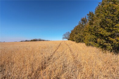
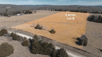
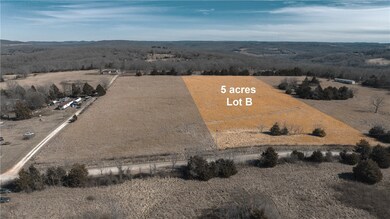
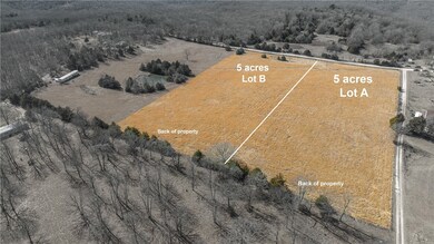
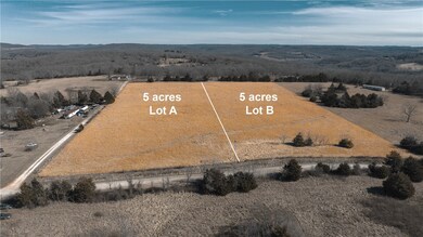
Multiple home sites on 5 cleared acres in southern Washington County between West Fork and Winslow. Convenient location less than 10 minutes from I49. Elevation of 1958 ft above sea level. Electric and rural water at the street. Previously perked. No covenants or deed restrictions. Not far from Devil’s Den State Park.

Last Agent to Sell the Property

Jennifer M Sims

Lindsey & Associates Inc License #EB00081886 Listed on: 02/15/2022

Lindsey & Associates Inc

Last Buyer's Agent

Mindy Cox

Collier & Associates License #SA00080907

Property Details

Property Type

  • Land

Est. Annual Taxes

  • $663

Lot Details

  • 5 Acre Lot
  • Rural Setting
  • Partially Fenced Property
  • Lot Has A Rolling Slope
  • Cleared Lot

Utilities

  • Natural Gas Not Available
  • Water Tap or Transfer Fee
  • Septic Needed

Additional Features

  • Outside City Limits
  • Pasture
  • Mobile Home Allowed

Community Details

  • Long Minor Sub Subdivision

Listing and Financial Details

  • Tax Lot B

Property Details

Property Type

Land

Est. Annual Taxes

$663

Lot Details

0

Listing Details

  • Property Sub Type: Agriculture
  • Prop. Type: Land
  • Lot Size Acres: 5.0
  • Road Surface Type: Gravel
  • Subdivision Name: Long Minor Sub
  • Directions: From I49, take the Winslow exit #45, turn west on Hwy 74, right on Winn Road (CR 228), left on Bethlehem Road, property on right.
  • ResoPropertyType: Land
  • Special Features: VirtualTour

Exterior Features

  • Fencing: Partial
  • Lot Features: Cleared, Mobile Home Allowed, Outside City Limits, Rural Lot, Pasture
  • Topography: Rolling

Utilities

  • Sewer: Septic Needed
  • Utilities: Natural Gas Not Available, Electricity Available
  • Water Source: Rural, Water Tap Fee

Schools

  • Junior High Dist: West Fork

Lot Info

  • Zoning: N
  • ResoLotSizeUnits: Acres

Tax Info

  • Tax Annual Amount: 8.0
  • Tax Block: N/A
  • Tax Lot: B

Ownership History

Date Name Owned For Owner Type

Purchase Details

Closed on
Jun 10, 1993
Bought by
Long Gerald D and Long Aneta P
Current Estimated Value
$185,238
Source: Public Records

Range of Values:

--
Value Increase
--
Percent Increase
--
Adjusted for Inflation
Collateral Analytics

Collateral Analytics Collateral Analytics AVMs (Automated Valuation Model) employ a number of statistical approaches combined with neighborhood-specific comparable selection guarantees the most up-to-date and precise valuations.

Not Available

Collateral Analytics does not have data for the current month. Please view the chart for historical values.

ICE

ICE Mortgage Technology ICE Mortgage Technology’s AVM (Automated Valuation Model) is a state-of-the-art online residential property valuation tool that provides a quick and accurate estimate of the value of almost any home in the U.S.

Not Available

ICE Mortgage Technology does not have data for the current month. Please view the chart for historical values.

First American

First American First American Data & Analytics’ next-generation AVM combines unrivaled data assets with a blended ensemble of valuation models to produce highly accurate, reliable valuations you can trust.

Not Available

First American does not have data for the current month. Please view the chart for historical values.

Quantarium

Quantarium Quantarium’s valuation service, repeatedly proven the industry’s most accurate and comprehensive, is supercharged with a self-learning and auto-tuning AI engine that continually becomes smarter and more accurate as it processes daily inputs from the industry’s leading RE data lake.

Not Available

Quantarium does not have data for the current month. Please view the chart for historical values.

Average Value
Not Available
List Price
Sold Price
Create a Home Valuation Report for This Property
The Home Valuation Report is an in-depth analysis detailing your home's value as well as a comparison with similar homes in the area

Home Values in the Area

Source: Public Records

Average Home Value in this Area


Source: Public Records

Purchase History

Date Buyer Sale Price Title Company
Long Gerald D $19,000 --
Source: Public Records

Property History

Date Event Price List to Sale Price per Sq Ft
06/17/2022 06/17/22 Sold $105,000 -4.5% --
05/03/2022 05/03/22 Pending -- -- --
02/15/2022 02/15/22 For Sale $110,000 -- --
Source: Northwest Arkansas Board of REALTORS®

Tax History Compared to Growth

Source: Public Records

Tax History

Year Tax Paid Tax Assessment Tax Assessment Total Assessment is a certain percentage of the fair market value that is determined by local assessors to be the total taxable value of land and additions on the property. Land Improvement
2025 $663 $26,370 $15,800 $10,570
2024 $763 $26,370 $15,800 $10,570
2023 $760 $15,800 $15,800 $0
2022 $8 $160 $160 $0
2021 $8 $160 $160 $0
2020 $8 $160 $160 $0
2019 $7 $150 $150 $0
2018 $7 $150 $150 $0
2017 $7 $150 $150 $0
2016 $7 $150 $150 $0
2015 $7 $150 $150 $0
Source: Public Records

Agents Affiliated with this Home

  • Section Image
  • Section Image
See All Agents

Map

Source: Northwest Arkansas Board of REALTORS®

MLS Number: 1210050

Northwest Arkansas Board of REALTORS®

APN: 299-00002-000