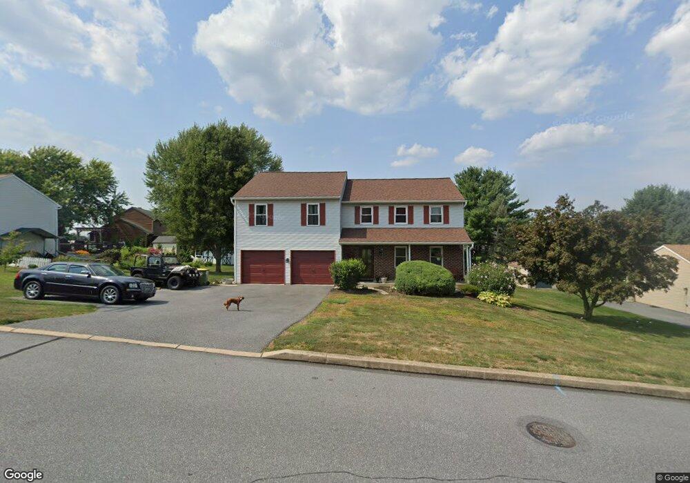
1735 Conard Rd Lancaster, PA 17602
Fertility NeighborhoodEstimated Value: $422,672 - $486,000
3
Beds
2
Baths
1,616
Sq Ft
$284/Sq Ft
Est. Value
About This Home
This home is located at 1735 Conard Rd, Lancaster, PA 17602 and is currently estimated at $459,418, approximately $284 per square foot. 1735 Conard Rd is a home located in Lancaster County with nearby schools including Lampeter Elementary School, Hans Herr Elementary School, and Martin Meylin Middle School.
Ownership History
Date
Name
Owned For
Owner Type
Purchase Details
Closed on
Jan 29, 2007
Sold by
Berry John F and Shaub Andrea K
Bought by
Ritchie Sparks E and Ritchie Cheryl K
Current Estimated Value
Home Financials for this Owner
Home Financials are based on the most recent Mortgage that was taken out on this home.
Original Mortgage
$231,325
Outstanding Balance
$138,477
Interest Rate
6.15%
Mortgage Type
Purchase Money Mortgage
Estimated Equity
$320,941
Purchase Details
Closed on
Oct 26, 2005
Sold by
Berry John F and Shaub Andrea K
Bought by
Berry John F and Shaub Andrea K
Home Financials for this Owner
Home Financials are based on the most recent Mortgage that was taken out on this home.
Original Mortgage
$161,300
Interest Rate
5.93%
Mortgage Type
Fannie Mae Freddie Mac
Purchase Details
Closed on
Nov 21, 2000
Sold by
Berry John F and Berry Janice L
Bought by
Berry John F
Create a Home Valuation Report for This Property
The Home Valuation Report is an in-depth analysis detailing your home's value as well as a comparison with similar homes in the area
Home Values in the Area
Average Home Value in this Area
Purchase History
| Date | Buyer | Sale Price | Title Company |
|---|---|---|---|
| Ritchie Sparks E | $243,500 | None Available | |
| Berry John F | -- | Service Link | |
| Berry John F | -- | -- |
Source: Public Records
Mortgage History
| Date | Status | Borrower | Loan Amount |
|---|---|---|---|
| Open | Ritchie Sparks E | $231,325 | |
| Previous Owner | Berry John F | $161,300 |
Source: Public Records
Tax History Compared to Growth
Tax History
| Year | Tax Paid | Tax Assessment Tax Assessment Total Assessment is a certain percentage of the fair market value that is determined by local assessors to be the total taxable value of land and additions on the property. | Land | Improvement |
|---|---|---|---|---|
| 2025 | $4,839 | $218,700 | $69,500 | $149,200 |
| 2024 | $4,839 | $218,700 | $69,500 | $149,200 |
| 2023 | $4,732 | $218,700 | $69,500 | $149,200 |
| 2022 | $4,660 | $218,700 | $69,500 | $149,200 |
| 2021 | $4,550 | $218,700 | $69,500 | $149,200 |
| 2020 | $4,550 | $218,700 | $69,500 | $149,200 |
| 2019 | $4,489 | $218,700 | $69,500 | $149,200 |
| 2018 | $5,343 | $218,700 | $69,500 | $149,200 |
| 2017 | $4,555 | $180,900 | $56,400 | $124,500 |
| 2016 | $4,555 | $180,900 | $56,400 | $124,500 |
| 2015 | $893 | $180,900 | $56,400 | $124,500 |
| 2014 | $3,439 | $180,900 | $56,400 | $124,500 |
Source: Public Records
Map
Nearby Homes
- 36 Myers Crossing
- 1716 Newport Dr
- 1770 Windy Hill Rd
- 1560 S Jefferson Ct
- 19 Thicket Ln
- 26 Upper Green
- 1624 Morningside Dr
- 123 Glebe Ln
- 166 Huntingwood Dr
- 1827 Krystle Dr
- 452 Longfellow Dr
- 154 River Bend Park
- 257 Longfellow Dr
- 415 Lampeter Rd
- 1864 Lincoln Hwy E
- 305 Greenland Dr Unit 385
- 439 Coreopsis Dr
- 347 Greenland Dr
- 32 Katherines Way
- 305 Conestoga Blvd