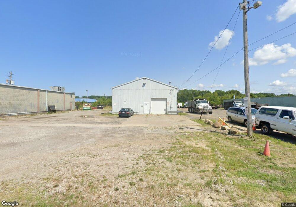
1735 Iowa Ave Lorain, OH 44052
Estimated Value: $270,759
--
Bed
--
Bath
6,272
Sq Ft
$43/Sq Ft
Est. Value
About This Home
This home is located at 1735 Iowa Ave, Lorain, OH 44052 and is currently estimated at $270,759, approximately $43 per square foot. 1735 Iowa Ave is a home located in Lorain County with nearby schools including Hawthorne Elementary School, Longfellow Middle School, and Lorain High School.
Ownership History
Date
Name
Owned For
Owner Type
Purchase Details
Closed on
Dec 19, 2017
Sold by
Muzilla Properties Llc
Bought by
Nem Holdings Llc
Current Estimated Value
Home Financials for this Owner
Home Financials are based on the most recent Mortgage that was taken out on this home.
Original Mortgage
$101,600
Outstanding Balance
$85,450
Interest Rate
3.9%
Mortgage Type
Commercial
Estimated Equity
$185,309
Purchase Details
Closed on
Jul 30, 2007
Sold by
Colorado Offices Llc
Bought by
Muzilla Properties Llc
Purchase Details
Closed on
Jun 25, 2007
Sold by
Colorado Offices Llc
Bought by
Colorado Offices Llc
Create a Home Valuation Report for This Property
The Home Valuation Report is an in-depth analysis detailing your home's value as well as a comparison with similar homes in the area
Home Values in the Area
Average Home Value in this Area
Purchase History
| Date | Buyer | Sale Price | Title Company |
|---|---|---|---|
| Nem Holdings Llc | $127,000 | Ohio Real Title | |
| Muzilla Properties Llc | $135,000 | 1St Nationwide Title Agency | |
| Baumler Properties Llc | $75,000 | 1St Nationwide Title Agency | |
| Colorado Offices Llc | -- | 1St National Title Agency Lt |
Source: Public Records
Mortgage History
| Date | Status | Borrower | Loan Amount |
|---|---|---|---|
| Open | Nem Holdings Llc | $101,600 |
Source: Public Records
Tax History Compared to Growth
Tax History
| Year | Tax Paid | Tax Assessment Tax Assessment Total Assessment is a certain percentage of the fair market value that is determined by local assessors to be the total taxable value of land and additions on the property. | Land | Improvement |
|---|---|---|---|---|
| 2024 | $3,178 | $49,760 | $10,245 | $39,515 |
| 2023 | $3,122 | $39,722 | $8,537 | $31,185 |
| 2022 | $3,090 | $39,722 | $8,537 | $31,185 |
| 2021 | $3,105 | $39,722 | $8,537 | $31,185 |
| 2020 | $3,190 | $39,730 | $8,540 | $31,190 |
| 2019 | $3,163 | $39,730 | $8,540 | $31,190 |
| 2018 | $3,183 | $39,730 | $8,540 | $31,190 |
| 2017 | $3,262 | $37,740 | $8,540 | $29,200 |
| 2016 | $3,221 | $37,740 | $8,540 | $29,200 |
| 2015 | $3,070 | $37,740 | $8,540 | $29,200 |
| 2014 | $3,035 | $37,740 | $8,540 | $29,200 |
| 2013 | $3,041 | $37,740 | $8,540 | $29,200 |
Source: Public Records
Map
Nearby Homes
- 1330 Maryland Ave
- 1318 Maryland Ave
- 423 Kansas Ave
- 723 E St
- 2236 Randall St
- 248 E Marina Pkwy
- 313 Kansas Ave
- 1943 G St
- 207 Georgia Ave
- 906 E Erie Ave
- 2279 Adams St
- 374 Bascule Dr
- 223 W 16th St
- 1623 Nevada Ave
- 1603 Nevada Ave
- 322 Bascule Dr
- 1651 E Erie Ave
- 1039 Streator Place
- 1725 Reid Ave
- 0 New Hampshire Ave
- 1354 Colorado Ave
- 1808 Henderson Dr
- 1270 Colorado Ave
- 1339 Colorado Ave
- 1319 Colorado Ave
- 1230 Colorado Ave
- 1397 Colorado Ave
- 1407 Colorado Ave
- V/L Root Rd
- 1643 Kansas Ave
- 1039 Bridge Dr
- 1431 Colorado Ave
- 721 Idaho Ave
- 1620 Kansas Ave
- 1443 Colorado Ave
- 1625 Kansas Ave
- 1010 Colorado Ave
- 1630 Lehigh Ave
- 1626 Lehigh Ave
- 1604 Kansas Ave