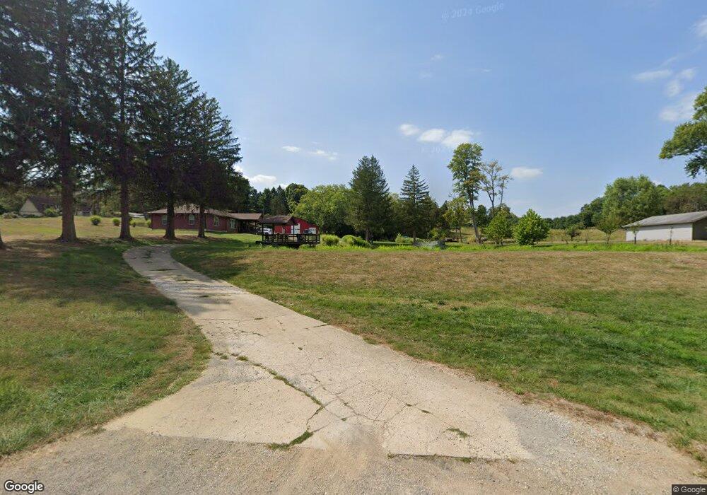
1735 Stringtown Rd NE Lancaster, OH 43130
Estimated Value: $322,000 - $545,000
3
Beds
2
Baths
1,434
Sq Ft
$286/Sq Ft
Est. Value
About This Home
This home is located at 1735 Stringtown Rd NE, Lancaster, OH 43130 and is currently estimated at $409,680, approximately $285 per square foot. 1735 Stringtown Rd NE is a home located in Fairfield County with nearby schools including Medill Elementary School, Thomas Ewing Junior High School, and Lancaster High School.
Ownership History
Date
Name
Owned For
Owner Type
Purchase Details
Closed on
Jun 11, 2015
Sold by
Bmi Federal Credit Union
Bought by
Miller Jason R
Current Estimated Value
Home Financials for this Owner
Home Financials are based on the most recent Mortgage that was taken out on this home.
Original Mortgage
$136,000
Outstanding Balance
$106,267
Interest Rate
4%
Mortgage Type
Adjustable Rate Mortgage/ARM
Estimated Equity
$303,413
Purchase Details
Closed on
Sep 22, 2014
Sold by
Merritt Karen
Bought by
Bmi Fcu
Purchase Details
Closed on
Sep 27, 1995
Sold by
Rife Martha M
Bought by
Merritt Sam W and Merritt Karen
Home Financials for this Owner
Home Financials are based on the most recent Mortgage that was taken out on this home.
Original Mortgage
$175,000
Interest Rate
8%
Mortgage Type
New Conventional
Create a Home Valuation Report for This Property
The Home Valuation Report is an in-depth analysis detailing your home's value as well as a comparison with similar homes in the area
Home Values in the Area
Average Home Value in this Area
Purchase History
| Date | Buyer | Sale Price | Title Company |
|---|---|---|---|
| Miller Jason R | $160,000 | Northwest Title Family Of Co | |
| Bmi Fcu | $128,000 | Attorney | |
| Merritt Sam W | $195,000 | -- |
Source: Public Records
Mortgage History
| Date | Status | Borrower | Loan Amount |
|---|---|---|---|
| Open | Miller Jason R | $136,000 | |
| Previous Owner | Merritt Sam W | $175,000 |
Source: Public Records
Tax History Compared to Growth
Tax History
| Year | Tax Paid | Tax Assessment Tax Assessment Total Assessment is a certain percentage of the fair market value that is determined by local assessors to be the total taxable value of land and additions on the property. | Land | Improvement |
|---|---|---|---|---|
| 2024 | $11,157 | $114,900 | $21,620 | $93,280 |
| 2023 | $4,631 | $114,900 | $21,620 | $93,280 |
| 2022 | $4,689 | $114,900 | $21,620 | $93,280 |
| 2021 | $3,837 | $91,400 | $19,660 | $71,740 |
| 2020 | $3,647 | $90,510 | $19,660 | $70,850 |
| 2019 | $3,480 | $90,510 | $19,660 | $70,850 |
| 2018 | $3,170 | $77,920 | $19,660 | $58,260 |
| 2017 | $3,171 | $77,920 | $19,660 | $58,260 |
| 2016 | $2,485 | $65,830 | $19,660 | $46,170 |
| 2015 | $2,546 | $63,810 | $19,660 | $44,150 |
| 2014 | $2,370 | $63,810 | $19,660 | $44,150 |
| 2013 | $2,370 | $63,810 | $19,660 | $44,150 |
Source: Public Records
Map
Nearby Homes
- 173 Lakeview Dr NE
- 715 Sherman Bluff Way Unit 14715
- 1916 Country Place
- 1801 Pleasantview Dr NE
- 2149 Pleasantview Dr NE
- 1700 Rosewood Dr NE
- 1189 Ridge Rd NE
- 626 Rainbow Dr NW
- 319 Greenfield Ave
- 2865 Stringtown Rd NW
- 534 Overlook Dr NE
- 1799 Declaration Dr W
- 0 Old Millersport Rd NE Unit Lot 10 225033491
- 0 Old Millersport Rd NE Unit 225010386
- 0 Old Millersport Rd NE Unit Tract 8 224028101
- 0 Declaration Dr W Unit 219044159
- 0 Coonpath Rd NW Unit Tract 7 224028097
- 0 Coonpath Rd NW Unit Tract 4 224028093
- 1760 Rainbow Dr NE
- 2444 Sheridan Dr
- 1695 Stringtown Rd NE
- 362 Lakeview Dr NE
- 1740 Neel Ave
- 1720 Stringtown Rd NE
- 1720 Stringtown Rd NE
- 284 Lakeview Dr NE
- 1795 Stringtown Rd NE
- 1655 Stringtown Rd NE
- 1770 Stringtown Rd NE
- 304 Lakeview Dr NE
- 304 Lakeview Dr NE
- 315 Lakeview Dr NE
- 283 Lakeview Dr NE
- 1660 Stringtown Rd NE
- 1800 Stringtown Rd NE
- 256 Lakeview Dr NE
- 1825 Stringtown Rd NE
- 1845 Stringtown Rd NE
- 261 Lakeview Dr NE
- 261 Lakeview Dr NE