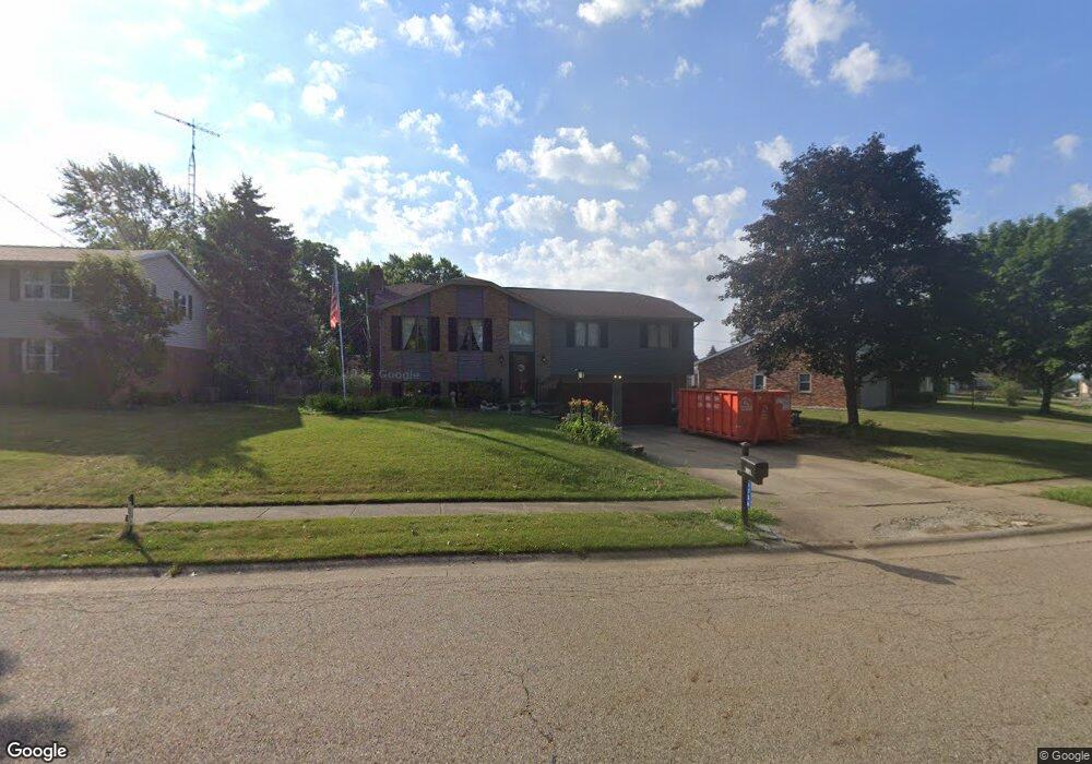
1736 Hiram St Louisville, OH 44641
Estimated Value: $243,977 - $258,000
3
Beds
3
Baths
1,296
Sq Ft
$194/Sq Ft
Est. Value
About This Home
This home is located at 1736 Hiram St, Louisville, OH 44641 and is currently estimated at $250,994, approximately $193 per square foot. 1736 Hiram St is a home located in Stark County with nearby schools including Louisville High School and St. Thomas Aquinas High School & Middle School.
Ownership History
Date
Name
Owned For
Owner Type
Purchase Details
Closed on
Oct 24, 2005
Sold by
Little Don R and Little Janet E
Bought by
Akers Lisa A
Current Estimated Value
Home Financials for this Owner
Home Financials are based on the most recent Mortgage that was taken out on this home.
Original Mortgage
$125,200
Outstanding Balance
$67,266
Interest Rate
5.82%
Mortgage Type
Fannie Mae Freddie Mac
Estimated Equity
$183,728
Create a Home Valuation Report for This Property
The Home Valuation Report is an in-depth analysis detailing your home's value as well as a comparison with similar homes in the area
Home Values in the Area
Average Home Value in this Area
Purchase History
| Date | Buyer | Sale Price | Title Company |
|---|---|---|---|
| Akers Lisa A | $156,500 | -- |
Source: Public Records
Mortgage History
| Date | Status | Borrower | Loan Amount |
|---|---|---|---|
| Open | Akers Lisa A | $125,200 |
Source: Public Records
Tax History Compared to Growth
Tax History
| Year | Tax Paid | Tax Assessment Tax Assessment Total Assessment is a certain percentage of the fair market value that is determined by local assessors to be the total taxable value of land and additions on the property. | Land | Improvement |
|---|---|---|---|---|
| 2025 | -- | $65,980 | $14,980 | $51,000 |
| 2024 | -- | $65,980 | $14,980 | $51,000 |
| 2023 | $2,354 | $54,780 | $11,690 | $43,090 |
| 2022 | $2,360 | $54,780 | $11,690 | $43,090 |
| 2021 | $2,367 | $54,780 | $11,690 | $43,090 |
| 2020 | $1,994 | $50,130 | $10,540 | $39,590 |
| 2019 | $2,002 | $49,670 | $11,480 | $38,190 |
| 2018 | $1,976 | $49,670 | $11,480 | $38,190 |
| 2017 | $1,797 | $43,580 | $9,520 | $34,060 |
| 2016 | $1,834 | $43,580 | $9,520 | $34,060 |
| 2015 | $1,784 | $42,250 | $9,520 | $32,730 |
| 2014 | $1,767 | $38,920 | $8,750 | $30,170 |
| 2013 | $887 | $38,920 | $8,750 | $30,170 |
Source: Public Records
Map
Nearby Homes
- 1561 Noel St
- 0 Pilot Knob Ave NE
- 6285 California Ave
- 5700 Broadway Ave
- 0 Brookridge Ave
- 0 Glenbar St
- 5623 Shallow Creek Ave
- 5700 Glena St
- 6395 Easton St NE
- 704 Reno Dr
- 5470 Alcorn Ave
- 6779 Easton St NE
- 6083 Apple St
- 414 Honeycrisp Dr NE
- 248 Menegay Rd
- 3047 Mcintosh Dr NE
- 2950 Mcintosh Dr NE
- 2956 Mcintosh Dr NE
- 2962 Mcintosh Dr NE
- 2951 Mcintosh Dr NE
- 1737 Hiram St
- 1724 Hiram St
- 1802 Hiram St
- 1725 Hiram St
- 1716 Hiram St
- 1811 Hiram St
- 1812 Hiram St
- 2116 Capital St
- 1717 Hiram St
- 2115 Capital St
- 1822 Hiram St
- 1706 Hiram St
- 2126 Capital St
- 1705 Hiram St
- 1821 Hiram St
- 2015 Wittenburg St
- 2121 Capital St
- 2129 Wittenburg St
- 1681 Malone St
- 2134 Capital St