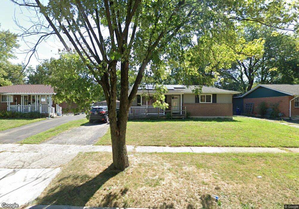
1736 Simpson Dr Columbus, OH 43227
Leawood NeighborhoodEstimated Value: $216,000 - $256,000
3
Beds
2
Baths
1,101
Sq Ft
$206/Sq Ft
Est. Value
About This Home
This home is located at 1736 Simpson Dr, Columbus, OH 43227 and is currently estimated at $226,658, approximately $205 per square foot. 1736 Simpson Dr is a home located in Franklin County with nearby schools including Leawood Elementary School, Sherwood Middle School, and Walnut Ridge High School.
Ownership History
Date
Name
Owned For
Owner Type
Purchase Details
Closed on
Jan 13, 2021
Sold by
Smith Judith E
Bought by
Rivera Louis N and De Rivera Yeidy
Current Estimated Value
Home Financials for this Owner
Home Financials are based on the most recent Mortgage that was taken out on this home.
Original Mortgage
$149,900
Interest Rate
2.7%
Mortgage Type
New Conventional
Purchase Details
Closed on
Jul 6, 2017
Sold by
Smith Wendel K and Smith Judith E
Bought by
Smith Wendel K and Smith Judith E
Purchase Details
Closed on
Jan 25, 1971
Bought by
Smith Wendel K
Create a Home Valuation Report for This Property
The Home Valuation Report is an in-depth analysis detailing your home's value as well as a comparison with similar homes in the area
Home Values in the Area
Average Home Value in this Area
Purchase History
| Date | Buyer | Sale Price | Title Company |
|---|---|---|---|
| Rivera Louis N | $149,900 | First Ohio Title Insurance | |
| Smith Wendel K | -- | None Available | |
| Smiht Wendel K | -- | None Available | |
| Smith Wendel K | -- | -- |
Source: Public Records
Mortgage History
| Date | Status | Borrower | Loan Amount |
|---|---|---|---|
| Previous Owner | Rivera Louis N | $149,900 |
Source: Public Records
Tax History Compared to Growth
Tax History
| Year | Tax Paid | Tax Assessment Tax Assessment Total Assessment is a certain percentage of the fair market value that is determined by local assessors to be the total taxable value of land and additions on the property. | Land | Improvement |
|---|---|---|---|---|
| 2024 | $2,793 | $62,230 | $16,170 | $46,060 |
| 2023 | $2,757 | $62,230 | $16,170 | $46,060 |
| 2022 | $2,008 | $38,720 | $7,110 | $31,610 |
| 2021 | $1,972 | $37,040 | $7,110 | $29,930 |
| 2020 | $1,472 | $37,040 | $7,110 | $29,930 |
| 2019 | $1,249 | $29,340 | $5,710 | $23,630 |
| 2018 | $888 | $29,340 | $5,710 | $23,630 |
| 2017 | $1,248 | $29,340 | $5,710 | $23,630 |
| 2016 | $949 | $23,070 | $5,600 | $17,470 |
| 2015 | $431 | $23,070 | $5,600 | $17,470 |
| 2014 | $863 | $23,070 | $5,600 | $17,470 |
| 2013 | $546 | $27,125 | $6,580 | $20,545 |
Source: Public Records
Map
Nearby Homes
- 1691 Shady Lane Rd
- 4589 Belfast Dr
- 4475 Ellery Dr
- 1607 Shady Lane Rd
- 1563 Genoa Place
- 4701 Janis Dr
- 1693 Gaynor Rd
- 1571 Baxter Dr
- 4571 Aragon Ave
- 1618 S Hamilton Rd
- 1752 S Hamilton Rd
- 1678 Huxley Dr
- 4677 E Livingston Ave
- 1787 Lattimer Dr
- 1543 S Hamilton Rd
- 4467 Grimsby Rd
- 4484 Grimsby Rd
- 4501 Amesbury Rd
- 4530 Amesbury Rd
- 4295 Colby Ave
- 1744 Simpson Dr
- 1730 Simpson Dr
- 1722 Simpson Dr
- 1750 Simpson Dr
- 1755 Shady Lane Rd
- 1761 Shady Lane Rd
- 1747 Shady Lane Rd
- 1767 Shady Lane Rd
- 1716 Simpson Dr
- 1756 Simpson Dr
- 1733 Simpson Dr
- 1725 Simpson Dr
- 1741 Shady Lane Rd
- 4502 Drifton Dr
- 1773 Shady Lane Rd
- 4523 Keeler Dr
- 1710 Simpson Dr
- 1760 Simpson Dr
- 1735 Shady Lane Rd
- 1779 Shady Lane Rd