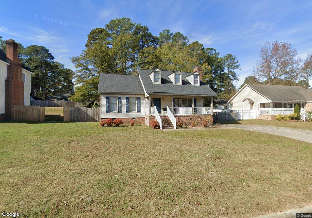
1736 Sparrow Hawk Ln Rocky Mount, NC 27804
Estimated Value: $216,601 - $242,000
4
Beds
2
Baths
1,574
Sq Ft
$145/Sq Ft
Est. Value
About This Home
This home is located at 1736 Sparrow Hawk Ln, Rocky Mount, NC 27804 and is currently estimated at $228,650, approximately $145 per square foot. 1736 Sparrow Hawk Ln is a home located in Nash County with nearby schools including Northern Nash High School, Benvenue Elementary School, and Red Oak Middle School.
Ownership History
Date
Name
Owned For
Owner Type
Purchase Details
Closed on
Jan 15, 2025
Sold by
Gillyard Mary C
Bought by
Benton Zeleka G
Current Estimated Value
Purchase Details
Closed on
Oct 17, 2007
Sold by
Bank Of New York
Bought by
Gillyard Theodore and Gillyard Mary C
Home Financials for this Owner
Home Financials are based on the most recent Mortgage that was taken out on this home.
Original Mortgage
$59,900
Interest Rate
6.44%
Mortgage Type
Purchase Money Mortgage
Purchase Details
Closed on
Jun 4, 2007
Sold by
Arrington Fred D
Bought by
Bank Of New York and Certificateholders Of Cwabs 2004-05
Create a Home Valuation Report for This Property
The Home Valuation Report is an in-depth analysis detailing your home's value as well as a comparison with similar homes in the area
Home Values in the Area
Average Home Value in this Area
Purchase History
| Date | Buyer | Sale Price | Title Company |
|---|---|---|---|
| Benton Zeleka G | -- | None Listed On Document | |
| Benton Zeleka G | -- | None Listed On Document | |
| Gillyard Theodore | $110,000 | U S Land Title | |
| Bank Of New York | $112,500 | None Available |
Source: Public Records
Mortgage History
| Date | Status | Borrower | Loan Amount |
|---|---|---|---|
| Previous Owner | Gillyard Theodore | $59,900 |
Source: Public Records
Tax History Compared to Growth
Tax History
| Year | Tax Paid | Tax Assessment Tax Assessment Total Assessment is a certain percentage of the fair market value that is determined by local assessors to be the total taxable value of land and additions on the property. | Land | Improvement |
|---|---|---|---|---|
| 2025 | $1,222 | $194,000 | $35,360 | $158,640 |
| 2024 | $1,226 | $120,330 | $31,820 | $88,510 |
| 2023 | $810 | $120,330 | $0 | $0 |
| 2022 | $828 | $120,330 | $31,820 | $88,510 |
| 2021 | $810 | $120,330 | $31,820 | $88,510 |
| 2020 | $808 | $120,330 | $31,820 | $88,510 |
| 2019 | $808 | $120,330 | $31,820 | $88,510 |
| 2018 | $808 | $120,330 | $0 | $0 |
| 2017 | $808 | $120,570 | $0 | $0 |
| 2015 | $905 | $135,006 | $0 | $0 |
| 2014 | $905 | $135,016 | $0 | $0 |
Source: Public Records
Map
Nearby Homes
- 1740 Sparrow Hawk Ln
- 1732 Sparrow Hawk Ln
- 1729 Burnt Mill Rd
- 1725 Burnt Mill Rd
- 1728 Sparrow Hawk Ln
- 1733 Burnt Mill Rd
- 1744 Sparrow Hawk Ln
- 1733 Sparrow Hawk Ln
- 1737 Sparrow Hawk Ln
- 1729 Sparrow Hawk Ln
- 1721 Burnt Mill Rd
- 1741 Sparrow Hawk Ln
- 1724 Sparrow Hawk Ln
- 1725 Sparrow Hawk Ln
- 1717 Burnt Mill Rd
- 1800 Sparrow Hawk Ln
- 1721 Sparrow Hawk Ln
- 1728 Bobwhite Ln
- 1724 Bobwhite Ln
- 1720 Sparrow Hawk Ln