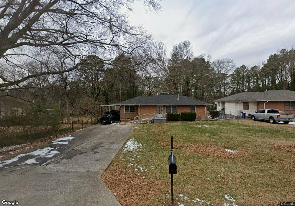
1737 Derrill Dr Decatur, GA 30032
Estimated Value: $248,900 - $297,000
3
Beds
1
Bath
1,640
Sq Ft
$170/Sq Ft
Est. Value
About This Home
This home is located at 1737 Derrill Dr, Decatur, GA 30032 and is currently estimated at $278,725, approximately $169 per square foot. 1737 Derrill Dr is a home located in DeKalb County with nearby schools including Peachcrest Elementary School, Mary McLeod Bethune Middle School, and Towers High School.
Ownership History
Date
Name
Owned For
Owner Type
Purchase Details
Closed on
Jul 31, 1998
Sold by
Grady Willis Lisa and Grady Winston
Bought by
White James and White Veronica L
Current Estimated Value
Home Financials for this Owner
Home Financials are based on the most recent Mortgage that was taken out on this home.
Original Mortgage
$66,564
Outstanding Balance
$13,586
Interest Rate
6.97%
Mortgage Type
FHA
Estimated Equity
$265,139
Purchase Details
Closed on
Feb 24, 1995
Sold by
Owen Harold F
Bought by
Grady Willis Lisa Winston
Create a Home Valuation Report for This Property
The Home Valuation Report is an in-depth analysis detailing your home's value as well as a comparison with similar homes in the area
Home Values in the Area
Average Home Value in this Area
Purchase History
| Date | Buyer | Sale Price | Title Company |
|---|---|---|---|
| White James | $68,000 | -- | |
| Grady Willis Lisa Winston | $54,000 | -- |
Source: Public Records
Mortgage History
| Date | Status | Borrower | Loan Amount |
|---|---|---|---|
| Open | White James | $66,564 | |
| Closed | Grady Willis Lisa Winston | $0 |
Source: Public Records
Tax History
| Year | Tax Paid | Tax Assessment Tax Assessment Total Assessment is a certain percentage of the fair market value that is determined by local assessors to be the total taxable value of land and additions on the property. | Land | Improvement |
|---|---|---|---|---|
| 2025 | $693 | $112,600 | $31,960 | $80,640 |
| 2024 | $723 | $106,640 | $31,960 | $74,680 |
| 2023 | $723 | $58,800 | $12,936 | $45,864 |
Source: Public Records
Map
Nearby Homes
- 1764 Thomas Terrace
- 1692 Derrill Dr
- 1737 Mckenzie Dr
- 3570 Birdstone Dr
- 3089 Del Monico Dr
- 1564 Columbia Dr
- 3094 Santa Monica Dr
- 1847 Derrill Dr
- 1846 Shamrock Dr
- 1885 Shoal Creek Blvd
- 1554 Columbia Cir
- 1609 Tanager Cir
- 1827 Ridgeland Dr
- 1463 Columbia Dr
- 1881 Derrill Dr
- 3159 Bobolink Dr
- 3723 Glenwood Rd
- 1529 N Columbia Place
- 3037 San Juan Dr
- 1621 N Columbia Place
- 1737 Thomas Terrace
- 1743 Thomas Terrace
- 1731 Derrill Dr
- 1731 Thomas Terrace
- 1749 Thomas Terrace
- 1725 Derrill Dr
- 1725 Thomas Terrace
- 1730 Ivy Glenn Rd
- 1719 Derrill Dr
- 1724 Ivy Glenn Rd
- 1734 Ivy Glenn Rd
- 1718 Ivy Glenn Rd
- 1736 Lynn Ln
- 1760 Thomas Terrace
- 1715 Derrill Dr
- 1761 Derrill Dr
- 1757 Thomas Terrace
- 1736 Derrill Dr Unit 13
- 1736 Derrill Dr
- 1730 Derrill Dr
Your Personal Tour Guide
Ask me questions while you tour the home.