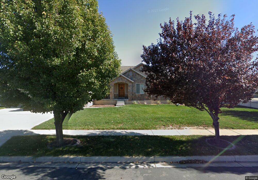
1737 E 70 N Unit 214D Spanish Fork, UT 84660
Estimated Value: $573,000 - $735,000
3
Beds
2
Baths
3,934
Sq Ft
$175/Sq Ft
Est. Value
About This Home
This home is located at 1737 E 70 N Unit 214D, Spanish Fork, UT 84660 and is currently estimated at $688,006, approximately $174 per square foot. 1737 E 70 N Unit 214D is a home located in Utah County with nearby schools including Sierra Bonita Elementary School, Diamond Fork Junior High School, and Mapleton Junior High School.
Ownership History
Date
Name
Owned For
Owner Type
Purchase Details
Closed on
Sep 27, 2013
Sold by
Salisbury Developers Inc
Bought by
Robinson Joshua and Robinson Jalyce
Current Estimated Value
Home Financials for this Owner
Home Financials are based on the most recent Mortgage that was taken out on this home.
Original Mortgage
$264,100
Outstanding Balance
$198,142
Interest Rate
4.46%
Mortgage Type
New Conventional
Estimated Equity
$489,864
Purchase Details
Closed on
Jun 18, 2013
Sold by
Central Bank
Bought by
Salisbury Development Inc
Home Financials for this Owner
Home Financials are based on the most recent Mortgage that was taken out on this home.
Original Mortgage
$191,900
Interest Rate
3.48%
Mortgage Type
Construction
Create a Home Valuation Report for This Property
The Home Valuation Report is an in-depth analysis detailing your home's value as well as a comparison with similar homes in the area
Home Values in the Area
Average Home Value in this Area
Purchase History
| Date | Buyer | Sale Price | Title Company |
|---|---|---|---|
| Robinson Joshua | -- | Provo Land Title Co | |
| Salisbury Development Inc | -- | Provo Land Title Co |
Source: Public Records
Mortgage History
| Date | Status | Borrower | Loan Amount |
|---|---|---|---|
| Open | Robinson Joshua | $264,100 | |
| Previous Owner | Salisbury Development Inc | $191,900 |
Source: Public Records
Tax History Compared to Growth
Tax History
| Year | Tax Paid | Tax Assessment Tax Assessment Total Assessment is a certain percentage of the fair market value that is determined by local assessors to be the total taxable value of land and additions on the property. | Land | Improvement |
|---|---|---|---|---|
| 2025 | $3,360 | $367,565 | $236,200 | $432,100 |
| 2024 | $3,360 | $346,280 | $0 | $0 |
| 2023 | $3,490 | $360,085 | $0 | $0 |
| 2022 | $3,503 | $354,475 | $0 | $0 |
| 2021 | $2,716 | $439,700 | $141,100 | $298,600 |
| 2020 | $2,524 | $397,300 | $128,300 | $269,000 |
| 2019 | $2,228 | $369,000 | $120,200 | $248,800 |
| 2018 | $2,129 | $340,800 | $109,900 | $230,900 |
| 2017 | $2,095 | $180,235 | $0 | $0 |
| 2016 | $2,013 | $170,940 | $0 | $0 |
| 2015 | $1,937 | $162,525 | $0 | $0 |
| 2014 | $1,937 | $163,075 | $0 | $0 |
Source: Public Records
Map
Nearby Homes
- 882 N 1650 E Unit 265
- 858 N 1650 E Unit 266
- 857 N 1650 E Unit 267
- 1455 E 100 S
- 125 N 1430 E
- 1005 E 260 N Unit 20
- 1495 E 400 N
- 2597 E 360 N Unit 16
- 3687 E 1270 S
- 1658 Dover Dr
- 1025 E 360 N Unit 5
- 1001 E 360 N Unit 7
- 1022 E 360 N Unit 27
- 991 E 360 N Unit 8
- 2264 E 320 N Unit 43
- 2232 E 320 N Unit 45
- 2318 E 320 N Unit 1
- 2302 E 320 N Unit 41
- 2248 E 320 N Unit 44
- 2282 E 320 N Unit 42
- 1759 E 70 N Unit MM215D
- 96 N 1700 E
- 1732 E 130 N
- 1758 E 130 N Unit 122a
- 1716 E 130 N
- 1716 E 130 N Unit 124
- 1777 E 70 N Unit 216D
- 1738 E 70 N Unit 213D
- 1738 E 70 N
- 1756 E 70 N
- 52 N 1700 E Unit 126
- 1778 E 130 N
- 1776 E 70 N
- 81 N 1700 E
- 101 N 1700 E
- 101 N 1700 E Unit 150
- 1797 E 70 N Unit 217D
- 63 N 1700 E Unit MM148A
- 127 N 1800 E Unit MM120A
- 1682 E 130 N