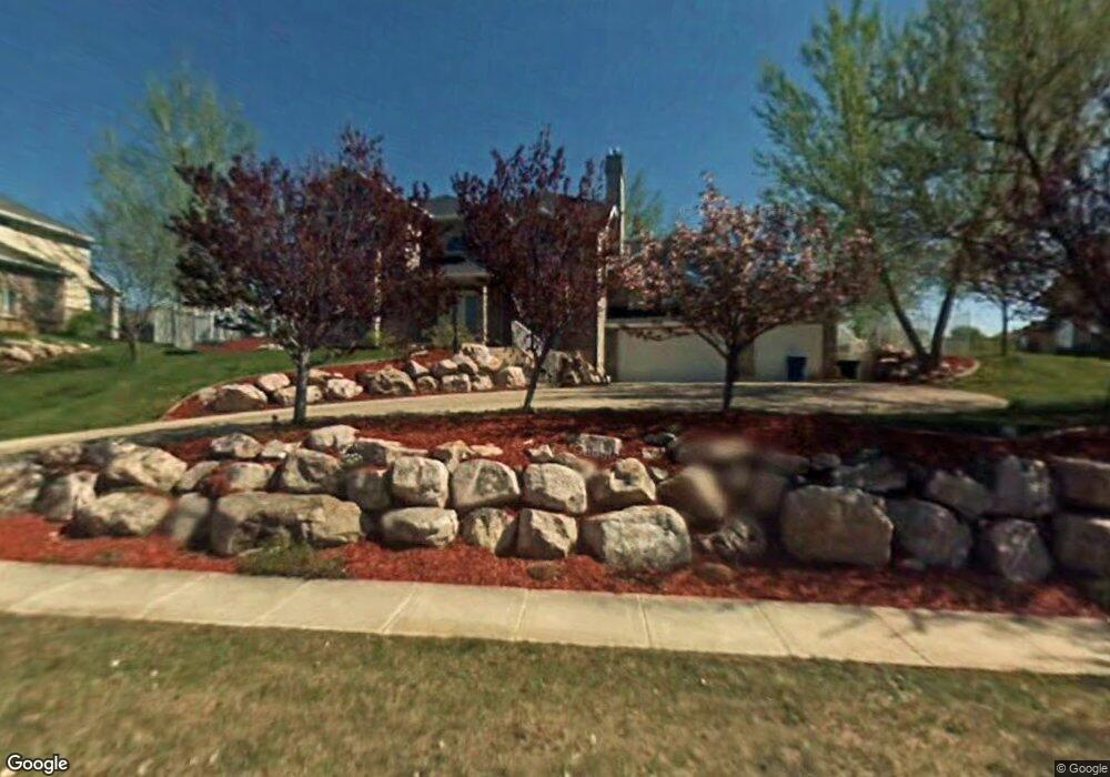
1737 Mohawk Ln Ogden, UT 84403
Southeast Ogden NeighborhoodEstimated Value: $747,791 - $952,000
4
Beds
4
Baths
4,206
Sq Ft
$204/Sq Ft
Est. Value
About This Home
This home is located at 1737 Mohawk Ln, Ogden, UT 84403 and is currently estimated at $858,948, approximately $204 per square foot. 1737 Mohawk Ln is a home located in Weber County with nearby schools including Shadow Valley School, Mount Ogden Junior High School, and Ogden High School.
Ownership History
Date
Name
Owned For
Owner Type
Purchase Details
Closed on
Jun 13, 2023
Sold by
Aguilar Courtney B and Aguilar Miguel
Bought by
Miguel T Aguilar Living Trust and Aguilar
Current Estimated Value
Purchase Details
Closed on
Dec 10, 2021
Sold by
Miguel Aguilar
Bought by
Miguel T Aguilar Living Trust
Purchase Details
Closed on
Feb 25, 2020
Sold by
Aguilar Miguel T and Aguilar Courtney B
Bought by
Aguilar Courtney B and Aguilar Miguel
Home Financials for this Owner
Home Financials are based on the most recent Mortgage that was taken out on this home.
Original Mortgage
$450,000
Interest Rate
3.6%
Mortgage Type
New Conventional
Purchase Details
Closed on
Jul 3, 2019
Sold by
Aguilar Courtney B and Aguilar Miguel T
Bought by
Aguilar Miguel T and Aguilar Courtney B
Home Financials for this Owner
Home Financials are based on the most recent Mortgage that was taken out on this home.
Original Mortgage
$451,631
Interest Rate
4%
Mortgage Type
VA
Purchase Details
Closed on
Nov 20, 2003
Sold by
Jacobson Michael Thomas and Jacobson Christine Renee
Bought by
Jacobson Michael T and Jacobson Christine R
Purchase Details
Closed on
Mar 22, 1997
Sold by
Hopkins Lisa
Bought by
Jacobson Michael Thomas and Jacobson Christine Renee
Home Financials for this Owner
Home Financials are based on the most recent Mortgage that was taken out on this home.
Original Mortgage
$268,000
Interest Rate
7.74%
Purchase Details
Closed on
Mar 21, 1996
Sold by
Hopkins C Richard and Hopkins Lisa
Bought by
Hopkins Lisa
Home Financials for this Owner
Home Financials are based on the most recent Mortgage that was taken out on this home.
Original Mortgage
$300,000
Interest Rate
6.5%
Purchase Details
Closed on
Mar 14, 1996
Sold by
Melaleuca Inc
Bought by
Hopkins C Richard and Hopkins Lisa
Home Financials for this Owner
Home Financials are based on the most recent Mortgage that was taken out on this home.
Original Mortgage
$300,000
Interest Rate
6.5%
Purchase Details
Closed on
Jan 12, 1996
Sold by
Oshiro Bryan Tatsuya and Oshiro Ann Keiko
Bought by
Melaleuca Inc
Create a Home Valuation Report for This Property
The Home Valuation Report is an in-depth analysis detailing your home's value as well as a comparison with similar homes in the area
Home Values in the Area
Average Home Value in this Area
Purchase History
| Date | Buyer | Sale Price | Title Company |
|---|---|---|---|
| Miguel T Aguilar Living Trust | -- | Stewart Title | |
| Aguilar Courtney B | -- | Stewart Title | |
| Miguel T Aguilar Living Trust | -- | None Listed On Document | |
| Aguilar Courtney B | -- | Title Guarantee | |
| Aguilar Miguel T | -- | Backman Title Services Ltd | |
| Jacobson Michael T | -- | -- | |
| Jacobson Michael Thomas | -- | Equity Title | |
| Hopkins Lisa | -- | Security Title | |
| Hopkins C Richard | -- | Security Title | |
| Melaleuca Inc | -- | Security Title |
Source: Public Records
Mortgage History
| Date | Status | Borrower | Loan Amount |
|---|---|---|---|
| Previous Owner | Aguilar Courtney B | $450,000 | |
| Previous Owner | Aguilar Miguel T | $451,631 | |
| Previous Owner | Jacobson Michael Thomas | $268,000 | |
| Previous Owner | Hopkins C Richard | $300,000 |
Source: Public Records
Tax History
| Year | Tax Paid | Tax Assessment Tax Assessment Total Assessment is a certain percentage of the fair market value that is determined by local assessors to be the total taxable value of land and additions on the property. | Land | Improvement |
|---|---|---|---|---|
| 2025 | $1,267 | $393,560 | $126,374 | $267,186 |
| 2024 | $5,380 | $407,549 | $126,373 | $281,176 |
| 2023 | $5,390 | $413,601 | $126,374 | $287,227 |
| 2022 | $5,661 | $437,250 | $110,002 | $327,248 |
| 2021 | $4,876 | $623,000 | $125,027 | $497,973 |
| 2020 | $4,551 | $537,000 | $100,007 | $436,993 |
| 2019 | $4,427 | $492,000 | $100,007 | $391,993 |
| 2018 | $4,163 | $460,000 | $100,007 | $359,993 |
| 2017 | $4,197 | $436,000 | $97,045 | $338,955 |
| 2016 | $3,785 | $213,183 | $49,603 | $163,580 |
| 2015 | $3,796 | $209,454 | $49,603 | $159,851 |
| 2014 | $3,547 | $192,754 | $46,856 | $145,898 |
Source: Public Records
Map
Nearby Homes
- 5341 Fillmore Ave
- 1880 Shadow Valley Dr
- 1762 Whispering Oaks Dr
- 5600 Meadow Ln Unit 193
- 1963 Cherokee Cir
- 1916 E 5625 S
- 1842 E 5625 S Unit C
- 5630 Meadow Ln Unit 172
- 1929 E 5625 S
- 5660 S Meadow Ln Unit 156
- 5660 S Meadow Ln Unit 140
- 5304 S Skyline Pkwy
- 1443 Washakie Cir
- 5538 Elderberry Ct
- 1644 Wasatch Dr
- 5210 Skyline Pkwy
- 1860 Wasatch Dr
- 4983 Quail Ln
- 1805 E 5750 S
- 5142 Sunset Way Unit 401
- 1751 Mohawk Ln
- 1729 Mohawk Ln
- 1729 Mohawk Ln Unit 148
- 5385 Shoshone Cir
- 5346 Arrowhead Ln
- 5375 Shoshone Cir
- 1728 Shoshone Dr
- 1728 Shoshone Dr Unit 3
- 1748 Mohawk Ln
- 1759 Mohawk Ln
- 1719 Mohawk Ln
- 1719 Mohawk Ln Unit 149
- 1714 Shoshone Dr
- 1742 Shoshone Dr
- 5334 Arrowhead Ln
- 5369 Shoshone Cir
- 5325 Mohawk Cir
- 1756 Shoshone Dr
- 1698 Shoshone Dr
- 1777 Mohawk Ln
Your Personal Tour Guide
Ask me questions while you tour the home.