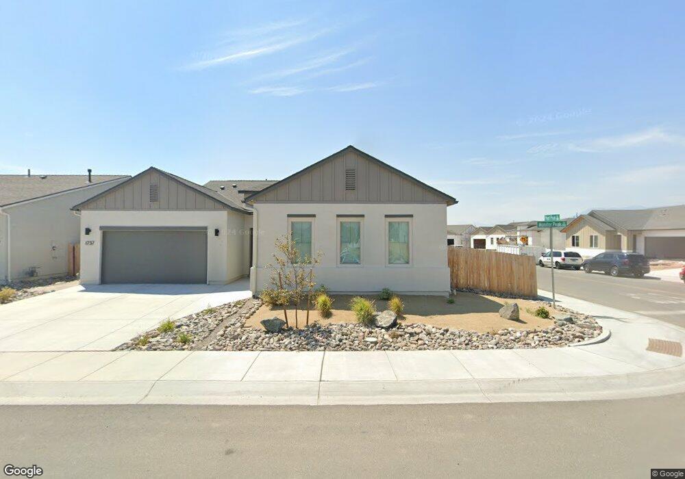
1737 Monitor Peak St Carson City, NV 89701
Saliman and Fifth NeighborhoodEstimated Value: $591,000 - $648,000
4
Beds
3
Baths
2,172
Sq Ft
$288/Sq Ft
Est. Value
About This Home
This home is located at 1737 Monitor Peak St, Carson City, NV 89701 and is currently estimated at $626,459, approximately $288 per square foot. 1737 Monitor Peak St is a home with nearby schools including J.C. Fremont Elementary School, Eagle Valley Middle School, and Carson High School.
Ownership History
Date
Name
Owned For
Owner Type
Purchase Details
Closed on
May 20, 2022
Sold by
Capitol Homebuilders Llc
Bought by
Harvinder S Kalsi And Jatinder Kaur Inter Viv
Current Estimated Value
Home Financials for this Owner
Home Financials are based on the most recent Mortgage that was taken out on this home.
Original Mortgage
$379,929
Outstanding Balance
$360,924
Interest Rate
5.25%
Mortgage Type
New Conventional
Estimated Equity
$265,535
Purchase Details
Closed on
May 18, 2022
Sold by
Capitol Homebuilders Llc
Bought by
Harvinder S Kalsi And Jatinder Kaur Inter Viv
Home Financials for this Owner
Home Financials are based on the most recent Mortgage that was taken out on this home.
Original Mortgage
$379,929
Outstanding Balance
$360,924
Interest Rate
5.25%
Mortgage Type
New Conventional
Estimated Equity
$265,535
Create a Home Valuation Report for This Property
The Home Valuation Report is an in-depth analysis detailing your home's value as well as a comparison with similar homes in the area
Home Values in the Area
Average Home Value in this Area
Purchase History
| Date | Buyer | Sale Price | Title Company |
|---|---|---|---|
| Harvinder S Kalsi And Jatinder Kaur Inter Viv | $633,215 | Ticor Title | |
| Harvinder S Kalsi And Jatinder Kaur Inter Viv | $633,215 | Ticor Title |
Source: Public Records
Mortgage History
| Date | Status | Borrower | Loan Amount |
|---|---|---|---|
| Open | Harvinder S Kalsi And Jatinder Kaur Inter Viv | $379,929 | |
| Closed | Harvinder S Kalsi And Jatinder Kaur Inter Viv | $379,929 |
Source: Public Records
Tax History Compared to Growth
Tax History
| Year | Tax Paid | Tax Assessment Tax Assessment Total Assessment is a certain percentage of the fair market value that is determined by local assessors to be the total taxable value of land and additions on the property. | Land | Improvement |
|---|---|---|---|---|
| 2025 | $5,925 | $181,191 | $38,500 | $142,691 |
| 2024 | $5,634 | $186,979 | $43,050 | $143,929 |
| 2023 | $5,470 | $174,577 | $36,050 | $138,527 |
| 2022 | $5,169 | $144,722 | $24,150 | $120,572 |
| 2021 | $692 | $19,320 | $19,320 | $0 |
Source: Public Records
Map
Nearby Homes
- Cross Creek, Plan 3 at Cross Creek
- Cross Creek, Plan 5 at Cross Creek
- Cross Creek, Plan 1 at Cross Creek
- Cross Creek, Plan 4X at Cross Creek
- Cross Creek, Plan 6 at Cross Creek
- Cross Creek, Plan 4 at Cross Creek
- Cross Creek, Plan 2 at Cross Creek
- 1877 Monitor Peak St
- 1891 Monitor Peak St
- 1892 Monitor Peak St
- 1772 Hogan Peak St
- 1933 Monitor Peak St
- 1922 Hogan Peak St
- 207 Pilot Peak Dr
- 1968 Hogan Peak St
- 1504 Pinto Ct
- 1418 E Telegraph St
- 400 S Saliman Rd Unit 106
- 400 S Saliman Rd Unit 15
- 400 S Saliman Rd Unit 56
- 1765 Monitor Peak St
- 204 Pearl Peak Dr
- 204 Pearl Peak Dr Unit 2585376-18522
- 1777 Monitor Peak St
- 1728 Monitor Peak St
- 1736 Tipton Peak St
- 1764 Tipton Peak St Unit Homesite 79
- 298 Porter Peak Dr
- 1783 Monitor Peak St
- 1776 Tipton Peak St Unit Homesite 80
- 160 Pearl Peak Dr
- 237 Porter Peak Dr
- 205 Wildcat Peak Dr
- 181 Wildcat Peak Dr
- 316 Porter Peak Dr
- 273 Porter Peak Dr
- 159 Wildcat Peak Dr
- 1889 Gilson Peak St
- 1904 Gilson Peak St
- 1903 Gilson Peak St