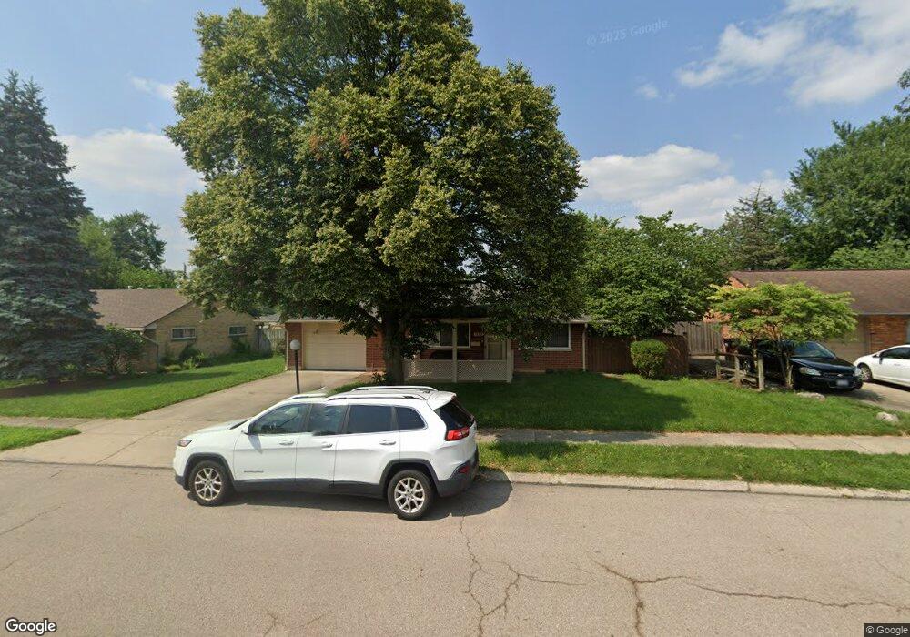
1737 W Stroop Rd Dayton, OH 45439
Estimated Value: $165,827 - $189,000
3
Beds
1
Bath
1,040
Sq Ft
$170/Sq Ft
Est. Value
About This Home
This home is located at 1737 W Stroop Rd, Dayton, OH 45439 and is currently estimated at $176,957, approximately $170 per square foot. 1737 W Stroop Rd is a home located in Montgomery County with nearby schools including Southdale Elementary School, Van Buren Middle School, and Kettering Fairmont High School.
Ownership History
Date
Name
Owned For
Owner Type
Purchase Details
Closed on
Jun 28, 2019
Sold by
Daf Investments Ltd
Bought by
1737 W Stroop Llc
Current Estimated Value
Purchase Details
Closed on
Apr 11, 2018
Sold by
Noren Shannon M and Bank Of America Na
Bought by
Daf Investment Ltd
Purchase Details
Closed on
Apr 24, 2009
Sold by
Whitehead Clyde W
Bought by
Noren Shannon M
Home Financials for this Owner
Home Financials are based on the most recent Mortgage that was taken out on this home.
Original Mortgage
$84,442
Interest Rate
5.05%
Mortgage Type
FHA
Purchase Details
Closed on
Nov 25, 1997
Sold by
Ulm Christopher L and Serrino Ulm Christine A
Bought by
Whitehead Clyde W
Purchase Details
Closed on
Jun 24, 1994
Sold by
Neitman Robert L
Bought by
Ulm Christopher L and Serrino Christine A
Create a Home Valuation Report for This Property
The Home Valuation Report is an in-depth analysis detailing your home's value as well as a comparison with similar homes in the area
Home Values in the Area
Average Home Value in this Area
Purchase History
| Date | Buyer | Sale Price | Title Company |
|---|---|---|---|
| 1737 W Stroop Llc | -- | None Available | |
| Daf Investment Ltd | $58,200 | None Available | |
| Noren Shannon M | $86,000 | Attorney | |
| Whitehead Clyde W | $76,900 | -- | |
| Ulm Christopher L | -- | -- |
Source: Public Records
Mortgage History
| Date | Status | Borrower | Loan Amount |
|---|---|---|---|
| Previous Owner | Noren Shannon M | $84,442 |
Source: Public Records
Tax History Compared to Growth
Tax History
| Year | Tax Paid | Tax Assessment Tax Assessment Total Assessment is a certain percentage of the fair market value that is determined by local assessors to be the total taxable value of land and additions on the property. | Land | Improvement |
|---|---|---|---|---|
| 2024 | $2,035 | $31,780 | $16,820 | $14,960 |
| 2023 | $2,035 | $31,780 | $16,820 | $14,960 |
| 2022 | $1,666 | $20,500 | $7,000 | $13,500 |
| 2021 | $1,512 | $20,500 | $7,000 | $13,500 |
| 2020 | $1,879 | $25,550 | $7,000 | $18,550 |
| 2019 | $1,718 | $20,600 | $8,400 | $12,200 |
| 2018 | $1,727 | $20,600 | $8,400 | $12,200 |
| 2017 | $1,593 | $20,600 | $8,400 | $12,200 |
| 2016 | $1,685 | $20,500 | $8,400 | $12,100 |
| 2015 | $1,610 | $20,500 | $8,400 | $12,100 |
| 2014 | $1,610 | $20,500 | $8,400 | $12,100 |
| 2012 | -- | $20,530 | $8,400 | $12,130 |
Source: Public Records
Map
Nearby Homes
- 1673 W Stroop Rd
- 2090 Mattis Dr
- 4301 Tait Rd
- 4207 S Dixie Dr
- 3519 Waterbury Dr
- 1905 Tait Circle Rd
- 1952 Tait Circle Rd
- 3720 Ridgeleigh Rd Unit D
- 4519 Harbison St
- 4629 Richwood Dr
- 4661 Richwood Dr
- 1349 Tamerlane Rd
- 2639 Blanchard Ave
- 2050 William Ln
- 4792 Loxley Dr
- 2571 Cluster Ave
- 3225 Southdale Dr Unit 1
- 1314 Ridgeview Ave
- 1301 Ridgeview Ave
- 1955 Kresswood Cir
- 1725 W Stroop Rd
- 1724 Hillwood Dr
- 1716 Hillwood Dr
- 1732 Hillwood Dr
- 1713 W Stroop Rd
- 1761 W Stroop Rd
- 1708 Hillwood Dr
- 1740 Hillwood Dr
- 1773 W Stroop Rd
- 2074 W Stroop Rd
- 1701 W Stroop Rd
- 3971 Cordell Dr
- 1748 Hillwood Dr
- 2090 W Stroop Rd
- 2062 W Stroop Rd
- 1700 Hillwood Dr
- 2106 W Stroop Rd
- 1725 Hillwood Dr
- 1785 W Stroop Rd
- 1733 Hillwood Dr