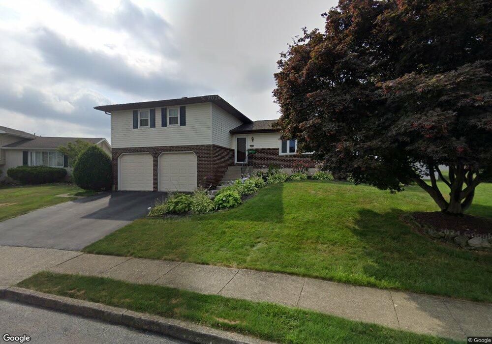
1738 Michael Dr Whitehall, PA 18052
Fullerton NeighborhoodEstimated Value: $422,000 - $487,000
4
Beds
3
Baths
1,972
Sq Ft
$229/Sq Ft
Est. Value
About This Home
This home is located at 1738 Michael Dr, Whitehall, PA 18052 and is currently estimated at $450,949, approximately $228 per square foot. 1738 Michael Dr is a home located in Lehigh County with nearby schools including Zephyr Elementary School, Clarence M Gockley Elementary School, and George D Steckel Elementary School.
Ownership History
Date
Name
Owned For
Owner Type
Purchase Details
Closed on
Oct 30, 2009
Sold by
Frederick Donald K
Bought by
Platton Kenneth W
Current Estimated Value
Home Financials for this Owner
Home Financials are based on the most recent Mortgage that was taken out on this home.
Original Mortgage
$215,710
Outstanding Balance
$141,282
Interest Rate
5.06%
Mortgage Type
FHA
Estimated Equity
$309,667
Purchase Details
Closed on
Sep 29, 1995
Sold by
Scharmann Jr Robert L and Scharmann Rita F
Bought by
Frederick Donald K and Frederick Linda L
Purchase Details
Closed on
Nov 24, 1993
Sold by
Todd Leo W and Todd Beatrice G
Bought by
Scharmann Robert L and Scharmann Rita F
Purchase Details
Closed on
Jul 31, 1991
Sold by
Todd Larry W and Todd Susan C
Bought by
Todd Leo W and Todd Beatrice G
Purchase Details
Closed on
Mar 17, 1986
Bought by
Todd Larry W and Todd Susan C
Create a Home Valuation Report for This Property
The Home Valuation Report is an in-depth analysis detailing your home's value as well as a comparison with similar homes in the area
Home Values in the Area
Average Home Value in this Area
Purchase History
| Date | Buyer | Sale Price | Title Company |
|---|---|---|---|
| Platton Kenneth W | $251,000 | -- | |
| Frederick Donald K | $143,000 | -- | |
| Scharmann Robert L | $144,000 | -- | |
| Todd Leo W | -- | -- | |
| Todd Larry W | -- | -- |
Source: Public Records
Mortgage History
| Date | Status | Borrower | Loan Amount |
|---|---|---|---|
| Open | Platton Kenneth W | $215,710 |
Source: Public Records
Tax History Compared to Growth
Tax History
| Year | Tax Paid | Tax Assessment Tax Assessment Total Assessment is a certain percentage of the fair market value that is determined by local assessors to be the total taxable value of land and additions on the property. | Land | Improvement |
|---|---|---|---|---|
| 2025 | $7,084 | $241,600 | $38,400 | $203,200 |
| 2024 | $6,846 | $241,600 | $38,400 | $203,200 |
| 2023 | $6,705 | $241,600 | $38,400 | $203,200 |
| 2022 | $6,553 | $241,600 | $203,200 | $38,400 |
| 2021 | $6,444 | $241,600 | $38,400 | $203,200 |
| 2020 | $6,197 | $241,600 | $38,400 | $203,200 |
| 2019 | $5,714 | $241,600 | $38,400 | $203,200 |
| 2018 | $5,565 | $241,600 | $38,400 | $203,200 |
| 2017 | $5,463 | $241,600 | $38,400 | $203,200 |
| 2016 | -- | $241,600 | $38,400 | $203,200 |
| 2015 | -- | $241,600 | $38,400 | $203,200 |
| 2014 | -- | $241,600 | $38,400 | $203,200 |
Source: Public Records
Map
Nearby Homes
- 36 Peachtree Cir
- 1844 Schadt Ave
- 1313 Hemlock Dr
- 109 Johnson Ct
- 195 Shiloh Ct
- 1640 Alta Dr
- 1924 Alberta Dr
- 1575 Creekside Rd Unit 21
- 1733 Elmhurst Dr
- 1553 Creekside Rd Unit B23
- 2101 Van Buren Dr
- 1573 Abigail Ln
- 1590 Abigail Ln Unit LOT 59
- 2 Grantarthur #Franklin Ct
- 1 Grantartur #Taylor Ct
- 4 Grantarthur #Morris Ct
- 3 Grantarthur #Liberty Ct
- 1 Grantarthur #Taylor Ct
- 318 Mickley Rd
- 2011 N 1st Ave
- 1740 Michael Dr
- 1736 Michael Dr
- 1755 Peachtree Cir
- 1757 Peachtree Cir
- 1742 Michael Dr
- 1753 Peachtree Cir
- 1759 Peachtree Cir
- 1747 Peachtree Cir
- 1734 Michael Dr
- 1739 Michael Dr
- 1733 Michael Dr
- 1745 Peachtree Cir
- 1741 Michael Dr
- 1744 Michael Dr
- 1761 Peachtree Cir
- 1732 Michael Dr
- 1756 Peachtree Cir
- 1754 Peachtree Cir
- 1731 Michael Dr
- 1743 Peachtree Cir