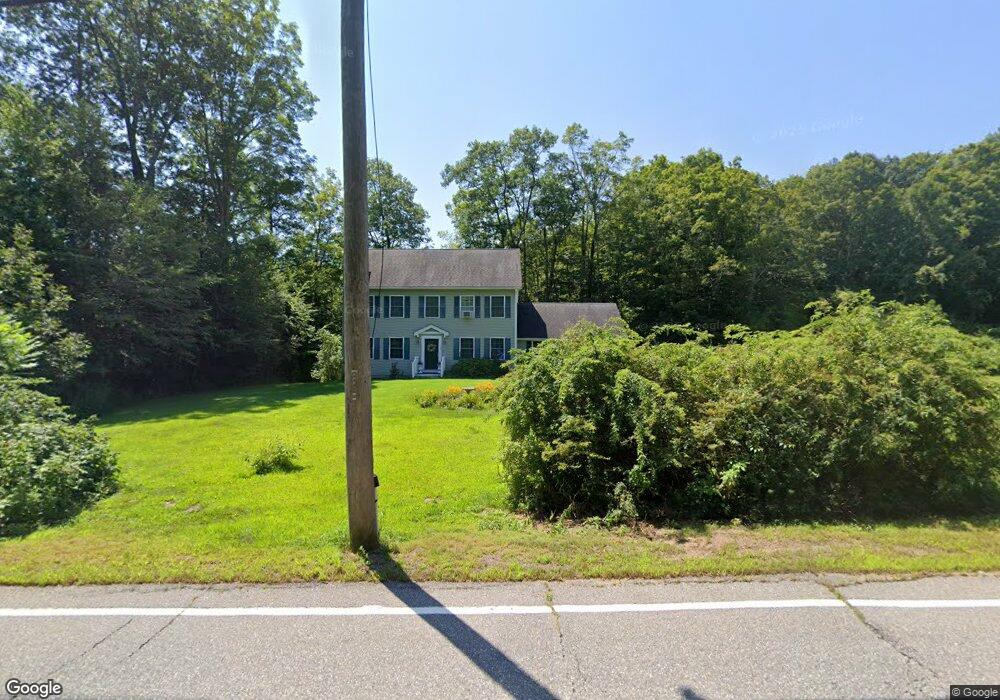
1738 Route 197 Woodstock, CT 06281
Estimated Value: $509,000 - $607,000
3
Beds
3
Baths
2,304
Sq Ft
$241/Sq Ft
Est. Value
About This Home
This home is located at 1738 Route 197, Woodstock, CT 06281 and is currently estimated at $554,256, approximately $240 per square foot. 1738 Route 197 is a home located in Windham County with nearby schools including Woodstock Elementary School and Woodstock Middle School.
Ownership History
Date
Name
Owned For
Owner Type
Purchase Details
Closed on
Dec 7, 2009
Sold by
Fidelity Joint Vent In
Bought by
Draper James M and Draper Rosemarie
Current Estimated Value
Home Financials for this Owner
Home Financials are based on the most recent Mortgage that was taken out on this home.
Original Mortgage
$232,000
Outstanding Balance
$156,144
Interest Rate
5.01%
Mortgage Type
Purchase Money Mortgage
Estimated Equity
$398,113
Purchase Details
Closed on
Aug 13, 2009
Sold by
Westcott Custom Homes
Bought by
Fidelity Joint Ventur
Purchase Details
Closed on
Aug 29, 2007
Sold by
Muirfield Development
Bought by
J & B Unlimited Constr
Home Financials for this Owner
Home Financials are based on the most recent Mortgage that was taken out on this home.
Original Mortgage
$236,700
Interest Rate
6.71%
Mortgage Type
Purchase Money Mortgage
Create a Home Valuation Report for This Property
The Home Valuation Report is an in-depth analysis detailing your home's value as well as a comparison with similar homes in the area
Home Values in the Area
Average Home Value in this Area
Purchase History
| Date | Buyer | Sale Price | Title Company |
|---|---|---|---|
| Draper James M | $290,000 | -- | |
| Fidelity Joint Ventur | -- | -- | |
| J & B Unlimited Constr | $155,000 | -- |
Source: Public Records
Mortgage History
| Date | Status | Borrower | Loan Amount |
|---|---|---|---|
| Open | J & B Unlimited Constr | $232,000 | |
| Previous Owner | J & B Unlimited Constr | $297,000 | |
| Previous Owner | J & B Unlimited Constr | $236,700 |
Source: Public Records
Tax History Compared to Growth
Tax History
| Year | Tax Paid | Tax Assessment Tax Assessment Total Assessment is a certain percentage of the fair market value that is determined by local assessors to be the total taxable value of land and additions on the property. | Land | Improvement |
|---|---|---|---|---|
| 2025 | $6,652 | $272,500 | $31,900 | $240,600 |
| 2024 | $6,278 | $272,500 | $31,900 | $240,600 |
| 2023 | $6,107 | $272,500 | $31,900 | $240,600 |
| 2022 | $5,682 | $272,500 | $31,900 | $240,600 |
| 2021 | $5,840 | $229,000 | $31,900 | $197,100 |
| 2020 | $5,049 | $206,100 | $31,900 | $174,200 |
| 2019 | $5,049 | $206,100 | $31,900 | $174,200 |
| 2018 | $5,049 | $206,100 | $31,900 | $174,200 |
| 2017 | $5,008 | $206,100 | $31,900 | $174,200 |
| 2016 | $4,635 | $192,800 | $41,500 | $151,300 |
| 2015 | $4,504 | $192,800 | $41,500 | $151,300 |
| 2014 | $4,454 | $192,800 | $41,500 | $151,300 |
Source: Public Records
Map
Nearby Homes
- 0 Rr 197 Rd
- 1820 Route 197
- 381 Bungay Hill Rd
- 278 Child Rd
- 10 Laurel Hill Dr
- 29 Crooked Trail Extension
- 56 Laurel Hill Dr
- 70 Laurel Hill Dr
- 19 Hiawatha Heights
- 80 Bungay Hill Rd
- 23 Little Bungee Hill Rd
- 0 Hemlock Dr
- 0 Aplin Hill Ln
- 30 Lyon Rd
- 60 Indian Spring Rd
- 4 Perrin Rd
- 00 Ide Perrin Rd
- 101 Center Rd
- 145 Perrin Rd
- 00 Route 171 Unit Lot 1
- 1742 Route 197
- 1722 Connecticut 197
- 1722 Route 197
- 1750 Route 197
- 1727 Route 197
- 1741 Route 197
- 1719 Route 197
- 43 Sherman Rd
- 1712 Route 197
- 1751 Route 197
- 55 Sherman Rd
- 1774 Route 197 Unit A
- 1774 Route 197 Unit B
- 1774 Route 197 Unit 197
- 1796 Route 197 Unit B
- 1796 Route 197 Unit 197
- 1711 Route 197
- 1702 Connecticut 197
- 1776 Route 197
- 47 Sherman Rd