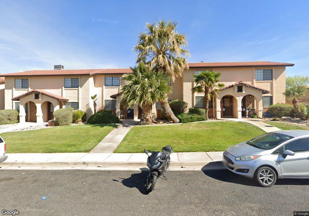
1738 W 1020 N Unit 122 Saint George, UT 84770
Estimated Value: $229,000 - $241,000
2
Beds
2
Baths
1,010
Sq Ft
$234/Sq Ft
Est. Value
About This Home
This home is located at 1738 W 1020 N Unit 122, Saint George, UT 84770 and is currently estimated at $236,845, approximately $234 per square foot. 1738 W 1020 N Unit 122 is a home located in Washington County with nearby schools including Paradise Canyon, Snow Canyon Middle School, and Lava Ridge Intermediate School.
Ownership History
Date
Name
Owned For
Owner Type
Purchase Details
Closed on
Apr 17, 2017
Sold by
Bnb Holdings Llc
Bought by
Bnb Holdings 2 Llc
Current Estimated Value
Purchase Details
Closed on
Jun 2, 2016
Sold by
Wilson Brent and Wilson Brenda
Bought by
Bnbholding Llc
Purchase Details
Closed on
Jun 17, 2013
Sold by
Scheidle Michael F
Bought by
Wilson Brent and Wilson Brenda
Home Financials for this Owner
Home Financials are based on the most recent Mortgage that was taken out on this home.
Original Mortgage
$67,920
Interest Rate
3.32%
Mortgage Type
New Conventional
Purchase Details
Closed on
Jan 15, 2009
Sold by
Finlayson Lairn
Bought by
Scheidle Michael F and Michael F Scheidle Family Living Trust
Create a Home Valuation Report for This Property
The Home Valuation Report is an in-depth analysis detailing your home's value as well as a comparison with similar homes in the area
Home Values in the Area
Average Home Value in this Area
Purchase History
| Date | Buyer | Sale Price | Title Company |
|---|---|---|---|
| Bnb Holdings 2 Llc | -- | None Available | |
| Bnbholding Llc | -- | None Available | |
| Wilson Brent | -- | Mountain View Title St Georg | |
| Scheidle Michael F | -- | Sun West Title |
Source: Public Records
Mortgage History
| Date | Status | Borrower | Loan Amount |
|---|---|---|---|
| Previous Owner | Wilson Brent | $67,920 |
Source: Public Records
Tax History Compared to Growth
Tax History
| Year | Tax Paid | Tax Assessment Tax Assessment Total Assessment is a certain percentage of the fair market value that is determined by local assessors to be the total taxable value of land and additions on the property. | Land | Improvement |
|---|---|---|---|---|
| 2025 | $926 | $129,910 | $30,250 | $99,660 |
| 2023 | $906 | $135,355 | $27,500 | $107,855 |
| 2022 | $1,123 | $129,470 | $27,500 | $101,970 |
| 2021 | $781 | $163,600 | $35,000 | $128,600 |
| 2020 | $711 | $140,400 | $30,000 | $110,400 |
| 2019 | $683 | $131,700 | $30,000 | $101,700 |
| 2018 | $654 | $63,250 | $0 | $0 |
| 2017 | $557 | $53,845 | $0 | $0 |
| 2016 | $502 | $44,880 | $0 | $0 |
| 2015 | $517 | $44,330 | $0 | $0 |
| 2014 | $481 | $41,525 | $0 | $0 |
Source: Public Records
Map
Nearby Homes
- 1742 W 1020 N Unit 123
- 1782 W 1020 N Unit 133
- 1711 W 1020 N Unit 60
- 954 N 1725 W Unit 32
- 1840 W 1100 N Unit 28
- 1840 W 1100 N Unit 1
- 1122 N 1620 W Unit 11
- 1040 N 2000 W
- 1811 W 1300 N
- 1075 N 1400 W Unit 32
- 1360 N Dixie Downs Dr Unit 4
- 1360 N Dixie Downs Rd Unit 55
- 1360 N Dixie Downs Rd Unit 24
- 1360 N Dixie Downs Rd Unit 5
- 1360 N Dixie Downs Rd Unit 14
- 1373 N 1610 W
- 1225 N Dixie Downs Rd Unit 136
- 1225 N Dixie Downs Rd Unit 69
- 1225 N Dixie Downs Rd Unit 16
- 1225 N Dixie Downs Rd Unit 110
- 1734 W 1020 N Unit 121
- 1746 W 1020 N Unit 124
- 1730 W 1020 N Unit 120
- 1750 W 1020 N Unit 125
- 1758 W 1020 N Unit 127
- 1762 W 1020 N Unit 128
- 1762 W 1020 N S Unit 128
- 1766 W 1020 N Unit 129
- 1015 N 1725 W Unit 70
- 1770 W 1020 N Unit 130
- 1749 W 1020 N Unit 71
- 1749 W 1020 N
- 1011 N 1725 W Unit 69
- 1751 W 1020 N Unit 72
- 1751 W 1020 N Unit n/a
- 1753 W 1020 N Unit 73
- 1007 N 1725 W Unit 68
- 1778 W 1020 N Unit 132
- 1003 N 1725 W Unit 67
- 1724 W 1020 N Unit 138