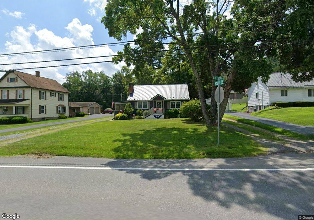
17383 Route 36 Punxsutawney, PA 15767
Estimated Value: $105,000 - $157,000
--
Bed
--
Bath
957
Sq Ft
$129/Sq Ft
Est. Value
About This Home
This home is located at 17383 Route 36, Punxsutawney, PA 15767 and is currently estimated at $123,630, approximately $129 per square foot. 17383 Route 36 is a home located in Jefferson County with nearby schools including Punxsutawney Area High School, Punxsutawney Christian School, and Sunset View Amish School.
Ownership History
Date
Name
Owned For
Owner Type
Purchase Details
Closed on
May 10, 2019
Sold by
Sallack Scott A
Bought by
Sallack Beth A
Current Estimated Value
Purchase Details
Closed on
Jun 26, 2017
Sold by
Jacobson Jasin J and Jacobson Ashlee Marie
Bought by
Sallack Scott A
Purchase Details
Closed on
Mar 29, 2010
Sold by
Brown David A
Bought by
Jacobson Jason J
Home Financials for this Owner
Home Financials are based on the most recent Mortgage that was taken out on this home.
Original Mortgage
$52,250
Interest Rate
4.97%
Mortgage Type
New Conventional
Create a Home Valuation Report for This Property
The Home Valuation Report is an in-depth analysis detailing your home's value as well as a comparison with similar homes in the area
Home Values in the Area
Average Home Value in this Area
Purchase History
| Date | Buyer | Sale Price | Title Company |
|---|---|---|---|
| Sallack Beth A | $60,000 | None Available | |
| Sallack Scott A | $55,000 | None Available | |
| Jacobson Jason J | $55,000 | None Available |
Source: Public Records
Mortgage History
| Date | Status | Borrower | Loan Amount |
|---|---|---|---|
| Previous Owner | Jacobson Jason J | $52,250 |
Source: Public Records
Tax History Compared to Growth
Tax History
| Year | Tax Paid | Tax Assessment Tax Assessment Total Assessment is a certain percentage of the fair market value that is determined by local assessors to be the total taxable value of land and additions on the property. | Land | Improvement |
|---|---|---|---|---|
| 2025 | $1,402 | $32,740 | $2,430 | $30,310 |
| 2024 | $1,371 | $32,740 | $2,430 | $30,310 |
| 2023 | $1,206 | $28,760 | $2,370 | $26,390 |
| 2022 | $1,182 | $28,760 | $2,370 | $26,390 |
| 2021 | $1,166 | $28,760 | $2,370 | $26,390 |
| 2020 | $1,143 | $28,100 | $2,370 | $25,730 |
| 2019 | $1,139 | $28,100 | $2,370 | $25,730 |
| 2018 | $1,117 | $28,100 | $2,370 | $25,730 |
| 2017 | $1,113 | $28,100 | $2,370 | $25,730 |
| 2016 | $1,103 | $28,100 | $2,370 | $25,730 |
| 2015 | -- | $28,100 | $2,370 | $25,730 |
| 2012 | -- | $28,100 | $2,370 | $25,730 |
Source: Public Records
Map
Nearby Homes
- 17245 Pennsylvania 36
- 17927 Pennsylvania 36
- 238 Rikers Rd
- 5 Starlite Ln
- 000 Riker's Rd
- 125 Hall St
- 600 Rockland Ave
- 512 Woodland Ave
- 409 Greenwood Ave
- 501 Woodland Ave
- 313 Greenwood Ave
- 478 Albion Rd
- 402 S Penn St
- 501 E Mahoning St
- 321 E Union St
- 576 Clawson St
- 231 Lane Ave
- 114 Ellsmore Ave
- 4965 Juneau Rd
- 116 Clark St
- 21 Cloe Cherry St
- 17367 Route 36
- 39 Cloe Cherry St
- 17368 Route 36
- 17343 Route 36
- 1044 Pine Tree Rd
- 58 Cloe Cherry St
- 53 Cloe Cherry St
- 17329 Route 36
- 1066 Pine Tree Rd
- 17336 Route 36
- 1086 Pine Tree Rd
- 1086 Pine Tree Rd
- 17307 Route 36
- 17307 Pennsylvania 36
- 0 Pennsylvania 36
- 17386 Route 36
- 1077 Pine Tree Rd
- 1007 Pine Tree Rd
- 17278 Route 36