Estimated Value: $824,000 - $970,000
8
Beds
4
Baths
4,083
Sq Ft
$225/Sq Ft
Est. Value
About This Home
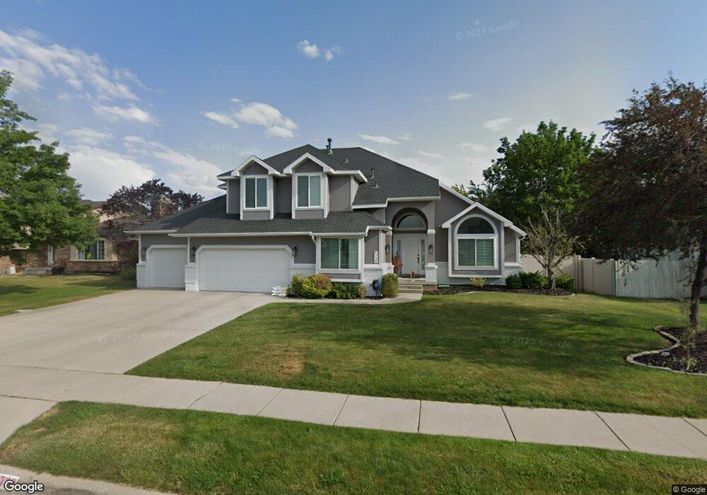
This home is located at 1739 E Michael Way, Sandy, UT 84093 and is currently estimated at $917,062, approximately $224 per square foot. 1739 E Michael Way is a home located in Salt Lake County with nearby schools including Silver Mesa Elementary School, Albion Middle School, and Hillcrest High School.
Ownership History
Date
Name
Owned For
Owner Type
Purchase Details
Closed on
Jan 17, 2019
Sold by
Baltic Sead
Bought by
Baltic Sead and Baltic Sabina
Current Estimated Value
Home Financials for this Owner
Home Financials are based on the most recent Mortgage that was taken out on this home.
Original Mortgage
$542,800
Outstanding Balance
$478,196
Interest Rate
4.7%
Mortgage Type
New Conventional
Estimated Equity
$438,866
Purchase Details
Closed on
May 8, 2014
Sold by
Norris Cheralyn Ruth and Rueckert Cheralyn Ruth
Bought by
Norris Cheralyn R
Home Financials for this Owner
Home Financials are based on the most recent Mortgage that was taken out on this home.
Original Mortgage
$70,000
Interest Rate
4.35%
Mortgage Type
Unknown
Purchase Details
Closed on
Oct 31, 2011
Sold by
Rueckert Brian Sperry and Rueckert Cheralyn Ruth
Bought by
Rueckert Cheralyn Ruth
Create a Home Valuation Report for This Property
The Home Valuation Report is an in-depth analysis detailing your home's value as well as a comparison with similar homes in the area
Home Values in the Area
Average Home Value in this Area
Purchase History
| Date | Buyer | Sale Price | Title Company |
|---|---|---|---|
| Baltic Sead | -- | Accommodation | |
| Baltic Sead | -- | Stewart Title Ins Agcy Of Ut | |
| Norris Cheralyn R | -- | First American Title | |
| Rueckert Cheralyn Ruth | -- | None Available |
Source: Public Records
Mortgage History
| Date | Status | Borrower | Loan Amount |
|---|---|---|---|
| Open | Baltic Sead | $542,800 | |
| Previous Owner | Norris Cheralyn R | $70,000 |
Source: Public Records
Tax History
| Year | Tax Paid | Tax Assessment Tax Assessment Total Assessment is a certain percentage of the fair market value that is determined by local assessors to be the total taxable value of land and additions on the property. | Land | Improvement |
|---|---|---|---|---|
| 2025 | $4,616 | $893,300 | $327,300 | $566,000 |
| 2024 | $4,616 | $865,200 | $315,000 | $550,200 |
| 2023 | $3,895 | $728,800 | $302,900 | $425,900 |
| 2022 | $4,042 | $744,000 | $297,000 | $447,000 |
| 2021 | $3,677 | $576,200 | $235,600 | $340,600 |
| 2020 | $3,708 | $548,300 | $235,600 | $312,700 |
| 2019 | $3,599 | $519,200 | $222,300 | $296,900 |
| 2016 | $3,090 | $431,200 | $200,300 | $230,900 |
Source: Public Records
Map
Nearby Homes
- 8921 S Shady Meadow Dr
- 1482 Waters Ln
- 1891 Richard Rd
- 8857 S Capella Way
- 8642 S Cessna Cir
- 8638 Piper Ln
- 1492 E Sandy Hills Dr
- 1430 E 8685 S
- 8492 S Mesa Dr
- 2156 E Falcon Way
- 1924 E Viscounti Cove
- 1371 Sudbury Ave
- 9078 S Daybreak Dr
- 1990 E Terra Vista Way
- 8483 Terrace Dr
- 8935 Quarry Stone Way
- 1138 E Quarry Stone Way
- 8411 S 1475 E
- 8971 Valley Bend Ct
- 1469 Winterwood Cir
- 1739 Michael Way
- 1729 Michael Way
- 1749 Michael Way
- 1742 Misty Meadow Cir
- 1742 Misty Meadows Cir
- 1732 Misty Meadows Cir
- 1732 E Misty Meadows Cir
- 1719 Michael Way
- 9081 S Shady Willow Cir
- 9081 Shady Willow Cir
- 1744 Michael Way
- 1744 E Michael Way
- 1752 Misty Meadow Cir
- 1759 Michael Way
- 1752 E Misty Meadow
- 1752 E Misty Meadows Cir
- 1752 Misty Meadows Cir
- 1720 Misty Meadows Cir
- 1720 E Misty Meadows Cir
- 1720 Misty Meadow Cir
Your Personal Tour Guide
Ask me questions while you tour the home.