Estimated Value: $357,853 - $498,000
3
Beds
3
Baths
1,935
Sq Ft
$211/Sq Ft
Est. Value
About This Home
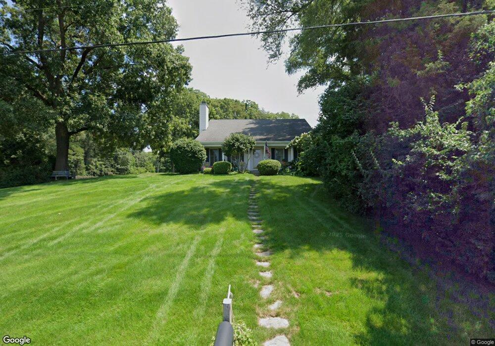
This home is located at 1739 N Philip Rd, Niles, MI 49120 and is currently estimated at $407,963, approximately $210 per square foot. 1739 N Philip Rd is a home located in Berrien County with nearby schools including Ballard Elementary School, Oak Manor Sixth Grade Center, and Ring Lardner Middle School.
Ownership History
Date
Name
Owned For
Owner Type
Purchase Details
Closed on
Jul 22, 2008
Sold by
Barlow William Lee and Barlow Vicki Jo
Bought by
Welch Tala J
Current Estimated Value
Home Financials for this Owner
Home Financials are based on the most recent Mortgage that was taken out on this home.
Original Mortgage
$164,500
Outstanding Balance
$108,413
Interest Rate
6.5%
Mortgage Type
Purchase Money Mortgage
Estimated Equity
$299,550
Purchase Details
Closed on
Dec 6, 1995
Purchase Details
Closed on
Mar 10, 1989
Create a Home Valuation Report for This Property
The Home Valuation Report is an in-depth analysis detailing your home's value as well as a comparison with similar homes in the area
Home Values in the Area
Average Home Value in this Area
Purchase History
| Date | Buyer | Sale Price | Title Company |
|---|---|---|---|
| Welch Tala J | $235,000 | Cti | |
| -- | $165,000 | -- | |
| -- | $4,000 | -- |
Source: Public Records
Mortgage History
| Date | Status | Borrower | Loan Amount |
|---|---|---|---|
| Open | Welch Tala J | $164,500 |
Source: Public Records
Tax History Compared to Growth
Tax History
| Year | Tax Paid | Tax Assessment Tax Assessment Total Assessment is a certain percentage of the fair market value that is determined by local assessors to be the total taxable value of land and additions on the property. | Land | Improvement |
|---|---|---|---|---|
| 2025 | $45 | $149,200 | $0 | $0 |
| 2024 | $25 | $156,600 | $0 | $0 |
| 2023 | $984 | $104,200 | $0 | $0 |
| 2022 | $938 | $94,700 | $0 | $0 |
| 2021 | $2,332 | $99,900 | $11,000 | $88,900 |
| 2020 | $2,301 | $92,500 | $0 | $0 |
| 2019 | $2,260 | $85,400 | $11,000 | $74,400 |
| 2018 | $2,153 | $85,400 | $0 | $0 |
| 2017 | $2,135 | $83,900 | $0 | $0 |
| 2016 | $2,079 | $78,200 | $0 | $0 |
| 2015 | $2,072 | $77,100 | $0 | $0 |
| 2014 | $821 | $76,200 | $0 | $0 |
Source: Public Records
Map
Nearby Homes
- 1478 Valley View Dr Unit Lot 8
- 1491 Valley View Dr
- 0 Drew Dr Unit Lot 29 25001527
- 0 Drew Dr Unit Lot 31 25001523
- 0 Drew Dr Unit Lot 22 25001525
- V/L Scenic View Dr
- 0 Rd
- 824 N Philip Rd
- 1801 Irma Ave
- 8 Marmont St
- 1519 Riverside Rd
- 1209 Morris Dr
- 1836 Platt St
- 209 N Philip Rd
- 232 Pokagon St
- 2802 Primrose Ct
- 117 N Fairview Ave
- 1610 N 5th St
- 1603 N 5th St
- 1201 N 6th St
- 1738 Southworth Dr
- 1742 Southworth Dr
- 1805 N Philip Rd
- 1601 Westview Dr
- 0 Southworth Dr Unit 69018032644
- 0 Southworth Dr Unit 18032644
- 0 Southworth Dr Unit 7018097
- 1723 N Philip Rd
- 1741 Southworth Dr
- 1809 N Philip Rd
- 1733 Southworth Dr
- 1729 Southworth Dr
- 1813 N Philip Rd
- 1720 N Philip Rd
- 1721 N Philip Rd
- 1548 Justice Ln
- 1544 Justice Ln
- 1725 Southworth Dr
- 1540 Justice Ln
- 1817 N Philip Rd