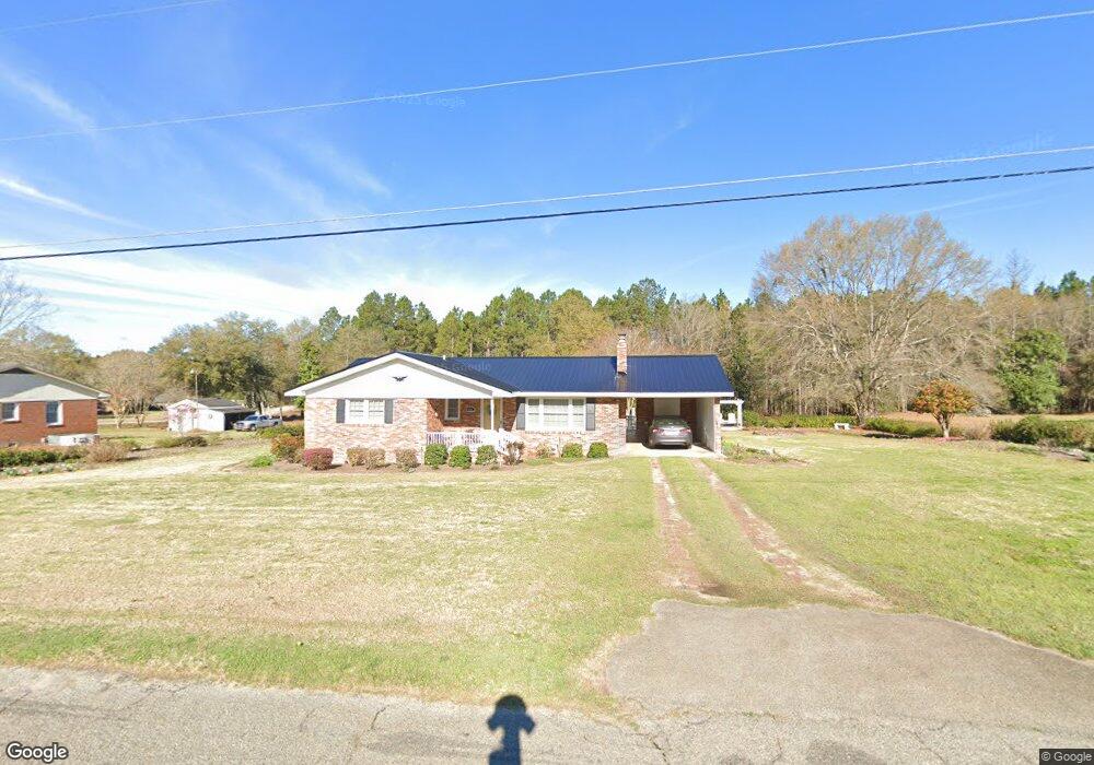
174 Carter St Soperton, GA 30457
Estimated Value: $116,000 - $139,529
--
Bed
2
Baths
1,201
Sq Ft
$103/Sq Ft
Est. Value
About This Home
This home is located at 174 Carter St, Soperton, GA 30457 and is currently estimated at $123,382, approximately $102 per square foot. 174 Carter St is a home located in Treutlen County with nearby schools including Treutlen Elementary School, Treutlen Middle/High School, and Faith Tabernacle Christian Academy.
Ownership History
Date
Name
Owned For
Owner Type
Purchase Details
Closed on
Oct 9, 2014
Sold by
Davis Kandi Carter
Bought by
Hughes Dalton Carter
Current Estimated Value
Purchase Details
Closed on
Oct 11, 2012
Sold by
Carter Garlon
Bought by
Davis Kandi Carter
Purchase Details
Closed on
May 6, 2005
Sold by
Carter Garlon F
Bought by
Carter Garlon F and Carter Arelia C
Purchase Details
Closed on
Mar 15, 2002
Sold by
Darley Darley J and Darley C
Bought by
Carter Garland
Purchase Details
Closed on
Apr 10, 1973
Bought by
Carter Garland
Purchase Details
Closed on
Jan 10, 1961
Create a Home Valuation Report for This Property
The Home Valuation Report is an in-depth analysis detailing your home's value as well as a comparison with similar homes in the area
Home Values in the Area
Average Home Value in this Area
Purchase History
| Date | Buyer | Sale Price | Title Company |
|---|---|---|---|
| Hughes Dalton Carter | -- | -- | |
| Davis Kandi Carter | -- | -- | |
| Carter Garlon F | -- | -- | |
| Carter Garland | $500 | -- | |
| Carter Garland | -- | -- | |
| -- | -- | -- |
Source: Public Records
Tax History Compared to Growth
Tax History
| Year | Tax Paid | Tax Assessment Tax Assessment Total Assessment is a certain percentage of the fair market value that is determined by local assessors to be the total taxable value of land and additions on the property. | Land | Improvement |
|---|---|---|---|---|
| 2024 | $986 | $31,760 | $2,560 | $29,200 |
| 2023 | $879 | $31,440 | $2,560 | $28,880 |
| 2022 | $754 | $27,960 | $2,560 | $25,400 |
| 2021 | $754 | $27,960 | $2,560 | $25,400 |
| 2020 | $753 | $27,960 | $2,560 | $25,400 |
| 2019 | $753 | $27,960 | $2,560 | $25,400 |
| 2018 | $822 | $27,960 | $2,560 | $25,400 |
| 2017 | $740 | $27,960 | $2,560 | $25,400 |
| 2016 | $726 | $27,960 | $2,560 | $25,400 |
| 2015 | -- | $27,960 | $2,560 | $25,400 |
| 2014 | -- | $27,960 | $2,560 | $25,400 |
| 2013 | -- | $27,960 | $2,560 | $25,400 |
Source: Public Records
Map
Nearby Homes
- 4687 W Main St
- 7586 Eastman Rd
- 46 Georgia 46
- 1785 Martin Luther King jr Dr
- 0 Hwy 297 - Tract 2 & 3
- 4004 E Louisiana Ave
- 0 Cedar Grove Rd
- 0 Rivoli Clay Rd
- 00 Rivoli Clay Rd
- 1936 Cedar Grove Rd
- 0 Knox Mill Rd Unit 10640244
- 0 Beasley Hill Place Unit 10640367
- 4281 Ga Highway 46
- 4281 Sr-46
- 481 Windmill Way
- 0 County Line Rd Unit n/a 113727
- 0 Muskogee Trail Unit 25917
- 0 Muskogee Trail Unit LOT 78 20128125
- 95 Railroad Ave
- 0 Lake Helen Loop Unit 10640271
- 144 Carter St
- 194 Carter St
- 195 Carter St
- 147 Carter St
- 114 Carter St
- 115 Carter St
- 246 Carter St
- 1826 Mississippi Ave
- 115 Carter St
- 229 Carter St
- 96 Carter St
- 1851 Mississippi Ave
- 705 Mississippi Ave W
- 97 Carter St
- 266 Carter St
- 257 Carter St
- 79 Carter St
- 1769 Georgia Ave
- 1769 W Georgia Ave
- 1881 Mississippi Ave