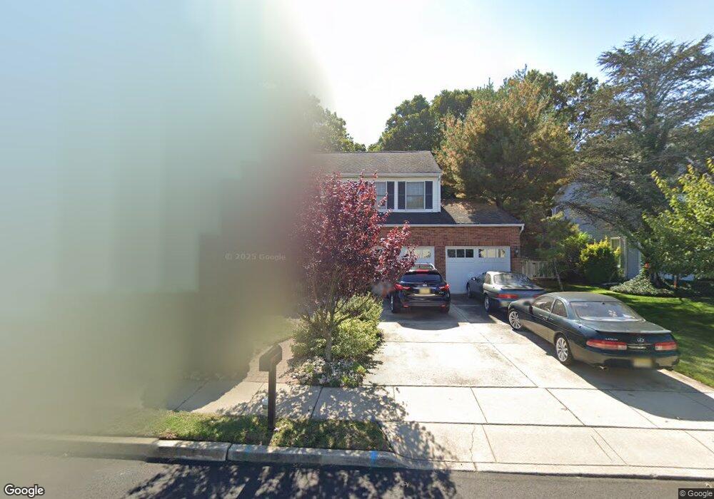
174 Dundee Dr Williamstown, NJ 08094
Monroe Township Gloucester NeighborhoodEstimated Value: $448,780 - $472,000
--
Bed
--
Bath
2,192
Sq Ft
$211/Sq Ft
Est. Value
About This Home
This home is located at 174 Dundee Dr, Williamstown, NJ 08094 and is currently estimated at $461,945, approximately $210 per square foot. 174 Dundee Dr is a home located in Gloucester County with nearby schools including Williamstown High School, St. Mary School, and Finest of the Wheat Christian.
Ownership History
Date
Name
Owned For
Owner Type
Purchase Details
Closed on
Aug 22, 2002
Sold by
Talley Brenda L and Talley Patrick Carl
Bought by
Patrick Carl A
Current Estimated Value
Home Financials for this Owner
Home Financials are based on the most recent Mortgage that was taken out on this home.
Original Mortgage
$140,600
Outstanding Balance
$52,216
Interest Rate
6.48%
Estimated Equity
$409,729
Purchase Details
Closed on
Jun 15, 2000
Sold by
Miller Russell N and Miller Joan E
Bought by
Talley Brenda L and Talley Patrick Carl
Home Financials for this Owner
Home Financials are based on the most recent Mortgage that was taken out on this home.
Original Mortgage
$140,600
Interest Rate
8.28%
Purchase Details
Closed on
Feb 13, 1998
Sold by
Miller Russell N and Miller Joan
Bought by
Miller Joan E
Create a Home Valuation Report for This Property
The Home Valuation Report is an in-depth analysis detailing your home's value as well as a comparison with similar homes in the area
Home Values in the Area
Average Home Value in this Area
Purchase History
| Date | Buyer | Sale Price | Title Company |
|---|---|---|---|
| Patrick Carl A | -- | Clear Advantage Title Inc | |
| Talley Brenda L | $148,000 | -- | |
| Miller Joan E | -- | -- |
Source: Public Records
Mortgage History
| Date | Status | Borrower | Loan Amount |
|---|---|---|---|
| Open | Patrick Carl A | $140,600 | |
| Closed | Talley Brenda L | $140,600 |
Source: Public Records
Tax History Compared to Growth
Tax History
| Year | Tax Paid | Tax Assessment Tax Assessment Total Assessment is a certain percentage of the fair market value that is determined by local assessors to be the total taxable value of land and additions on the property. | Land | Improvement |
|---|---|---|---|---|
| 2025 | $8,342 | $227,800 | $51,500 | $176,300 |
| 2024 | $8,281 | $227,800 | $51,500 | $176,300 |
| 2023 | $8,281 | $227,800 | $51,500 | $176,300 |
| 2022 | $8,242 | $227,800 | $51,500 | $176,300 |
| 2021 | $7,869 | $227,800 | $51,500 | $176,300 |
| 2020 | $8,285 | $227,800 | $51,500 | $176,300 |
| 2019 | $8,235 | $227,800 | $51,500 | $176,300 |
| 2018 | $8,101 | $227,800 | $51,500 | $176,300 |
| 2017 | $8,016 | $226,300 | $58,200 | $168,100 |
| 2016 | $7,914 | $226,300 | $58,200 | $168,100 |
| 2015 | $7,687 | $226,300 | $58,200 | $168,100 |
| 2014 | $7,463 | $226,300 | $58,200 | $168,100 |
Source: Public Records
Map
Nearby Homes
- 24 W Lois Dr
- 1309 Galloway Ct
- 1311 N Main St
- 128 Kerry Lynn Ct
- 23 Grandview Ave
- 9 Birchwood Ln
- 1 Birchwood Ln
- 58 Burr St
- 32 Burr St
- The Derby Plan at Grandview Mews at Monroe
- The Ascot Plan at Grandview Mews at Monroe
- 743 Lois Dr
- 317 Comfort Rd
- 1003 Baywood Dr
- 161 Riley St
- 1029 Baywood Dr
- 357 Brookdale Blvd
- 1420 N Black Horse Pk Pike
- 404 Virgin Island Dr
- 315 Laurel Ave