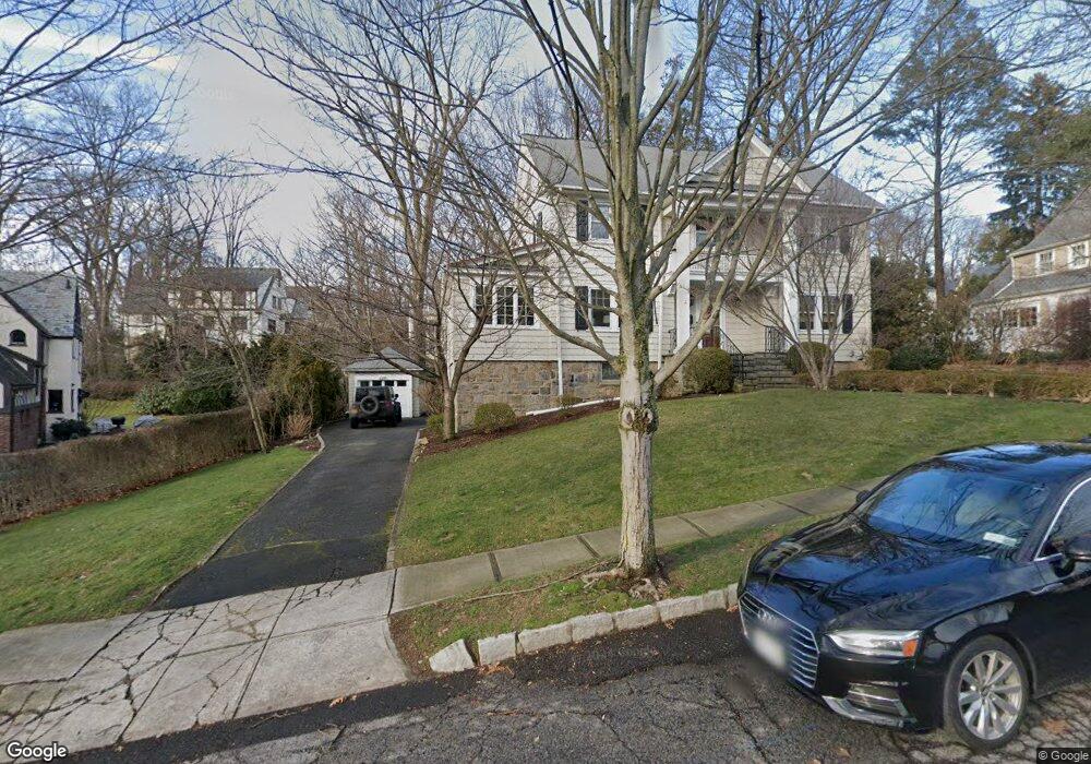
174 Ellison Ave Bronxville, NY 10708
Cedar Knolls NeighborhoodEstimated Value: $1,373,000 - $1,529,000
5
Beds
5
Baths
2,052
Sq Ft
$697/Sq Ft
Est. Value
About This Home
This home is located at 174 Ellison Ave, Bronxville, NY 10708 and is currently estimated at $1,431,008, approximately $697 per square foot. 174 Ellison Ave is a home located in Westchester County with nearby schools including St. Eugene School and Saint Joseph School.
Ownership History
Date
Name
Owned For
Owner Type
Purchase Details
Closed on
Dec 17, 2020
Sold by
Mugno Anthony L and Mugno Marissa R
Bought by
Spillane Brendan and Spillane Deirdre
Current Estimated Value
Home Financials for this Owner
Home Financials are based on the most recent Mortgage that was taken out on this home.
Original Mortgage
$600,000
Outstanding Balance
$533,699
Interest Rate
2.65%
Mortgage Type
New Conventional
Estimated Equity
$897,309
Purchase Details
Closed on
Jun 9, 2003
Sold by
Gelinas Michelle
Bought by
Mugno Anthony L and Mugno Marissa R
Purchase Details
Closed on
Jan 26, 1999
Sold by
Taylor Frederick H and Taylor Barbara M
Bought by
Gelinas Peter G and Gelinas Michelle
Create a Home Valuation Report for This Property
The Home Valuation Report is an in-depth analysis detailing your home's value as well as a comparison with similar homes in the area
Home Values in the Area
Average Home Value in this Area
Purchase History
| Date | Buyer | Sale Price | Title Company |
|---|---|---|---|
| Spillane Brendan | $1,040,000 | Thoroughbred Title Svcs Llc | |
| Mugno Anthony L | $781,500 | -- | |
| Gelinas Peter G | $457,000 | First American Title Ins Co |
Source: Public Records
Mortgage History
| Date | Status | Borrower | Loan Amount |
|---|---|---|---|
| Open | Spillane Brendan | $600,000 |
Source: Public Records
Tax History Compared to Growth
Tax History
| Year | Tax Paid | Tax Assessment Tax Assessment Total Assessment is a certain percentage of the fair market value that is determined by local assessors to be the total taxable value of land and additions on the property. | Land | Improvement |
|---|---|---|---|---|
| 2024 | $3,564 | $20,000 | $5,000 | $15,000 |
| 2023 | $3,545 | $20,000 | $5,000 | $15,000 |
| 2022 | $3,522 | $20,000 | $5,000 | $15,000 |
| 2021 | $17,164 | $20,000 | $5,000 | $15,000 |
| 2020 | $17,166 | $20,000 | $5,000 | $15,000 |
| 2019 | $19,790 | $20,000 | $5,000 | $15,000 |
| 2018 | $16,229 | $20,000 | $5,000 | $15,000 |
| 2017 | $0 | $20,000 | $5,000 | $15,000 |
| 2016 | $17,805 | $20,000 | $5,000 | $15,000 |
| 2015 | -- | $20,000 | $5,000 | $15,000 |
| 2014 | -- | $17,500 | $5,000 | $12,500 |
| 2013 | -- | $17,500 | $5,000 | $12,500 |
Source: Public Records
Map
Nearby Homes
- 139 Ellison Ave
- 46 Dellwood Rd
- 16 Bryn Mawr Pkwy
- 119 Pondfield Rd W
- 133 Pondfield Rd W Unit 2B
- 49 Rockledge Rd Unit 12E
- 209 Pondfield Rd W
- 764 Palmer Rd Unit 1B
- 29 Chatfield Rd
- 212 Pondfield Rd W
- 86 Pondfield Rd W
- 9 Winchester Ave Unit 2B
- 15 Sunnybrook Rd Unit 2A
- 609 Palmer Rd Unit 3M
- 609 Palmer Rd Unit 4C
- 609 Palmer Rd Unit 4J
- 766 Palmer Rd Unit 2D
- 632 Palmer Rd Unit 10B
- 615 Palmer Rd Unit 602
- 615 Palmer Rd Unit 102
- 168 Ellison Ave
- 142 Millard Ave
- 182 Ellison Ave
- 173 Ellison Ave
- 10 Dellwood Cir
- 18 Dellwood Cir
- 162 Ellison Ave
- 181 Ellison Ave
- 161 Ellison Ave
- 24 Dellwood Cir
- 172 Ellison Ave Unit 1
- 172 Ellison Ave
- 4 Dellwood Cir
- 138 Millard Ave
- 156 Ellison Ave
- 153 Ellison Ave
- 151 Millard Ave
- 147 Millard Ave
- 7 Millison Close
- 2 Birch Brook Rd