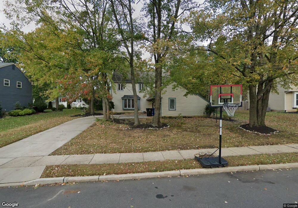
174 Forge Rd Delran, NJ 08075
Swedes Run NeighborhoodEstimated Value: $506,743 - $598,000
Studio
--
Bath
2,120
Sq Ft
$257/Sq Ft
Est. Value
About This Home
This home is located at 174 Forge Rd, Delran, NJ 08075 and is currently estimated at $544,186, approximately $256 per square foot. 174 Forge Rd is a home located in Burlington County with nearby schools including Millbridge Elementary School, Delran Intermediate School, and Delran Middle School.
Ownership History
Date
Name
Owned For
Owner Type
Purchase Details
Closed on
Dec 5, 2007
Sold by
Thompson John J and Thompson Margaret L
Bought by
Vanetten Dennis
Current Estimated Value
Home Financials for this Owner
Home Financials are based on the most recent Mortgage that was taken out on this home.
Original Mortgage
$298,800
Outstanding Balance
$189,128
Interest Rate
6.3%
Mortgage Type
Purchase Money Mortgage
Estimated Equity
$355,058
Purchase Details
Closed on
Jan 26, 1999
Sold by
Dresser Thomas and Dresser Rebecca
Bought by
Thompson John J and Thompson Margaret L
Home Financials for this Owner
Home Financials are based on the most recent Mortgage that was taken out on this home.
Original Mortgage
$147,000
Interest Rate
6.78%
Create a Home Valuation Report for This Property
The Home Valuation Report is an in-depth analysis detailing your home's value as well as a comparison with similar homes in the area
Home Values in the Area
Average Home Value in this Area
Purchase History
| Date | Buyer | Sale Price | Title Company |
|---|---|---|---|
| Vanetten Dennis | $373,500 | None Available | |
| Thompson John J | $197,000 | Weichert Title Agency |
Source: Public Records
Mortgage History
| Date | Status | Borrower | Loan Amount |
|---|---|---|---|
| Open | Vanetten Dennis | $298,800 | |
| Previous Owner | Thompson John J | $147,000 |
Source: Public Records
Tax History
| Year | Tax Paid | Tax Assessment Tax Assessment Total Assessment is a certain percentage of the fair market value that is determined by local assessors to be the total taxable value of land and additions on the property. | Land | Improvement |
|---|---|---|---|---|
| 2025 | $10,286 | $258,700 | $65,000 | $193,700 |
| 2024 | $10,193 | $258,700 | $65,000 | $193,700 |
| 2023 | $10,193 | $258,700 | $65,000 | $193,700 |
| 2022 | $10,061 | $258,700 | $65,000 | $193,700 |
| 2021 | $10,066 | $258,700 | $65,000 | $193,700 |
| 2020 | $10,045 | $258,700 | $65,000 | $193,700 |
| 2019 | $9,952 | $258,700 | $65,000 | $193,700 |
| 2018 | $9,787 | $258,700 | $65,000 | $193,700 |
| 2017 | $9,631 | $258,700 | $65,000 | $193,700 |
| 2016 | $9,489 | $258,700 | $65,000 | $193,700 |
| 2015 | $9,331 | $258,700 | $65,000 | $193,700 |
| 2014 | $8,925 | $258,700 | $65,000 | $193,700 |
Source: Public Records
Map
Nearby Homes
- 139 Coopers Kill Rd
- 154 Fox Chase Dr
- 124 Coopers Kill Rd
- 120 Coopers Kill Rd
- 247 Southview Dr
- 101 Tarlton Ct
- 98 Red Stone Ridge
- 347 Tom Brown Rd
- 123 Shelly Ln
- 343 Tom Brown Rd
- 100 Diane Ave
- 115 Haines Mill Rd
- 207 Farmington Rd
- 108 Patricia Ave
- 2211 Chestnut Hill Dr
- 119 Linda Ave
- 504 Wellfleet Rd
- 715 Willow Dr
- 323 Parry Rd
- 23 Lehigh Dr
Your Personal Tour Guide
Ask me questions while you tour the home.