Estimated Value: $146,000 - $184,000
--
Bed
--
Bath
910
Sq Ft
$182/Sq Ft
Est. Value
About This Home
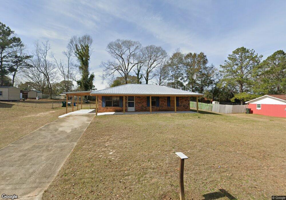
This home is located at 174 Hazelwood St, Ozark, AL 36360 and is currently estimated at $165,187, approximately $181 per square foot. 174 Hazelwood St is a home located in Dale County with nearby schools including Lisenby Primary School, Mixon Intermediate School, and D. A. Smith Middle School.
Ownership History
Date
Name
Owned For
Owner Type
Purchase Details
Closed on
Mar 3, 2025
Sold by
Matthews Roger and Matthews Amy
Bought by
Owens Nathaniel H
Current Estimated Value
Home Financials for this Owner
Home Financials are based on the most recent Mortgage that was taken out on this home.
Original Mortgage
$148,837
Outstanding Balance
$148,087
Interest Rate
6.95%
Mortgage Type
New Conventional
Estimated Equity
$17,100
Purchase Details
Closed on
Jul 11, 2024
Sold by
Whitman Karen
Bought by
Matthews Roger and Matthews Amy
Create a Home Valuation Report for This Property
The Home Valuation Report is an in-depth analysis detailing your home's value as well as a comparison with similar homes in the area
Home Values in the Area
Average Home Value in this Area
Purchase History
| Date | Buyer | Sale Price | Title Company |
|---|---|---|---|
| Owens Nathaniel H | $167,000 | None Listed On Document | |
| Owens Nathaniel H | $167,000 | None Listed On Document | |
| Matthews Roger | $60,000 | None Listed On Document |
Source: Public Records
Mortgage History
| Date | Status | Borrower | Loan Amount |
|---|---|---|---|
| Open | Owens Nathaniel H | $148,837 | |
| Closed | Owens Nathaniel H | $148,837 |
Source: Public Records
Tax History Compared to Growth
Tax History
| Year | Tax Paid | Tax Assessment Tax Assessment Total Assessment is a certain percentage of the fair market value that is determined by local assessors to be the total taxable value of land and additions on the property. | Land | Improvement |
|---|---|---|---|---|
| 2024 | $361 | $7,140 | $760 | $6,380 |
| 2023 | $361 | $5,800 | $560 | $5,240 |
| 2022 | $0 | $4,780 | $4,780 | $0 |
| 2021 | $159 | $4,460 | $560 | $3,900 |
| 2020 | $159 | $4,460 | $560 | $3,900 |
| 2019 | $159 | $4,460 | $560 | $3,900 |
| 2018 | $0 | $4,220 | $560 | $3,660 |
| 2017 | $159 | $4,220 | $560 | $3,660 |
| 2016 | $202 | $5,060 | $560 | $4,500 |
| 2015 | $202 | $5,060 | $560 | $4,500 |
| 2014 | $197 | $4,980 | $560 | $4,420 |
| 2013 | $196 | $4,980 | $560 | $4,420 |
Source: Public Records
Map
Nearby Homes
- Lot 6 Blk G Ashley Dr
- Lot 7 Blk G Amber Dr
- 238 Juniper Dr
- Lot 11 Blk C Garland Ave
- Lot 4 Block D Garland Ave
- 248 Alberta Dr
- TBD Whittle Hudson Rd
- 2.75 acres Whittle Hudson Rd
- 268 Green Village Rd
- 220 Evergreen Ave
- 102 Brookside Ln
- 572 Sharon Ln
- 137 Keisha Cir
- 2.33 acres Parker Rd
- 156 Casey Dr
- 183 Alec Cir
- 1 Acre Alley
- 1152 Whittle Hudson Rd
- 284 Alec Cir
- 1.18 Acre Alley
- 158 Hazelwood St
- 110 Hazelwood St
- 198 Hazelwood Ave
- 198 Hazelwood St
- 177 Hazelwood St
- 198 Hazelwood St
- 143 Hazelwood St
- 138 Hazelwood St
- 195 Hazelwood St
- 120 Hazelwood St
- 374 Juniper Dr
- 218 Hazelwood St
- 291 John D Seifert Dr
- 120 Hazelwood Ave
- 215 Hazelwood St
- 356 Juniper Dr
- 117 Hazelwood St
- 117 Hazelwood Ave
- 234 Hazelwood St
- 176 Ashley Dr