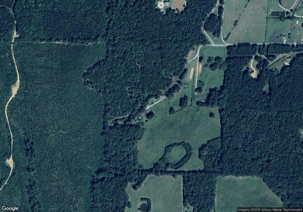
174 Lester Rd Cedartown, GA 30125
Estimated Value: $278,000 - $355,690
3
Beds
2
Baths
1,384
Sq Ft
$226/Sq Ft
Est. Value
About This Home
This home is located at 174 Lester Rd, Cedartown, GA 30125 and is currently estimated at $312,230, approximately $225 per square foot. 174 Lester Rd is a home located in Polk County.
Ownership History
Date
Name
Owned For
Owner Type
Purchase Details
Closed on
Mar 20, 2024
Sold by
Lester Donya C
Bought by
Lester Cecil Barry
Current Estimated Value
Purchase Details
Closed on
Mar 19, 2018
Sold by
Lester Mollie M
Bought by
Lester Donya C
Purchase Details
Closed on
Mar 10, 2011
Sold by
Lester Lelon Cecil
Bought by
Lester Cecil Barry
Purchase Details
Closed on
Aug 30, 1966
Sold by
Welchel John R
Bought by
Lester Cecil
Purchase Details
Closed on
Apr 11, 1964
Sold by
Bell Mrs Nettie
Bought by
Welchel John R
Purchase Details
Closed on
Jan 19, 1957
Bought by
Bell Mrs Nettie
Create a Home Valuation Report for This Property
The Home Valuation Report is an in-depth analysis detailing your home's value as well as a comparison with similar homes in the area
Home Values in the Area
Average Home Value in this Area
Purchase History
| Date | Buyer | Sale Price | Title Company |
|---|---|---|---|
| Lester Cecil Barry | -- | -- | |
| Lester Donya C | -- | -- | |
| Lester Cecil Barry | -- | -- | |
| Lester Cecil | -- | -- | |
| Welchel John R | -- | -- | |
| Bell Mrs Nettie | -- | -- |
Source: Public Records
Tax History Compared to Growth
Tax History
| Year | Tax Paid | Tax Assessment Tax Assessment Total Assessment is a certain percentage of the fair market value that is determined by local assessors to be the total taxable value of land and additions on the property. | Land | Improvement |
|---|---|---|---|---|
| 2024 | $2,120 | $101,397 | $44,124 | $57,273 |
| 2023 | $1,880 | $81,237 | $44,124 | $37,113 |
| 2022 | $1,626 | $70,495 | $38,422 | $32,073 |
| 2021 | $1,647 | $70,495 | $38,422 | $32,073 |
| 2020 | $1,698 | $70,495 | $38,422 | $32,073 |
| 2019 | $1,613 | $60,052 | $38,442 | $21,610 |
| 2018 | $1,272 | $59,500 | $38,442 | $21,058 |
| 2017 | $1,252 | $59,500 | $38,442 | $21,058 |
| 2016 | $1,017 | $50,868 | $29,810 | $21,058 |
| 2015 | $1,027 | $51,165 | $29,810 | $21,355 |
| 2014 | $1,034 | $51,165 | $29,810 | $21,355 |
Source: Public Records
Map
Nearby Homes
- 0 Culp Lake Rd (Tract 3)
- 0 Culp Lake Rd (Tract 2)
- 0 Culp Lake Rd Unit 1025-K 10390361
- 0 Culp Lake Rd Unit 1025-J 10390355
- 0 Culp Lake Rd Unit 1025-I 10390347
- 0 Culp Lake Rd Unit 1025-H 10390344
- 812 Brewster Field Rd
- 1870 Tallapoosa Hwy
- 745 Brewster Field Rd
- TR 2 Culp Lake Rd
- TR 3 Culp Lake Rd
- 1806 Piedmont Hwy
- 1810 Piedmont Hwy
- 966 Judkin Mill Rd
- 0 Judkin Mill Rd Unit LotWP001 19369404
- 50 + - Acres Off Ga Hwy 78
- 0 Cornelius Rd Unit 7646589
- 497 Judkin Mill Rd
- 525 Grogan Rd
- 539 Grogan Rd
- 215 Lester Rd
- 163 Lester Rd
- 138 Culp Lake Rd
- 0 Lester Rd
- 148 Culp Lake Rd
- 76 Lester Rd
- 3910 Johnson Lake Rd
- 190 Culp Lake Rd
- 128 Culp Lake Rd
- 250 Culp Lake Rd
- 190 Lester Rd
- 46 Lester Rd
- 32 Lester Rd
- 3798 Johnson Lake Rd
- 3830 Johnson Lake Rd
- 3868 Johnson Lake Rd
- 161 Culp Lake Rd
- 151 Culp Lake Rd
- 3762 Johnson Lake Rd
- 3792 Johnson Lake Rd
