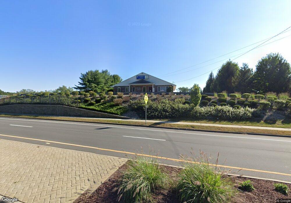
174 Merrow Rd Tolland, CT 06084
Estimated Value: $1,654,733
--
Bed
--
Bath
3,532
Sq Ft
$468/Sq Ft
Est. Value
About This Home
This home is located at 174 Merrow Rd, Tolland, CT 06084 and is currently estimated at $1,654,733, approximately $468 per square foot. 174 Merrow Rd is a home located in Tolland County with nearby schools including Birch Grove Primary School, Tolland Intermediate School, and Tolland Middle School.
Ownership History
Date
Name
Owned For
Owner Type
Purchase Details
Closed on
Mar 30, 2017
Sold by
174 Merrow Road Llc
Bought by
Ana Realty Llc
Current Estimated Value
Home Financials for this Owner
Home Financials are based on the most recent Mortgage that was taken out on this home.
Original Mortgage
$700,000
Interest Rate
4.15%
Mortgage Type
Commercial
Purchase Details
Closed on
Jan 20, 2015
Sold by
174 Merrow Road Llc
Bought by
Connecticut State Of
Purchase Details
Closed on
Nov 23, 2004
Sold by
T&S Connecticut Llc
Bought by
174 Merrow Road Llc
Purchase Details
Closed on
Jun 13, 1988
Sold by
Crossen Thomas
Bought by
Friedman Alan
Create a Home Valuation Report for This Property
The Home Valuation Report is an in-depth analysis detailing your home's value as well as a comparison with similar homes in the area
Home Values in the Area
Average Home Value in this Area
Purchase History
| Date | Buyer | Sale Price | Title Company |
|---|---|---|---|
| Ana Realty Llc | $875,000 | -- | |
| Ana Realty Llc | $875,000 | -- | |
| Connecticut State Of | $21,000 | -- | |
| Connecticut State Of | $21,000 | -- | |
| 174 Merrow Road Llc | $700,000 | -- | |
| 174 Merrow Road Llc | $700,000 | -- | |
| Friedman Alan | $525,000 | -- |
Source: Public Records
Mortgage History
| Date | Status | Borrower | Loan Amount |
|---|---|---|---|
| Closed | Friedman Alan | $700,000 |
Source: Public Records
Tax History Compared to Growth
Tax History
| Year | Tax Paid | Tax Assessment Tax Assessment Total Assessment is a certain percentage of the fair market value that is determined by local assessors to be the total taxable value of land and additions on the property. | Land | Improvement |
|---|---|---|---|---|
| 2025 | $8,878 | $326,500 | $151,800 | $174,700 |
| 2024 | $11,769 | $311,600 | $151,800 | $159,800 |
| 2023 | $11,632 | $311,600 | $151,800 | $159,800 |
| 2022 | $11,398 | $311,600 | $151,800 | $159,800 |
| 2021 | $11,563 | $311,600 | $151,800 | $159,800 |
| 2020 | $11,233 | $311,600 | $151,800 | $159,800 |
| 2019 | $10,963 | $304,100 | $151,800 | $152,300 |
| 2018 | $10,644 | $304,100 | $151,800 | $152,300 |
| 2017 | $10,397 | $304,100 | $151,800 | $152,300 |
| 2016 | -- | $304,100 | $151,800 | $152,300 |
| 2015 | -- | $309,900 | $157,600 | $152,300 |
| 2014 | $9,458 | $304,600 | $121,300 | $183,300 |
Source: Public Records
Map
Nearby Homes
- 12 Stone Pond Rd
- 248 Merrow Rd
- 284 Merrow Rd
- 317 Merrow Rd
- 312 Merrow Rd
- 30 Elgin Dr
- 226 Goose Ln
- 00 Tolland Stage Rd
- 56 Torry Rd
- 89 Tolland Green
- 137 Anthony Rd
- 999 Tolland Stage Rd
- 159 Anthony Rd
- 37 Dunn Hill Rd
- 211 Old Post Rd
- 25 Josephine Way
- 8 Walbridge Hill Rd
- 49 Walbridge Hill Rd
- 19 Thomas Dr
- 18 Raisch Dr
- 200 Merrow Rd
- 64 Stone Pond Rd
- 62 Stone Pond Rd
- 60 Stone Pond Rd
- 58 Stone Pond Rd
- 56 Stone Pond Rd
- 54 Stone Pond Rd
- 47 Stone Pond Rd
- 45 Stone Pond Rd
- 43 Stone Pond Rd
- 43 Stone Pond Rd Unit 43
- 41 Stone Pond Rd
- 41 Stone Pond Rd Unit 41
- 52 Stone Pond Rd
- 50 Stone Pond Rd
- 23 Fieldstone Common
- 48 Stone Pond Rd
- 48 Stone Pond Rd Unit 48
- 49 Stone Pond Rd
- 46 Stone Pond Rd