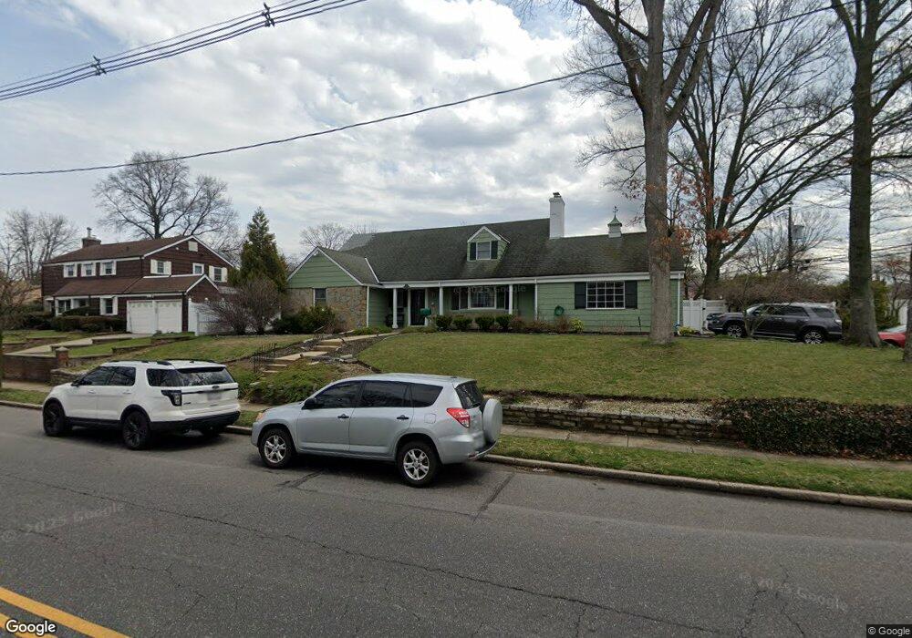
174 N Brookside Ave Freeport, NY 11520
Estimated Value: $806,000 - $845,579
Studio
3
Baths
2,839
Sq Ft
$291/Sq Ft
Est. Value
About This Home
This home is located at 174 N Brookside Ave, Freeport, NY 11520 and is currently estimated at $825,790, approximately $290 per square foot. 174 N Brookside Ave is a home located in Nassau County with nearby schools including Caroline G. Atkinson Intermediate School, Columbus Avenue School, and John W Dodd Middle School.
Ownership History
Date
Name
Owned For
Owner Type
Purchase Details
Closed on
Sep 28, 2012
Sold by
Wall Donald R and Wall Janet
Bought by
Ezumah Morris C and Ezumah Veroinica
Current Estimated Value
Home Financials for this Owner
Home Financials are based on the most recent Mortgage that was taken out on this home.
Original Mortgage
$389,809
Outstanding Balance
$269,024
Interest Rate
3.59%
Mortgage Type
FHA
Estimated Equity
$556,766
Purchase Details
Closed on
Aug 30, 2005
Sold by
Wall Janet Prussak
Create a Home Valuation Report for This Property
The Home Valuation Report is an in-depth analysis detailing your home's value as well as a comparison with similar homes in the area
Home Values in the Area
Average Home Value in this Area
Purchase History
| Date | Buyer | Sale Price | Title Company |
|---|---|---|---|
| Ezumah Morris C | $397,000 | -- | |
| Ezumah Morris C | $397,000 | -- | |
| Ezumah Morris C | $397,000 | -- | |
| Ezumah Morris C | $397,000 | -- | |
| Ezumah Morris C | $397,000 | -- | |
| -- | -- | -- | |
| -- | -- | -- |
Source: Public Records
Mortgage History
| Date | Status | Borrower | Loan Amount |
|---|---|---|---|
| Open | Ezumah Morris C | $389,809 | |
| Closed | Ezumah Morris C | $389,809 |
Source: Public Records
Tax History
| Year | Tax Paid | Tax Assessment Tax Assessment Total Assessment is a certain percentage of the fair market value that is determined by local assessors to be the total taxable value of land and additions on the property. | Land | Improvement |
|---|---|---|---|---|
| 2025 | $10,402 | $524 | $180 | $344 |
| 2024 | $1,123 | $524 | $180 | $344 |
Source: Public Records
Map
Nearby Homes
- 215 N Brookside Ave
- 6 Beverly Pkwy
- 89 Delaware Ave
- 883 Mckenna Ave
- 154 California Ave
- 858 Seaman Ave E
- 2098 Felix Ct
- 15 Mckenna Ave
- 107 California Ave
- 1850 Voshage St
- 1 Willowbrook Ln
- 139 New York Ave
- 60 Connecticut Ave
- 1878 Lake Dr W
- 2 Florence St
- 251 N Long Beach Ave
- 200 Evans Ave
- 161 Wallace St
- 661 Saint Lukes Place
- 101 Wallace St
- 43 Oakfield Ave
- 180 N Brookside Ave
- 51 Oakfield Ave
- 213 Maxson Ave
- 35 Oakfield Ave
- 173 N Brookside Ave
- 167 N Brookside Ave
- 188 N Brookside Ave
- 61 Oakfield Ave
- 179 N Brookside Ave
- 187 N Brookside Ave
- 156 N Brookside Ave
- 31 Oakfield Ave
- 42 Oakfield Ave
- 217 Maxson Ave
- 65 Oakfield Ave
- 50 Oakfield Ave
- 228 Maxson Ave
- 36 Oakfield Ave
- 194 N Brookside Ave
Your Personal Tour Guide
Ask me questions while you tour the home.