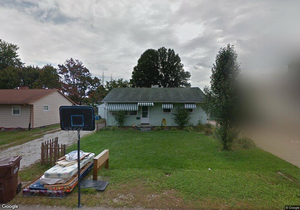
174 Page St NW Massillon, OH 44647
East Brookfield NeighborhoodEstimated Value: $119,861 - $153,000
3
Beds
1
Bath
864
Sq Ft
$160/Sq Ft
Est. Value
About This Home
This home is located at 174 Page St NW, Massillon, OH 44647 and is currently estimated at $138,215, approximately $159 per square foot. 174 Page St NW is a home located in Stark County with nearby schools including Massillon Intermediate School, Massillon Junior High School, and Washington High School.
Ownership History
Date
Name
Owned For
Owner Type
Purchase Details
Closed on
Jul 20, 2004
Sold by
Bank One Na
Bought by
Bruce Rental One Inc
Current Estimated Value
Purchase Details
Closed on
Apr 22, 2004
Sold by
Howell Michael G and Howell Sharon K
Bought by
Bank One Na
Purchase Details
Closed on
Apr 21, 2000
Sold by
Howell Sharon K
Bought by
Howell Michael G and Howell Sharon K
Home Financials for this Owner
Home Financials are based on the most recent Mortgage that was taken out on this home.
Original Mortgage
$35,000
Interest Rate
8.13%
Mortgage Type
Stand Alone Second
Purchase Details
Closed on
May 21, 1991
Purchase Details
Closed on
Jul 19, 1988
Create a Home Valuation Report for This Property
The Home Valuation Report is an in-depth analysis detailing your home's value as well as a comparison with similar homes in the area
Home Values in the Area
Average Home Value in this Area
Purchase History
| Date | Buyer | Sale Price | Title Company |
|---|---|---|---|
| Bruce Rental One Inc | $65,000 | -- | |
| Bank One Na | $48,000 | -- | |
| Howell Michael G | -- | Title America Llc | |
| -- | -- | -- | |
| -- | $45,500 | -- |
Source: Public Records
Mortgage History
| Date | Status | Borrower | Loan Amount |
|---|---|---|---|
| Previous Owner | Howell Michael G | $35,000 |
Source: Public Records
Tax History Compared to Growth
Tax History
| Year | Tax Paid | Tax Assessment Tax Assessment Total Assessment is a certain percentage of the fair market value that is determined by local assessors to be the total taxable value of land and additions on the property. | Land | Improvement |
|---|---|---|---|---|
| 2025 | -- | $29,090 | $9,770 | $19,320 |
| 2024 | -- | $29,090 | $9,770 | $19,320 |
| 2023 | $1,370 | $26,080 | $7,740 | $18,340 |
| 2022 | $687 | $26,080 | $7,740 | $18,340 |
| 2021 | $1,397 | $26,080 | $7,740 | $18,340 |
| 2020 | $1,194 | $20,970 | $6,340 | $14,630 |
| 2019 | $1,172 | $20,980 | $6,340 | $14,640 |
| 2018 | $1,171 | $20,980 | $6,340 | $14,640 |
| 2017 | $1,120 | $18,740 | $5,360 | $13,380 |
| 2016 | $1,139 | $18,740 | $5,360 | $13,380 |
| 2015 | $1,126 | $18,740 | $5,360 | $13,380 |
| 2014 | $1,123 | $18,070 | $5,150 | $12,920 |
| 2013 | $565 | $18,070 | $5,150 | $12,920 |
Source: Public Records
Map
Nearby Homes
- 313 23rd St NW
- 2760 Relda Cir SW
- 728 Hillside Place SW
- 1835 Main Ave W
- 1735 Woodruff Ave NW
- 485 Grosvenor Ave NW
- 104 16th St SW
- 2855 Poplar St NW
- 429 18th St NW
- 3130 Lincoln Way W
- 822 32nd St NW
- 315 14th St SW
- 3069 Castle West Cir NW
- 1301 Lincoln Way NW
- 3241 Lincoln Way NW
- 1616 Oberlin Ave SW
- 1110 14th St SW
- 830 Standish Cir NW
- 1105 Tremont Ave SW
- 425 11th St SW