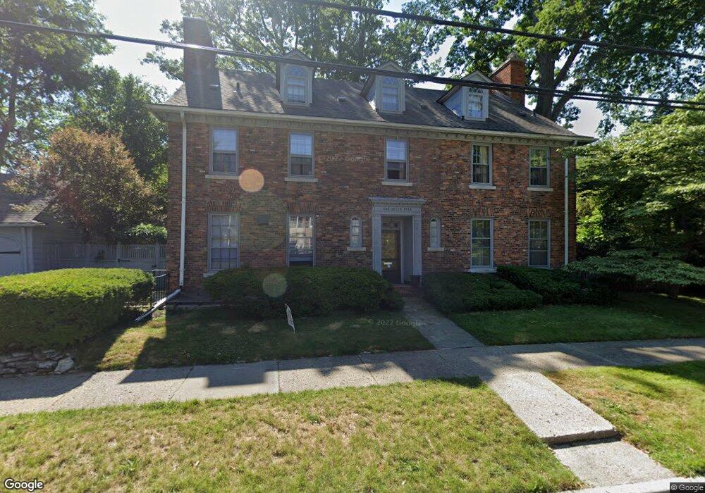
174 Ridge Rd Grosse Pointe Farms, MI 48236
Estimated Value: $1,008,000 - $1,159,000
--
Bed
1
Bath
4,018
Sq Ft
$264/Sq Ft
Est. Value
About This Home
This home is located at 174 Ridge Rd, Grosse Pointe Farms, MI 48236 and is currently estimated at $1,060,772, approximately $264 per square foot. 174 Ridge Rd is a home located in Wayne County with nearby schools including Richard Elementary School, Brownell Middle School, and Grosse Pointe South High School.
Ownership History
Date
Name
Owned For
Owner Type
Purchase Details
Closed on
Jul 17, 2006
Sold by
Mcelvenny Oldham Alice M and Mcelvenny Oldham Alice
Bought by
Piecuch Kevin J
Current Estimated Value
Create a Home Valuation Report for This Property
The Home Valuation Report is an in-depth analysis detailing your home's value as well as a comparison with similar homes in the area
Home Values in the Area
Average Home Value in this Area
Purchase History
| Date | Buyer | Sale Price | Title Company |
|---|---|---|---|
| Piecuch Kevin J | $710,000 | Lawyers Title Ins |
Source: Public Records
Tax History Compared to Growth
Tax History
| Year | Tax Paid | Tax Assessment Tax Assessment Total Assessment is a certain percentage of the fair market value that is determined by local assessors to be the total taxable value of land and additions on the property. | Land | Improvement |
|---|---|---|---|---|
| 2025 | $9,027 | $470,400 | $0 | $0 |
| 2024 | $9,027 | $435,700 | $0 | $0 |
| 2023 | $8,270 | $414,700 | $0 | $0 |
| 2022 | $8,270 | $373,400 | $0 | $0 |
| 2021 | $15,175 | $365,100 | $0 | $0 |
| 2019 | $14,921 | $351,700 | $0 | $0 |
| 2018 | $7,636 | $347,600 | $0 | $0 |
| 2017 | $13,249 | $340,400 | $0 | $0 |
| 2016 | $13,889 | $322,500 | $0 | $0 |
| 2015 | $27,510 | $299,200 | $0 | $0 |
| 2013 | $26,650 | $266,500 | $0 | $0 |
| 2012 | $6,950 | $261,300 | $79,200 | $182,100 |
Source: Public Records
Map
Nearby Homes
- 166 Lewiston Rd
- 213 Muir Rd
- 194 Charlevoix Ave
- 233 Mcmillan Rd
- 201 Mcmillan Rd
- 240 Mckinley Ave
- 218 Merriweather Rd
- 216 Ridge Rd
- 130 Merriweather Rd
- 276 Lewiston Rd
- 259 Mount Vernon Ave
- 180 Fisher Rd
- 93 Merriweather Rd
- 65 Mapleton Rd
- 159 Grosse Pointe Blvd
- 341 Mcmillan Rd
- 745 Lincoln Rd
- 302 Mount Vernon Ave
- 189 Cloverly Rd
- 352 Mckinley Ave
- 175 Ridge Rd
- 180 Lewiston Rd
- 166 Ridge Rd
- 207 Lewiston Rd Unit Bldg-Unit
- 207 Lewiston Rd
- 181 Lewiston Rd
- 181 Ridge Rd
- 180 Ridge Rd
- 172 Lewiston Rd
- 211 Lewiston Rd
- 171 Lewiston Rd
- 161 Rhode
- 171 Kenwood Rd
- 190 Ridge Rd
- 220 Lewiston Rd
- 165 Lewiston Rd
- 235 Kenwood Ct
- 185 Ridge Rd
- 191 Ridge Rd
- 221 Lewiston Rd