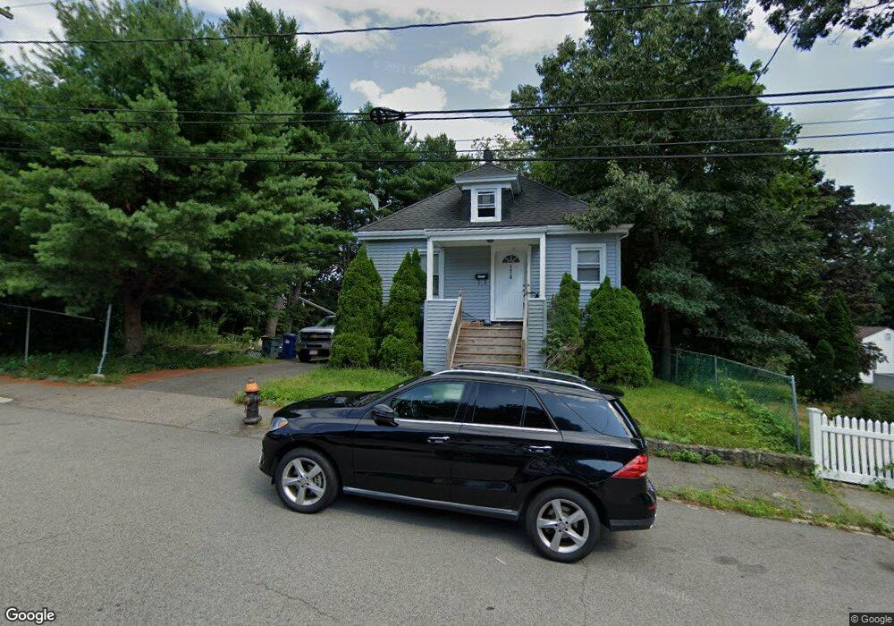
174 Savannah Ave Unit 1 Mattapan, MA 02126
Southern Mattapan NeighborhoodEstimated Value: $503,000 - $596,000
4
Beds
2
Baths
936
Sq Ft
$577/Sq Ft
Est. Value
About This Home
This home is located at 174 Savannah Ave Unit 1, Mattapan, MA 02126 and is currently estimated at $540,169, approximately $577 per square foot. 174 Savannah Ave Unit 1 is a home located in Suffolk County with nearby schools including KIPP Academy Boston Charter School, Boston Preparatory Charter Public School, and Berea Seventh-day Adventist Academy.
Ownership History
Date
Name
Owned For
Owner Type
Purchase Details
Closed on
Jan 29, 2016
Sold by
Palmer Elaine E
Bought by
Blackwell Sedgie R
Current Estimated Value
Home Financials for this Owner
Home Financials are based on the most recent Mortgage that was taken out on this home.
Original Mortgage
$238,400
Outstanding Balance
$190,171
Interest Rate
3.97%
Mortgage Type
New Conventional
Estimated Equity
$349,998
Purchase Details
Closed on
Jun 9, 2015
Sold by
Matra Richard
Bought by
Palmer Elaine E
Home Financials for this Owner
Home Financials are based on the most recent Mortgage that was taken out on this home.
Original Mortgage
$255,290
Interest Rate
3.5%
Mortgage Type
FHA
Purchase Details
Closed on
Mar 27, 2012
Sold by
Matra Richard
Bought by
Wells Fargo Bank Na
Purchase Details
Closed on
Aug 29, 2008
Sold by
Deutsche Bank Natl T C
Bought by
Matra Richard
Home Financials for this Owner
Home Financials are based on the most recent Mortgage that was taken out on this home.
Original Mortgage
$127,991
Interest Rate
6.29%
Mortgage Type
Purchase Money Mortgage
Purchase Details
Closed on
Jun 12, 2008
Sold by
John Kelson
Bought by
Deutsche Bank Natl T C
Purchase Details
Closed on
Feb 1, 2006
Sold by
Reynolds Kimberly
Bought by
John Kelson and Williams-John Tara
Home Financials for this Owner
Home Financials are based on the most recent Mortgage that was taken out on this home.
Original Mortgage
$238,400
Interest Rate
6.31%
Mortgage Type
Purchase Money Mortgage
Purchase Details
Closed on
Jul 31, 2002
Sold by
York Kami
Bought by
Reynolds Kimberly
Purchase Details
Closed on
Dec 29, 2000
Sold by
Dennis Eileen J and Dennis Lennox A
Bought by
York Kami
Purchase Details
Closed on
Aug 9, 1993
Sold by
Fletcher William G and Cason Candice S
Bought by
Dennis Lennox and Dennis Eileen
Create a Home Valuation Report for This Property
The Home Valuation Report is an in-depth analysis detailing your home's value as well as a comparison with similar homes in the area
Home Values in the Area
Average Home Value in this Area
Purchase History
| Date | Buyer | Sale Price | Title Company |
|---|---|---|---|
| Blackwell Sedgie R | $298,000 | -- | |
| Palmer Elaine E | $260,000 | -- | |
| Wells Fargo Bank Na | $140,070 | -- | |
| Matra Richard | $130,000 | -- | |
| Deutsche Bank Natl T C | $196,350 | -- | |
| John Kelson | $298,000 | -- | |
| Reynolds Kimberly | $219,000 | -- | |
| York Kami | $160,000 | -- | |
| Dennis Lennox | $93,000 | -- |
Source: Public Records
Mortgage History
| Date | Status | Borrower | Loan Amount |
|---|---|---|---|
| Open | Blackwell Sedgie R | $238,400 | |
| Previous Owner | Palmer Elaine E | $255,290 | |
| Previous Owner | Dennis Lennox | $128,360 | |
| Previous Owner | Matra Richard | $127,991 | |
| Previous Owner | John Kelson | $238,400 | |
| Previous Owner | Dennis Lennox | $227,000 |
Source: Public Records
Tax History Compared to Growth
Tax History
| Year | Tax Paid | Tax Assessment Tax Assessment Total Assessment is a certain percentage of the fair market value that is determined by local assessors to be the total taxable value of land and additions on the property. | Land | Improvement |
|---|---|---|---|---|
| 2025 | $4,781 | $412,900 | $157,500 | $255,400 |
| 2024 | $5,055 | $463,800 | $155,800 | $308,000 |
| 2023 | $4,743 | $441,600 | $148,300 | $293,300 |
| 2022 | $4,448 | $408,800 | $137,300 | $271,500 |
| 2021 | $4,096 | $383,900 | $130,800 | $253,100 |
| 2020 | $3,381 | $320,200 | $135,900 | $184,300 |
| 2019 | $3,246 | $308,000 | $101,900 | $206,100 |
| 2018 | $3,016 | $287,800 | $101,900 | $185,900 |
| 2017 | $2,796 | $264,000 | $101,900 | $162,100 |
| 2016 | $2,762 | $251,100 | $101,900 | $149,200 |
| 2015 | $2,430 | $200,700 | $85,300 | $115,400 |
| 2014 | $2,315 | $184,000 | $85,300 | $98,700 |
Source: Public Records
Map
Nearby Homes
- 231 Itasca St
- 839-843 Cummins Hwy
- 10 Brockton St
- 770 Cummins Hwy Unit 1
- 770 Cummins Hwy Unit 22
- 100 Itasca St
- 95 Woodhaven St
- 20 Monterey Ave
- 60 and 64 Monterey Ave
- 72 Livermore St
- 179 Hebron St
- 34 Ridlon Rd
- 14-14R Kennebec St
- 116 Almont St
- 90 Hollingsworth St
- 1465 Blue Hill Ave
- 265 Hebron St
- 48-50 Rockdale St
- 12 Hiawatha Rd
- 49 Fottler Rd
- 174 Savannah Ave
- 164 Savannah Ave
- 182 Savannah Ave
- 163 Orlando St
- 1 Canaan St
- 175 Savannah Ave Unit 175A
- 175 Savannah Ave Unit A
- 175 Savannah Ave Unit 2
- 175A Savannah Ave Unit 1
- 159 Orlando St
- 171 Savannah Ave
- 165 Savannah Ave
- 160 Savannah Ave
- 181 Savannah Ave
- 161 Savannah Ave
- 18 Corman Rd
- 186 Savannah Ave
- 151 Orlando St
- 157 Savannah Ave
- 156 Savannah Ave