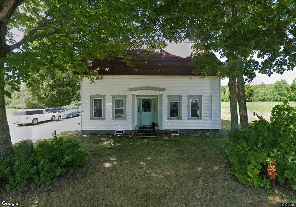
174 Todds Corner Rd Saint Albans, ME 04971
Estimated Value: $214,625 - $279,000
3
Beds
1
Bath
1,828
Sq Ft
$133/Sq Ft
Est. Value
About This Home
This home is located at 174 Todds Corner Rd, Saint Albans, ME 04971 and is currently estimated at $243,406, approximately $133 per square foot. 174 Todds Corner Rd is a home located in Somerset County with nearby schools including St Albans Consolidated, Somerset Elementary School, and Nokomis Regional Middle School/High School.
Ownership History
Date
Name
Owned For
Owner Type
Purchase Details
Closed on
Jun 24, 2009
Sold by
Dunn Kevin and Dunn Rebecca
Bought by
Umbrianna Michael and Umbrianna Carrie
Current Estimated Value
Home Financials for this Owner
Home Financials are based on the most recent Mortgage that was taken out on this home.
Original Mortgage
$61,019
Outstanding Balance
$38,532
Interest Rate
4.92%
Mortgage Type
Purchase Money Mortgage
Estimated Equity
$204,874
Create a Home Valuation Report for This Property
The Home Valuation Report is an in-depth analysis detailing your home's value as well as a comparison with similar homes in the area
Purchase History
| Date | Buyer | Sale Price | Title Company |
|---|---|---|---|
| Umbrianna Michael | -- | -- |
Source: Public Records
Mortgage History
| Date | Status | Borrower | Loan Amount |
|---|---|---|---|
| Open | Umbrianna Michael | $61,019 |
Source: Public Records
Tax History
| Year | Tax Paid | Tax Assessment Tax Assessment Total Assessment is a certain percentage of the fair market value that is determined by local assessors to be the total taxable value of land and additions on the property. | Land | Improvement |
|---|---|---|---|---|
| 2025 | $2,590 | $209,700 | $33,300 | $176,400 |
| 2022 | $2,355 | $140,600 | $25,300 | $115,300 |
| 2021 | $2,178 | $130,000 | $25,300 | $104,700 |
| 2020 | $2,178 | $130,000 | $25,300 | $104,700 |
| 2019 | $2,089 | $124,700 | $25,300 | $99,400 |
| 2018 | $2,051 | $124,700 | $25,300 | $99,400 |
| 2017 | $2,039 | $124,700 | $25,300 | $99,400 |
| 2016 | $1,669 | $75,200 | $14,400 | $60,800 |
| 2015 | $1,527 | $75,200 | $14,400 | $60,800 |
| 2012 | $1,527 | $83,900 | $14,400 | $69,500 |
Source: Public Records
Map
Nearby Homes
- 230 Todds Corner Rd
- 92 Todds Corner Rd
- PO72,P090 Cotta Lane & Rt 43
- 104 Cotta Ln
- 21 Corinna Rd
- 30 Main St
- Lot #86-3 Martin Rd
- M9 L7 Finson Rd
- 5 Oldham Rd
- 11 Finson Rd
- 355 Melody Ln
- TBD Dexter Rd
- 189 Commercial St
- 212 Ross Hill Rd
- 83 Commercial St
- 37 North St
- TBD Woodcock Rd
- 00 Ross Hill Rd
- 26 Mill St
- PL5,6,9,10 Great Moose Dr
- 174 Todd's Corner
- 173 Todds Corner Rd
- 155 Todds Corner Rd
- 150 Todds Corner Rd
- 152 Todds Corner Rd
- 202 Todds Corner Rd
- 138 Todds Corner Rd
- 135 Todds Corner Rd
- 27 Birch Island
- 20 Birch Island
- 220 Todds Corner Rd
- 37 Conklin Way
- 25 Conklin Way
- 235 Todds Corner Rd
- 0 Map 11 Unit LOT 15 1540288
- 0 Map 9 Unit LOT 21 1501176
- 20 Lakeside Dr
- 110 Todd's Corner Rd
- 110 Todds Corner Rd
- 248 Todds Corner Rd
Your Personal Tour Guide
Ask me questions while you tour the home.