174 Top St Unit 616 South Point, OH 45680
Estimated Value: $127,403 - $206,000
2
Beds
1
Bath
1,360
Sq Ft
$109/Sq Ft
Est. Value
About This Home
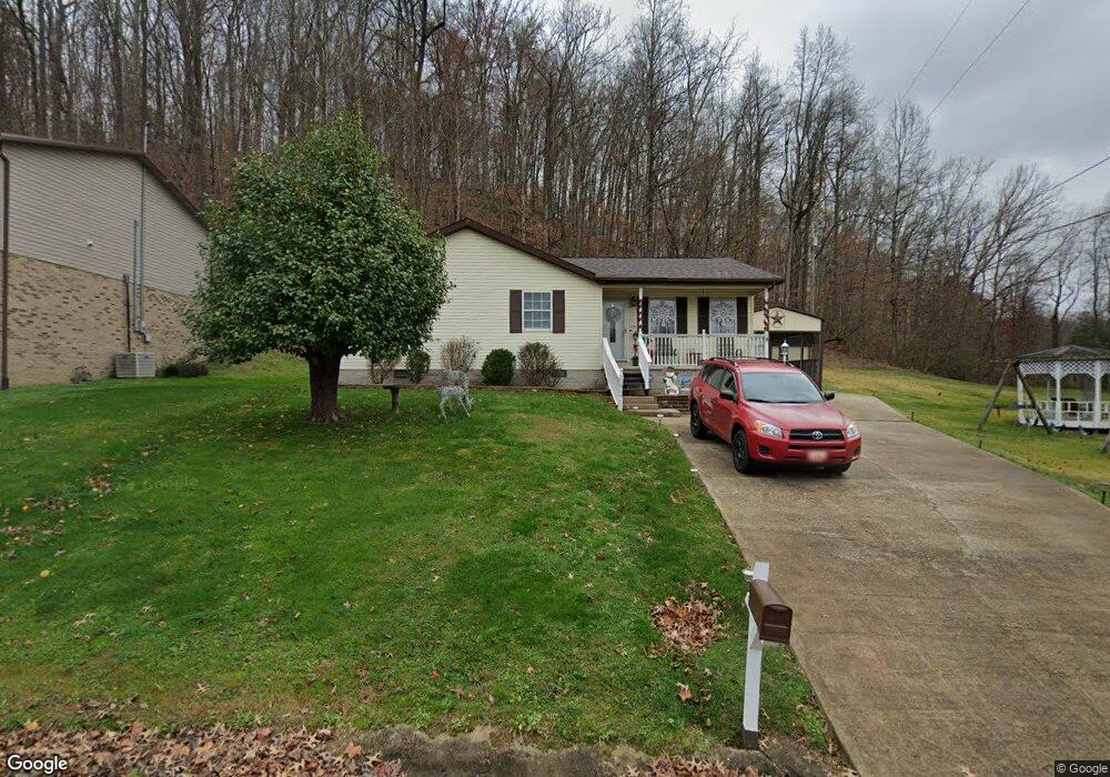
This home is located at 174 Top St Unit 616, South Point, OH 45680 and is currently estimated at $147,851, approximately $108 per square foot. 174 Top St Unit 616 is a home located in Lawrence County with nearby schools including Chesapeake Elementary School, Chesapeake Middle School, and Chesapeake High School.
Ownership History
Date
Name
Owned For
Owner Type
Purchase Details
Closed on
Feb 24, 2011
Sold by
Beneficial Ohio Inc
Bought by
Sanders Steven L
Current Estimated Value
Purchase Details
Closed on
Nov 17, 2010
Sold by
Mcchristian Vickie L and Barker Vickie L
Bought by
Beneficial Ohio Inc
Purchase Details
Closed on
Dec 10, 1998
Sold by
Barker David F and Barker Vickie
Bought by
Mcchristian Vickie L
Purchase Details
Closed on
Jun 15, 1998
Bought by
Barker David F and Barker Vickie
Purchase Details
Closed on
Feb 25, 1997
Sold by
Ashworth Betty Lou
Bought by
D.J. Ashworth, Inc.
Purchase Details
Closed on
Aug 8, 1989
Sold by
Ashworth William and Ashworth Betty
Bought by
Ashworth Betty Lou
Create a Home Valuation Report for This Property
The Home Valuation Report is an in-depth analysis detailing your home's value as well as a comparison with similar homes in the area
Home Values in the Area
Average Home Value in this Area
Purchase History
| Date | Buyer | Sale Price | Title Company |
|---|---|---|---|
| Sanders Steven L | $24,900 | Attorney | |
| Beneficial Ohio Inc | $47,018 | Attorney | |
| Mcchristian Vickie L | -- | -- | |
| Barker David F | $45,500 | -- | |
| D.J. Ashworth, Inc. | $20,000 | -- | |
| Ashworth Betty Lou | -- | -- |
Source: Public Records
Tax History Compared to Growth
Tax History
| Year | Tax Paid | Tax Assessment Tax Assessment Total Assessment is a certain percentage of the fair market value that is determined by local assessors to be the total taxable value of land and additions on the property. | Land | Improvement |
|---|---|---|---|---|
| 2024 | -- | $23,660 | $6,300 | $17,360 |
| 2023 | $447 | $23,660 | $6,300 | $17,360 |
| 2022 | $456 | $23,660 | $6,300 | $17,360 |
| 2021 | $409 | $21,950 | $5,950 | $16,000 |
| 2020 | $424 | $21,950 | $5,950 | $16,000 |
| 2019 | $422 | $21,950 | $5,950 | $16,000 |
| 2018 | $415 | $21,570 | $5,950 | $15,620 |
| 2017 | $235 | $21,570 | $5,950 | $15,620 |
| 2016 | $383 | $21,570 | $5,950 | $15,620 |
| 2015 | $462 | $23,410 | $7,700 | $15,710 |
| 2014 | $461 | $23,410 | $7,700 | $15,710 |
| 2013 | $460 | $23,410 | $7,700 | $15,710 |
Source: Public Records
Map
Nearby Homes
- 253 Township Road 1357
- 14 Township Road 1356
- 3493 County Road 31
- 2745 County Road 35
- 3171 County Road 31
- 66 Township Road 1523
- 1666 County Road 31
- 6757 County Road 15
- 6897 County Road 15
- 152 Township Road 1483
- 135 Township Road 85 E
- 983 County Road 104
- 142 Township Road 1156
- 6881 State Route 243
- 81 Township Road 158
- 301 Township Road 158
- 3859 County Road 15
- 30 Township Road 1482
- 101 Township Road 1199
- 0 County Road 123
- 174 Top St Unit 251
- 174 Top St Unit 99
- 174 Top St Unit 251
- 3340 Township Road 250
- 3518 Township Road 250
- 3870 Township Road 250
- 3906 Township Road 250
- 10436 State Route 243
- 3840 Township Road 250
- 10286 State Route 243
- 3932 Township Road 250
- 3917 County Road 17
- 10846 State Route 243
- 3988 County Road 17
- 3988 County Road 17
- 4293 County Road 17
- 10644 State Route 243
- 4362 County Road 31
- 10817 State Route 243
- 11119 State Route 243