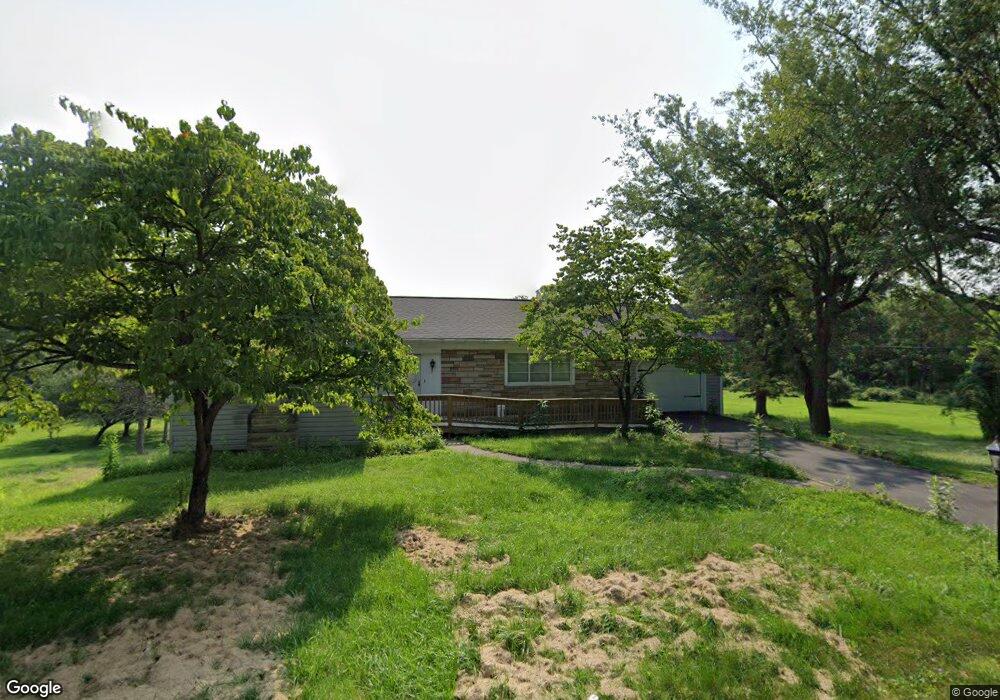
174 W Rittenhouse Mill Rd Berwick, PA 18603
Estimated Value: $184,000 - $212,000
--
Bed
--
Bath
1,372
Sq Ft
$148/Sq Ft
Est. Value
About This Home
This home is located at 174 W Rittenhouse Mill Rd, Berwick, PA 18603 and is currently estimated at $202,629, approximately $147 per square foot. 174 W Rittenhouse Mill Rd is a home located in Columbia County with nearby schools including Berwick Area High School, Holy Family Consolidated School, and New Story School.
Ownership History
Date
Name
Owned For
Owner Type
Purchase Details
Closed on
Mar 22, 2017
Sold by
Hunsinger Dorothylee and Estate Of Jane A Eveland
Bought by
Whitehead Patricia A
Current Estimated Value
Home Financials for this Owner
Home Financials are based on the most recent Mortgage that was taken out on this home.
Original Mortgage
$121,250
Outstanding Balance
$100,547
Interest Rate
4.17%
Mortgage Type
New Conventional
Estimated Equity
$102,082
Purchase Details
Closed on
Aug 24, 1976
Bought by
Eveland Jane A
Create a Home Valuation Report for This Property
The Home Valuation Report is an in-depth analysis detailing your home's value as well as a comparison with similar homes in the area
Home Values in the Area
Average Home Value in this Area
Purchase History
| Date | Buyer | Sale Price | Title Company |
|---|---|---|---|
| Whitehead Patricia A | $125,000 | Attorney | |
| Eveland Jane A | -- | -- |
Source: Public Records
Mortgage History
| Date | Status | Borrower | Loan Amount |
|---|---|---|---|
| Open | Whitehead Patricia A | $121,250 |
Source: Public Records
Tax History Compared to Growth
Tax History
| Year | Tax Paid | Tax Assessment Tax Assessment Total Assessment is a certain percentage of the fair market value that is determined by local assessors to be the total taxable value of land and additions on the property. | Land | Improvement |
|---|---|---|---|---|
| 2025 | $1,601 | $22,337 | $0 | $0 |
| 2024 | $1,579 | $22,337 | $4,250 | $18,087 |
| 2023 | $1,467 | $22,337 | $4,250 | $18,087 |
| 2022 | $1,406 | $22,337 | $4,250 | $18,087 |
| 2021 | $1,367 | $22,337 | $4,250 | $18,087 |
| 2020 | $1,327 | $22,337 | $4,250 | $18,087 |
| 2019 | $1,323 | $22,337 | $4,250 | $18,087 |
| 2018 | $1,323 | $22,337 | $4,250 | $18,087 |
| 2017 | $1,329 | $22,337 | $4,250 | $18,087 |
| 2016 | -- | $22,337 | $4,250 | $18,087 |
| 2015 | -- | $22,337 | $4,250 | $18,087 |
| 2014 | -- | $22,337 | $4,250 | $18,087 |
Source: Public Records
Map
Nearby Homes
- 109 1st Ave
- 1569 Pennsylvania 93
- 601 Welliver Rd
- 223 Maple Rd
- 1651 Brittain St
- 1638 Brittain St
- 120 Briarcliff Rd
- 1542 1st Ave
- 1522 1st Ave
- LOT 10 Lake Rd
- 0 Spring Garden Ave
- 825 N Mercer St
- 1345 7th Ave
- 1400 Orange St
- 1335 Freas Ave
- 405 N Mercer St
- 1318 7th Ave
- LOT #13 3rd Ave
- 1319 Ferris Ave
- 19 Kachinka Hollow Rd
- 179 W Rittenhouse Mill Rd
- 185 W Rittenhouse Mill Rd
- 0 Vacant Land Ruckle Hill Rd
- 152 W Rittenhouse Mill Rd
- 198 W Rittenhouse Mill Rd
- 202 W Rittenhouse Mill Rd
- 226 Ruckle Hill Rd
- 6083 Park Rd
- 6101 Park Rd
- 26 1st Ave
- 22 1st Ave
- 20 1st Ave
- 32 1st Ave
- 16 1st Ave
- 36 1st Ave
- 213 Ruckle Hill Rd
- 20 First Ave
- 10 1st Ave
- 40 1st Ave
- 129 W Rittenhouse Mill Rd