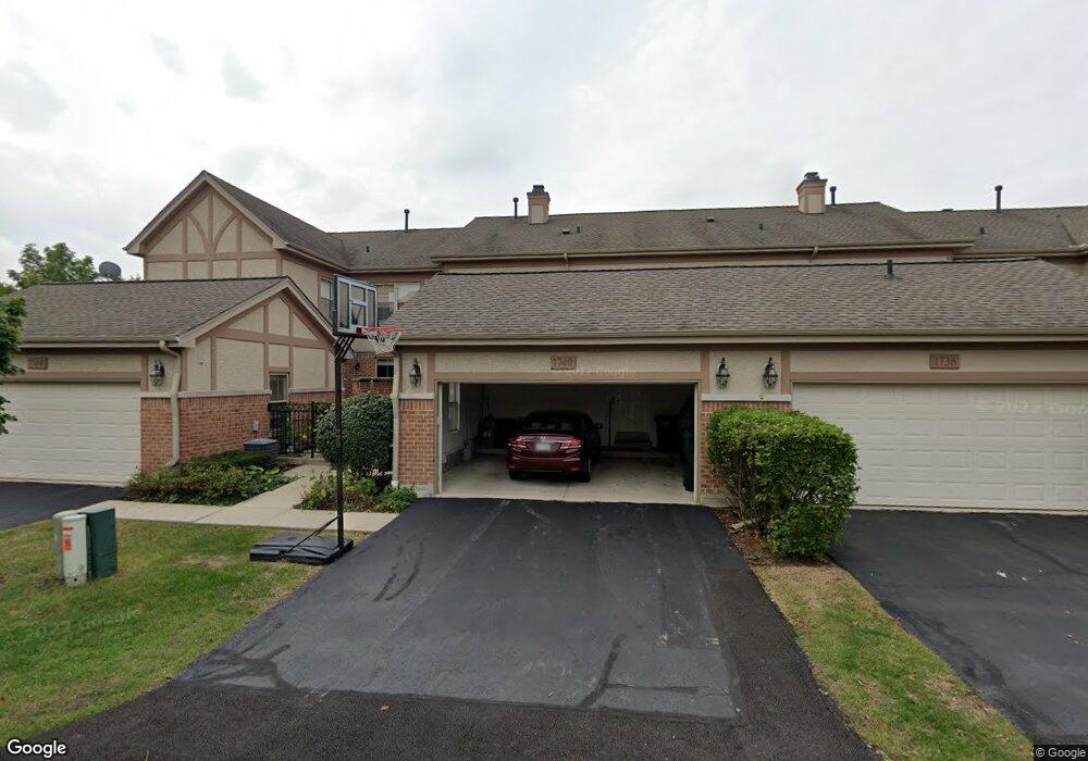
1740 Lancaster Way Northbrook, IL 60062
Estimated Value: $592,000 - $695,000
3
Beds
3
Baths
2,203
Sq Ft
$291/Sq Ft
Est. Value
About This Home
This home is located at 1740 Lancaster Way, Northbrook, IL 60062 and is currently estimated at $641,605, approximately $291 per square foot. 1740 Lancaster Way is a home located in Cook County with nearby schools including Wescott Elementary School, Maple School, and Glenbrook North High School.
Ownership History
Date
Name
Owned For
Owner Type
Purchase Details
Closed on
Sep 30, 2004
Sold by
Chicago Title Land Trust Co
Bought by
Dsouza Michael and Dsouza Laura
Current Estimated Value
Home Financials for this Owner
Home Financials are based on the most recent Mortgage that was taken out on this home.
Original Mortgage
$300,000
Interest Rate
5.89%
Mortgage Type
Unknown
Purchase Details
Closed on
Dec 16, 2003
Sold by
Rsd Shermer Llc
Bought by
Chicago Title Land Trust Co and Trust #1112451
Home Financials for this Owner
Home Financials are based on the most recent Mortgage that was taken out on this home.
Original Mortgage
$400,000
Interest Rate
4.5%
Mortgage Type
Unknown
Create a Home Valuation Report for This Property
The Home Valuation Report is an in-depth analysis detailing your home's value as well as a comparison with similar homes in the area
Home Values in the Area
Average Home Value in this Area
Purchase History
| Date | Buyer | Sale Price | Title Company |
|---|---|---|---|
| Dsouza Michael | $573,000 | Multiple | |
| Chicago Title Land Trust Co | $487,000 | -- |
Source: Public Records
Mortgage History
| Date | Status | Borrower | Loan Amount |
|---|---|---|---|
| Closed | Dsouza Michael | $300,000 | |
| Previous Owner | Chicago Title Land Trust Co | $400,000 | |
| Closed | Dsouza Michael | $73,000 |
Source: Public Records
Tax History Compared to Growth
Tax History
| Year | Tax Paid | Tax Assessment Tax Assessment Total Assessment is a certain percentage of the fair market value that is determined by local assessors to be the total taxable value of land and additions on the property. | Land | Improvement |
|---|---|---|---|---|
| 2024 | $9,853 | $45,000 | $9,500 | $35,500 |
| 2023 | $9,560 | $45,000 | $9,500 | $35,500 |
| 2022 | $9,560 | $45,000 | $9,500 | $35,500 |
| 2021 | $11,004 | $45,702 | $2,850 | $42,852 |
| 2020 | $10,954 | $45,702 | $2,850 | $42,852 |
| 2019 | $10,539 | $50,222 | $2,850 | $47,372 |
| 2018 | $10,197 | $45,213 | $2,493 | $42,720 |
| 2017 | $10,002 | $45,213 | $2,493 | $42,720 |
| 2016 | $9,187 | $45,213 | $2,493 | $42,720 |
| 2015 | $8,876 | $39,691 | $2,018 | $37,673 |
| 2014 | $8,667 | $39,691 | $2,018 | $37,673 |
| 2013 | $8,542 | $39,691 | $2,018 | $37,673 |
Source: Public Records
Map
Nearby Homes
- 1950 Farnsworth Ln Unit 202
- 1997 Kingsley Cir
- 1947 Summerton Place
- 2117 Illinois Rd
- 2221 Illinois Rd
- 1721 Elm Ave
- 2067 Butternut Ln
- 1412 Sycamore Ln
- 2411 Woodlawn Rd
- 1430 Voltz Rd
- 2005 Greenview Rd
- 2130 Mallard Dr
- 1302 Waukegan Rd
- 2409 Center Ave
- 1443 Woodhill Dr
- 1179 Shermer Rd
- 2050 Valencia Dr Unit 405C
- 1060 Cedar Ln
- 2378 Salceda Dr Unit 25B2378S
- 1913 Milton Ave
- 1736 Lancaster Way
- 1744 Lancaster Way
- 1732 Lancaster Way
- 1972 Brentwood Rd
- 1968 Brentwood Rd
- 1760 Lancaster Way
- 1975 Farnsworth Ln
- 1975 Farnsworth Ln
- 1964 Brentwood Rd
- 1971 Farnsworth Ln
- 1764 Lancaster Way
- 1764 Lancaster Way Unit 1764
- 1967 Farnsworth Ln
- 1960 Brentwood Rd
- 1768 Lancaster Way
- 1963 Farnsworth Ln
- 1956 Brentwood Rd
- 1969 Brentwood Rd
- 1772 Lancaster Way
- 1959 Farnsworth Ln