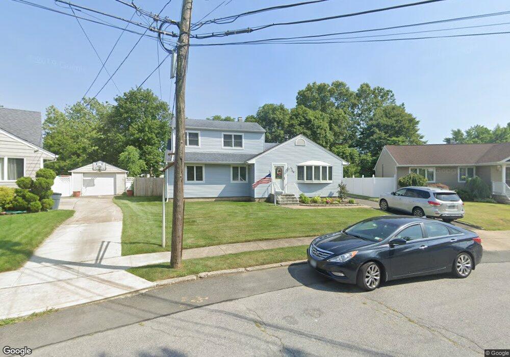
1740 Michael William Rd Merrick, NY 11566
Estimated Value: $849,000 - $971,110
4
Beds
3
Baths
1,823
Sq Ft
$499/Sq Ft
Est. Value
About This Home
This home is located at 1740 Michael William Rd, Merrick, NY 11566 and is currently estimated at $910,055, approximately $499 per square foot. 1740 Michael William Rd is a home located in Nassau County with nearby schools including Merrick Avenue Middle School, Sanford H Calhoun High School, and Progressive School of Long Island.
Ownership History
Date
Name
Owned For
Owner Type
Purchase Details
Closed on
Jul 29, 2016
Sold by
Bieda Andrew and Bieda Cheryl
Bought by
Negron Christopher and Negron Robert
Current Estimated Value
Home Financials for this Owner
Home Financials are based on the most recent Mortgage that was taken out on this home.
Original Mortgage
$364,000
Outstanding Balance
$289,772
Interest Rate
3.41%
Mortgage Type
New Conventional
Estimated Equity
$620,283
Purchase Details
Closed on
Jul 13, 1998
Sold by
Shapiro Michael
Bought by
Bieda Andrew and Bieda Cheryl
Create a Home Valuation Report for This Property
The Home Valuation Report is an in-depth analysis detailing your home's value as well as a comparison with similar homes in the area
Home Values in the Area
Average Home Value in this Area
Purchase History
| Date | Buyer | Sale Price | Title Company |
|---|---|---|---|
| Negron Christopher | $455,000 | Stewart Title | |
| Bieda Andrew | $198,000 | -- |
Source: Public Records
Mortgage History
| Date | Status | Borrower | Loan Amount |
|---|---|---|---|
| Open | Negron Christopher | $364,000 |
Source: Public Records
Tax History
| Year | Tax Paid | Tax Assessment Tax Assessment Total Assessment is a certain percentage of the fair market value that is determined by local assessors to be the total taxable value of land and additions on the property. | Land | Improvement |
|---|---|---|---|---|
| 2025 | $18,998 | $656 | $272 | $384 |
| 2024 | $4,852 | $656 | $272 | $384 |
Source: Public Records
Map
Nearby Homes
- 1721 Michael William Rd
- 1713 Camp Ave
- 1709 Camp Ave
- 1750 Henry Rd
- 1826 Camp Ave
- 57 Maeder Ave
- 1772 Rose St
- 45 Richard Ave
- 1526 Rhode Ave
- 1871 Relyea Dr
- 1719 William St
- 49 Prospect St
- 1656 Michalicki Place
- 132 Webster St
- 49 Elizabeth St
- 1741 Bushwick Ave
- 379 Washington Ave
- 25 Bainbridge St
- 1715 Remson Ave
- 1415 Rhode Ave
- 1746 Michael William Rd
- 1734 Michael William Rd
- 1666 Chapin Ave
- 1658 Chapin Ave
- 1674 Chapin Ave
- 1750 Michael William Rd
- 1728 Michael William Rd
- 1652 Chapin Ave
- 1680 Chapin Ave
- 1739 Michael William Rd
- 1742 Camp Ave
- 1754 Camp Ave
- 1749 Michael William Rd
- 5 Gildersleeve St Unit 5
- 1686 Chapin Ave
- 1722 Michael William Rd
- 1661 Chapin Ave
- 1659 Chapin Ave
- 1673 Chapin Ave
- 187 Camp Ave
Your Personal Tour Guide
Ask me questions while you tour the home.