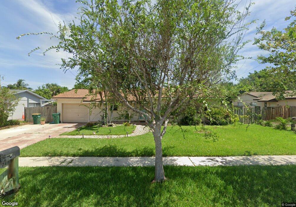
1740 S Merrimac Dr Merritt Island, FL 32952
Estimated Value: $293,000 - $375,000
3
Beds
2
Baths
1,219
Sq Ft
$271/Sq Ft
Est. Value
About This Home
This home is located at 1740 S Merrimac Dr, Merritt Island, FL 32952 and is currently estimated at $330,520, approximately $271 per square foot. 1740 S Merrimac Dr is a home located in Brevard County with nearby schools including Tropical Elementary School, Thomas Jefferson Middle School, and Merritt Island High School.
Ownership History
Date
Name
Owned For
Owner Type
Purchase Details
Closed on
Oct 6, 2022
Sold by
Nagy Sandor and Nagy Catherine
Bought by
Nagy Sandor E
Current Estimated Value
Purchase Details
Closed on
May 13, 2009
Sold by
The Bank Of New York
Bought by
Nagy Sandor and Nagy Catherine
Purchase Details
Closed on
Feb 10, 2009
Sold by
Coles Gregory and Cole Grace C
Bought by
The Bank Of New York
Purchase Details
Closed on
May 15, 2006
Sold by
Cater James L
Bought by
Coles Gregory and Blaton David W
Home Financials for this Owner
Home Financials are based on the most recent Mortgage that was taken out on this home.
Original Mortgage
$192,800
Interest Rate
7.37%
Create a Home Valuation Report for This Property
The Home Valuation Report is an in-depth analysis detailing your home's value as well as a comparison with similar homes in the area
Home Values in the Area
Average Home Value in this Area
Purchase History
| Date | Buyer | Sale Price | Title Company |
|---|---|---|---|
| Nagy Sandor E | $100 | -- | |
| Nagy Sandor | $85,000 | Landsafe Title | |
| The Bank Of New York | -- | Attorney | |
| Coles Gregory | $245,900 | Central Coast Title |
Source: Public Records
Mortgage History
| Date | Status | Borrower | Loan Amount |
|---|---|---|---|
| Previous Owner | Coles Gregory | $192,800 |
Source: Public Records
Tax History Compared to Growth
Tax History
| Year | Tax Paid | Tax Assessment Tax Assessment Total Assessment is a certain percentage of the fair market value that is determined by local assessors to be the total taxable value of land and additions on the property. | Land | Improvement |
|---|---|---|---|---|
| 2025 | $3,517 | $285,180 | -- | -- |
| 2024 | $3,223 | $273,120 | -- | -- |
| 2023 | $3,223 | $234,920 | $0 | $0 |
| 2022 | $3,059 | $250,270 | $0 | $0 |
| 2021 | $2,156 | $165,700 | $70,000 | $95,700 |
| 2020 | $2,616 | $165,900 | $70,000 | $95,900 |
| 2019 | $2,481 | $159,740 | $59,000 | $100,740 |
| 2018 | $2,390 | $152,660 | $45,000 | $107,660 |
| 2017 | $2,147 | $118,840 | $35,000 | $83,840 |
| 2016 | $2,067 | $109,190 | $25,000 | $84,190 |
| 2015 | $1,582 | $97,160 | $20,000 | $77,160 |
| 2014 | $1,479 | $88,990 | $20,000 | $68,990 |
Source: Public Records
Map
Nearby Homes
- 474 Newfound Harbor Dr
- 1740 Angel Ave
- 472 Newfound Harbor Dr
- 550 S Banana River Dr Unit 101
- 550 S Banana River Dr Unit 203
- 1784 N Merrimac Dr
- 513 Summers Creek Dr
- 790 Raven St
- 365 Newfound Harbor Dr
- 200 S Banana River Dr Unit B-3
- 200 S Banana River Dr Unit C-18
- 200 S Banana River Dr Unit D-17
- 200 S Banana River Dr Unit H-12
- 200 S Banana River Dr Unit E1
- 200 S Banana River Dr Unit D-18
- 200 S Banana River Dr Unit F12
- 200 S Banana River Dr Unit A12
- 200 S Banana River Dr
- 200 S Banana River Dr Unit A18
- 335 Newfound Harbor Dr
- 1730 S Merrimac Dr
- 535 Monitor St
- 1735 S Merrimac Dr
- 1745 Monitor St
- 1760 S Merrimac Dr
- 1700 S Merrimac Dr
- 1725 S Merrimac Dr
- 540 Newfound Harbor Dr
- 1755 S Merrimac Dr
- 525 Monitor St
- 1755 Monitor St
- 1715 S Merrimac Dr
- 530 Newfound Harbor Dr
- 1770 S Merrimac Dr
- 1765 S Merrimac Dr
- 1765 Monitor St
- 515 Monitor St
- 520 Monitor St
- 520 Newfound Harbor Dr
- 1775 S Merrimac Dr