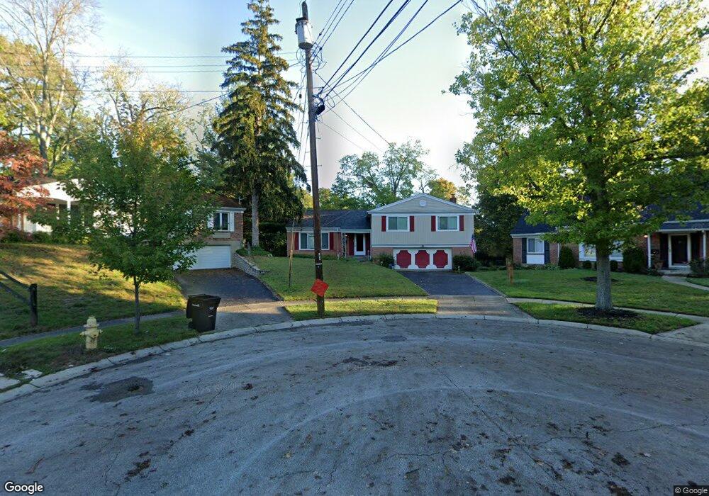
1740 Tiffany Ln Cincinnati, OH 45230
Mount Washington NeighborhoodEstimated Value: $319,297 - $352,000
4
Beds
2
Baths
2,075
Sq Ft
$161/Sq Ft
Est. Value
About This Home
This home is located at 1740 Tiffany Ln, Cincinnati, OH 45230 and is currently estimated at $335,074, approximately $161 per square foot. 1740 Tiffany Ln is a home located in Hamilton County with nearby schools including Mt. Washington Elementary School, Clark Montessori High School, and Shroder High School.
Ownership History
Date
Name
Owned For
Owner Type
Purchase Details
Closed on
Nov 27, 1996
Sold by
Bresser Cyril E and Bresser Esther M
Bought by
Brown Ronald S
Current Estimated Value
Home Financials for this Owner
Home Financials are based on the most recent Mortgage that was taken out on this home.
Original Mortgage
$85,000
Outstanding Balance
$6,558
Interest Rate
7.94%
Estimated Equity
$328,516
Create a Home Valuation Report for This Property
The Home Valuation Report is an in-depth analysis detailing your home's value as well as a comparison with similar homes in the area
Home Values in the Area
Average Home Value in this Area
Purchase History
| Date | Buyer | Sale Price | Title Company |
|---|---|---|---|
| Brown Ronald S | $115,000 | Longworth Title Agency Inc |
Source: Public Records
Mortgage History
| Date | Status | Borrower | Loan Amount |
|---|---|---|---|
| Open | Brown Ronald S | $85,000 |
Source: Public Records
Tax History
| Year | Tax Paid | Tax Assessment Tax Assessment Total Assessment is a certain percentage of the fair market value that is determined by local assessors to be the total taxable value of land and additions on the property. | Land | Improvement |
|---|---|---|---|---|
| 2025 | $4,640 | $85,575 | $10,395 | $75,180 |
| 2023 | $4,656 | $85,575 | $10,395 | $75,180 |
| 2022 | $3,493 | $60,151 | $8,778 | $51,373 |
| 2021 | $3,349 | $60,151 | $8,778 | $51,373 |
| 2020 | $3,463 | $60,151 | $8,778 | $51,373 |
| 2019 | $3,238 | $52,763 | $7,700 | $45,063 |
| 2018 | $3,243 | $52,763 | $7,700 | $45,063 |
| 2017 | $3,073 | $52,763 | $7,700 | $45,063 |
| 2016 | $3,262 | $54,912 | $7,700 | $47,212 |
| 2015 | $2,948 | $54,912 | $7,700 | $47,212 |
| 2014 | $2,970 | $54,912 | $7,700 | $47,212 |
| 2013 | $3,022 | $54,912 | $7,700 | $47,212 |
Source: Public Records
Map
Nearby Homes
- 1776 Wilaray Terrace
- 6258 Benneville St
- 6604 Ambar Ave
- 1630 Dell Terrace
- 1741 Mears Ave
- 6521 Glade Ave
- 1944 Rockland Ave
- 6123 Cambridge Ave
- 1361 Bursal Ave
- 2127 Oxford Ave Unit 10
- 1508 Beth Ln
- 1939 Lady Ellen Dr
- 6253 Sturdy Ave
- 2111 Sutton Ave
- 6803 Le Conte Ave
- 6931 Paddison Rd
- a Salem Rd
- 2121 Sutton Ave
- 6760 Bursal Ct
- 6952 Shadow Ridge Rd
- 1736 Tiffany Ln
- 1739 Tiffany Ln
- 1808 Belle Meade Ct
- 1808 Belle Meade Ct Unit 5
- 1800 Belle Meade Ct Unit 9
- 1802 Belle Meade Ct
- 1734 Tiffany Ln
- 1735 Tiffany Ln
- 1806 Belle Meade Ct Unit 8
- 1801 Belle Meade Ct Unit 11
- 1817 Belle Meade Ct Unit 18
- 1819 Belle Meade Ct
- 1814 Belle Meade Ct Unit 4
- 1810 Belle Meade Ct
- 1815 Belle Meade Ct
- 1809 Belle Meade Ct Unit 15
- 1811 Belle Meade Ct
- 1821 Belle Meade Ct
- 1803 Belle Meade Ct
- 1804 Belle Meade Ct
Your Personal Tour Guide
Ask me questions while you tour the home.