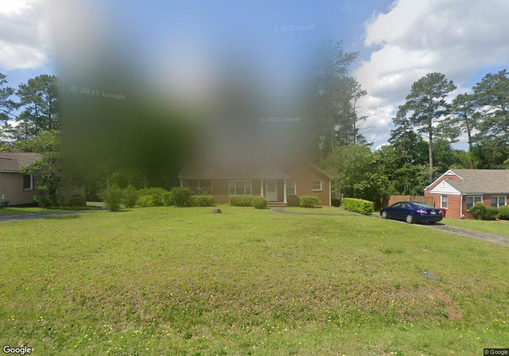
1740 Upper River Rd Macon, GA 31211
Estimated Value: $94,000 - $153,000
2
Beds
1
Bath
1,510
Sq Ft
$83/Sq Ft
Est. Value
About This Home
This home is located at 1740 Upper River Rd, Macon, GA 31211 and is currently estimated at $125,823, approximately $83 per square foot. 1740 Upper River Rd is a home located in Bibb County with nearby schools including Martin Luther King Jr. Elementary School, Appling Middle School, and Northeast High School.
Ownership History
Date
Name
Owned For
Owner Type
Purchase Details
Closed on
Apr 30, 2007
Sold by
Smith Shernette
Bought by
Smith Shernette and Stern Audrey M
Current Estimated Value
Home Financials for this Owner
Home Financials are based on the most recent Mortgage that was taken out on this home.
Original Mortgage
$99,200
Outstanding Balance
$59,578
Interest Rate
6.3%
Mortgage Type
Purchase Money Mortgage
Estimated Equity
$66,245
Purchase Details
Closed on
Mar 5, 2007
Sold by
Gonzalez Mario and Campbell Elizabeth A
Bought by
Smith Shernette
Home Financials for this Owner
Home Financials are based on the most recent Mortgage that was taken out on this home.
Original Mortgage
$99,200
Outstanding Balance
$59,578
Interest Rate
6.3%
Mortgage Type
Purchase Money Mortgage
Estimated Equity
$66,245
Purchase Details
Closed on
Jul 16, 2001
Bought by
Smith Shernette - Stern A
Create a Home Valuation Report for This Property
The Home Valuation Report is an in-depth analysis detailing your home's value as well as a comparison with similar homes in the area
Purchase History
| Date | Buyer | Sale Price | Title Company |
|---|---|---|---|
| Smith Shernette | -- | None Available | |
| Smith Shernette | $99,200 | None Available | |
| Smith Shernette - Stern A | $70,900 | -- |
Source: Public Records
Mortgage History
| Date | Status | Borrower | Loan Amount |
|---|---|---|---|
| Open | Smith Shernette | $99,200 |
Source: Public Records
Tax History
| Year | Tax Paid | Tax Assessment Tax Assessment Total Assessment is a certain percentage of the fair market value that is determined by local assessors to be the total taxable value of land and additions on the property. | Land | Improvement |
|---|---|---|---|---|
| 2025 | $912 | $44,114 | $5,850 | $38,264 |
| 2024 | $943 | $44,114 | $5,850 | $38,264 |
| 2023 | $359 | $39,123 | $5,850 | $33,273 |
| 2022 | $1,020 | $36,462 | $4,242 | $32,220 |
| 2021 | $655 | $24,225 | $3,787 | $20,438 |
| 2020 | $669 | $24,225 | $3,787 | $20,438 |
| 2019 | $674 | $24,225 | $3,787 | $20,438 |
| 2018 | $1,213 | $24,225 | $3,787 | $20,438 |
| 2017 | $645 | $24,225 | $3,787 | $20,438 |
| 2016 | $596 | $24,225 | $3,787 | $20,438 |
| 2015 | $844 | $24,225 | $3,787 | $20,438 |
| 2014 | $1,022 | $24,225 | $3,787 | $20,438 |
Source: Public Records
Map
Nearby Homes
- 1715 Foster Place
- 1735 Foster Place
- 1746 Hamilton Dr
- 1949 Deerwood Place
- 1987 Long Ridge Dr
- 1976 Long Ridge Dr
- 1971 Long Ridge Dr
- 1972 Wood Valley Rd
- 1954 Wood Valley Rd
- 1978 Wood Valley Rd
- 1898 Wood Valley Rd
- 1485 Lone Oak Dr
- 1916 Flintwood Dr
- 1825 Flintwood Dr
- 1435 Twin Pines Dr
- 1868 Waverland Dr
- 1154 Davis Cir
- 1174 Davis St E
- 1464 Twin Pines Dr
- 1728 Waverland Cir
- 1746 Upper River Rd
- 1746 Upper River Rd Unit 100
- 1730 Upper River Rd
- 1752 Upper River Rd
- 1695 Foster Place
- 1685 Foster Place
- 1705 Foster Place
- 1705 Foster Pl (Multiple Parcels)
- 1720 Upper River Rd
- 1720 Upper River Rd Unit 2
- 1758 Upper River Rd
- 1675 Foster Place
- 1802 Wood Valley Rd
- 1710 Upper River Rd
- 1678 Engle Dr
- 1725 Foster Place
- 1764 Upper River Rd
- 1805 Wood Valley Rd
- 1665 Foster Place
- 1770 Upper River Rd
Your Personal Tour Guide
Ask me questions while you tour the home.